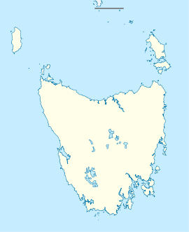
- Margate, Tasmania
-
Margate
TasmaniaPopulation: 1,368[1] Postcode: 7054 Location: - 20 km (12 mi) S of Hobart
- 7 km (4 mi) S of Kingston
- 6 km (4 mi) N of Snug, Tasmania
LGA: Kingborough Council State District: Franklin Federal Division: Franklin Margate is a small seaside town located on the Channel Highway between North-West Bay and the Snug Tiers, 7 kilometres (4 mi) south of Kingston in Tasmania, Australia. At the 2006 census, Margate had a population of 1,368.[1] Although more people live in the immediate region around the town. Margate is part of the Kingborough Council and is a frequent 'pit-stop' for those travelling south towards Snug, Kettering or Bruny Island. Vineyards, grazing fields and stands of trees surround the town and its approaches. The town itself has a range of shops, schools and religious buildings as well as several notable features including the Dru Point Bicentennial Park on the edge of North-West Bay.[2]
Recent history has seen Margate strongly affected by the building boom of the early 2000s with new housing developments in almost all directions. This in some ways reflects demographic themes within the population. A fair percentage of the population commute into the greater Hobart area while the rest are employed locally in either the service industry or commercial enterprises such as the Tassal fish factory or the Austal shipyard. Margate Primary school has been declared a "big winner" from the 2009 Australian federal budget, receiving $2.5 million for new buildings.[3] However the local ABC Learning centre narrowly avoided closure.[4] More recently the residents of Margate were found by the Sunday Tasmanian's National Health Test, to be the "happiest in the state."[5]
References
- ^ a b Australian Bureau of Statistics (25 October 2007). "Margate (Urban Centre/Locality)". 2006 Census QuickStats. http://www.censusdata.abs.gov.au/ABSNavigation/prenav/LocationSearch?collection=Census&period=2006&areacode=UCL610800&producttype=QuickStats&breadcrumb=PL&action=401. Retrieved 10 November 2007.
- ^ 'Local Attractions' Margate Online Access Centre. http://www.tco.asn.au/oac/local_attractions.cgi?oacID=60&articleID=178007 Retrieved 18 May 2009.
- ^ David Killick, '100 Million for Primary Schools' Sunday Tasmanian. (4 May 2009) http://www.themercury.com.au/article/2009/05/04/70695_tasmania-news.html
- ^ 'New owner steps up to save child care centre' ABC News. (29 April 2009) http://www.abc.net.au/news/stories/2009/04/29/2555564.htm
- ^ 'All smiles at Margate' Sunday Tasmanian. (10 May, 2009) http://www.themercury.com.au/article/2009/05/10/72245_tasmania-news.html
External links
Coordinates: 43°01′46″S 147°15′42″E / 43.02944°S 147.26167°E
Categories:- Towns in Tasmania
- Southern Tasmania
Wikimedia Foundation. 2010.

