- Minamisanriku, Miyagi
-
Minamisanriku
南三陸町— Town — Location of Minamisanriku in Miyagi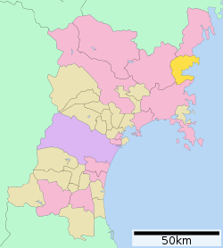

 Minamisanriku
Coordinates: 38°40′40″N 141°26′47″E / 38.67778°N 141.44639°ECoordinates: 38°40′40″N 141°26′47″E / 38.67778°N 141.44639°E Country Japan Region Tōhoku Prefecture Miyagi District Motoyoshi Area - Total 163.74 km2 (63.2 sq mi) Population (October 1, 2004) - Total 19,170 - Density 117.1/km2 (303.2/sq mi) Time zone Japan Standard Time (UTC+9) Website Town of Minamisanriku Minamisanriku (南三陸町 Minamisanriku-chō, "South three land"), also spelled Minami Sanriku, is a resort town on a coastline of wooded islands and mountainous inlets.[1] The town is in Motoyoshi District, Miyagi, Japan. It has an area of 163.74 square kilometres (63.22 sq mi), and as of October 1, 2004 the population of the area was 19,170. The town was formed through a merger on October 1, 2005, when the towns of Shizugawa and Utatsu, both from Motoyoshi District, merged to form the new town of Minamisanriku.
Minamisanriku was largely destroyed by the Japanese 2011 tsunami, with most buildings swept away by waves of 16 metres (52 ft) or more, and over half the town's population missing and almost certainly dead. If and when confirmed, the loss of life in this one small town would form a very significant percentage of the total nationwide Japanese death toll from the tsunami.
Contents
2011 earthquake and tsunami disaster
95 percent of the town was destroyed by the 2011 Japanese tsunami that followed the 2011 Tohuku earthquake. Only the tallest buildings remain and an estimated 9,500 people are missing, roughly half the population.[2][3][4][5][6] 9,700 people are confirmed alive and evacuated.[7]
The town had two evacuation centres where residents could go in the event of a tsunami, one on the southern headland overlooking the town, the other back from the centre of the town. However, although both were 20 metres above sea level, the tsunami inundated them and washed people away.[8] At least 31 of the town's 80 designated evacuation sites were inundated by the tsunami.[9]
One early report suggests that many residents may have evacuated to the nearby city of Tome, Miyagi.[10] According to an English teacher at the local high school located on a hill above the tsunami, "The entire town was simply swept away. It just no longer exists. There were around 7,000 of us on the hill that day. Perhaps a few thousand at the school on the hill opposite. But there are 17,000 in the town. All the others have gone." Since the schools were all on high ground, many children were orphaned.[11] Survivors wrote "SOS" in white lettering,[12] in the playing field of Shizugawa High school.[13]
When the earthquake struck, the mayor of the town, Jin Sato (佐藤仁), was talking at the town assembly about the (much smaller) tsunami caused by the March 9 foreshock of the March 11 earthquake.[14] The three-story building of the town's Crisis Management Department (防災対策庁舎 Bōsai Taisaku Chōsha) which Sato escaped to was submerged by the tsunami, and out of the 130 people who worked at the town hall, Sato was one of only 30 who reached the roof and one of only 10 who survived. He endured the torrent under the tsunami for about 3 minutes.[14][15] He returned to government affairs, founding the headquarters for disaster control at the Bayside Arena on March 13, 2011.[14]
Shizugawa hospital was one of the few major buildings that survived the tsunami, but was partly inundated, and 74 out of 109 patients died.[16] Close to 200 people were rescued from the roof of the building.[17]
Miki Endo (远藤未希), a 25 year old employee of the town's Crisis Management Department, was hailed in the Japanese news media as a heroine for continuing to broadcast warnings and alerts over a community loudspeaker system as the tsunami came in. She was credited with saving many lives. The three-storey headquarters of the department remained standing but was completely gutted, with only a red-colored steel skeleton remaining; in the aftermath of the disaster, Endo was missing and was later confirmed to have died.[18] Photos show the roof of the building completely submerged at the height of the inundation, with some persons clinging to the rooftop antenna.[19][20]
International response
The town is the site of the first field hospital established by an outside nation offering assistance following the disaster. An initial team of five doctors from Israel set up a surgery in preparation for a larger team once needs were assessed.[21] A 53 member delegation of medical personnel from the Home Front Command and the IDF’s Medical Corps opened a field hospital near Minamisanriku on March 29. The clinic included surgical, pediatrics and maternity wards, and an intensive care unit, pharmacy and laboratory along with 62 tons of medical supplies. The clinic was active in treating patients immediately upon opening.[22][23]
On April 23, 2011, the Prime Minister of Australia Julia Gillard visited Minami Sanriku.[24]
1960 tsunami
The Great Chilean Earthquake of 1960 triggered a tsunami that crossed the Pacific Ocean and struck the then town of Shizugawa with a height of up to 2.8 metres (9.2 ft),[25] causing what was by normal standards considered extensive damage.[26] As a result, two-storey-high harbor walls were built by 1963, and residents held tsunami drills each year on the anniversary. The harbor walls were ineffective in the 2011 tsunami, which washed over four-storey buildings.[27]
To mark the 30th anniversary in 1990, a bilingual Spanish-Japanese plaque was installed, with a message from President Patricio Aylwin of Chile, accompanied by a replica moai statue. The plaque survived the 2011 tsunami.[28][29]
The 2010 Chile earthquake caused a 1.3-metre (4.3 ft) tsunami in Minami Sanriku.[30]
Transportation
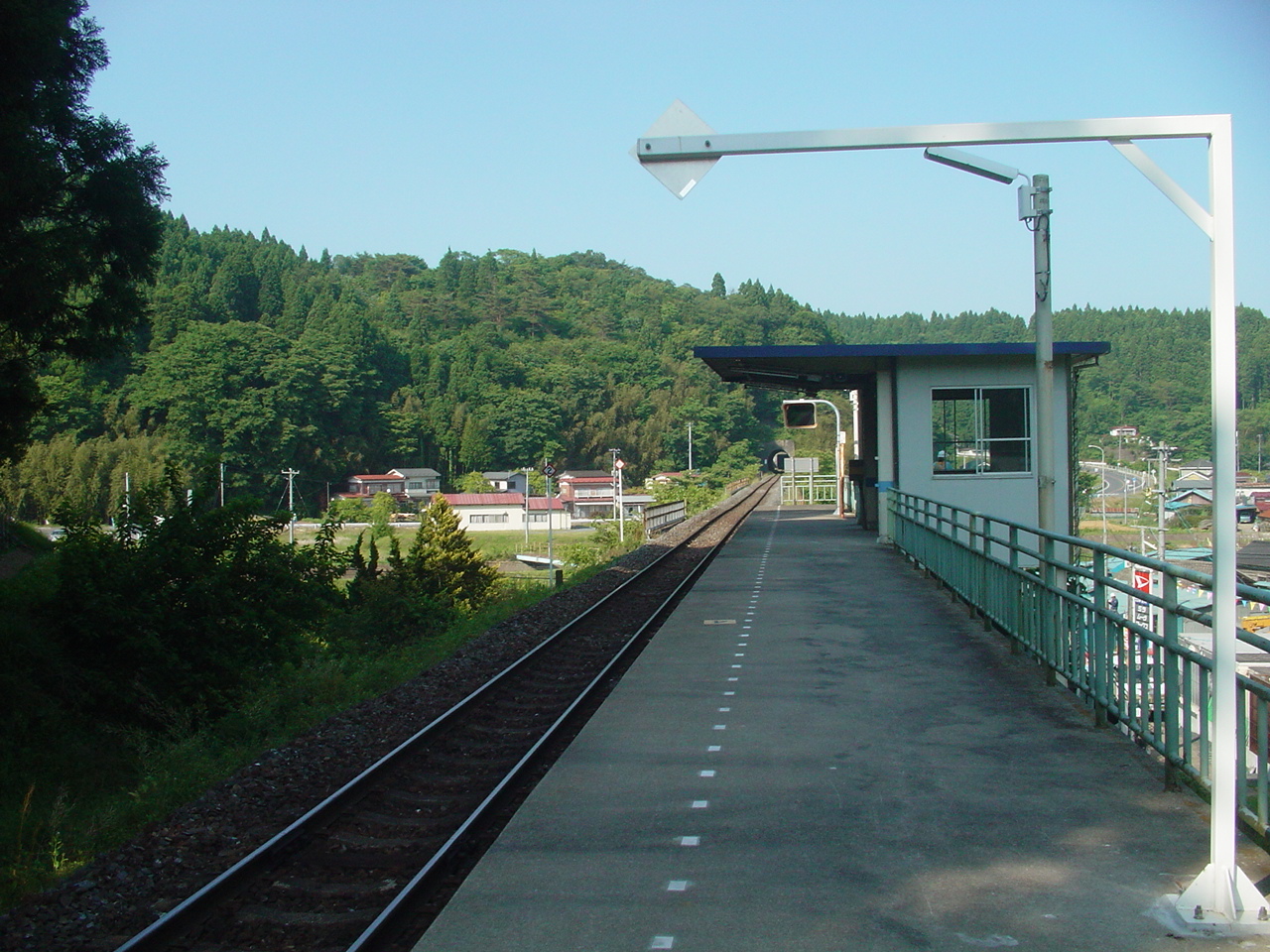
 Shizuhama station
The Kesennuma Line includes the following stops: Rikuzen-Togura, Shizugawa, Shizuhama, Utatsu, and Rikuzen-Minato. Major roads include Route 45 and Route 398.
See also
- Kesennuma
- Minamisōma
- Rikuzentakata
References
- ^ Inside Minamisanriku Channel 4 News, 13 March 20011
- ^ "9,500 still unaccounted in Minamisanriku of Japan's Miyagi Prefecture: Kyodo". Xinhua News Agency. http://news.xinhuanet.com/english2010/world/2011-03/12/c_13775336.htm. Retrieved 2011-03-12.
- ^ Kyung Lah, CNN (March 12, 2011). "Rescuers scramble to save lives as aftershocks jolt Japan". CNN.com. http://www.cnn.com/2011/WORLD/asiapcf/03/12/japan.quake/. Retrieved 2011-03-12.
- ^ 9,500 People Reported Missing in Small Town Following Japan Quake
- ^ Devastating pictures from the port where 10,000 are missing after it was swept away by the megaquake, peoplestar.co.uk, Retrieved on 2011-03-13.
- ^ Horiuchi, Junko, (Kyodo News) "Evacuees persevere, eye future", Japan Times, 29 March 2011, p. 3.
- ^ [1](Japanese)
- ^ Natures fury leaves a silt-covered graveyard The Age, 16 March 2011
- ^ Kyodo News, "Tsunami hit more than 100 designated evacuation sites", Japan Times, 14 April 2011, p. 1.
- ^ 2,000 bodies found on Japanese shores ABC Sydney, 14 March 2011
- ^ Minamisanriku: Japan's tsunami-hit ground zero Channel 4 News, 14 March 2011
- ^ Flock, Elizabeth (March 13, 2011). "Japan tsunami: Minamisanriku, a fishing port that vanished". The Washington Post. http://www.washingtonpost.com/blogs/blogpost/post/japan-tsunami-minamisanriku-a-fishing-port-that-vanished-/2011/03/13/ABulj1T_blog.html. Retrieved 18 March 2011.
- ^ Zenrin Co. Ltd. (2011). "Google Maps". Google. http://maps.google.com/maps?hl=en&ll=38.680711,141.43926&spn=0.003999,0.008256&z=18. Retrieved 18 March 2011.
- ^ a b c "安否不明の町長生還 骨組みだけの庁舎で一夜 宮城・南三陸" (in Japanese). Kahoku Shimpo. March 14, 2011. http://www.kahoku.co.jp/news/2011/03/20110314t13031.htm. Retrieved March 15, 2011.
- ^ "南三陸町 庁舎10人奇跡の生還" (in Japanese). Tokyo Shimbun. March 15, 2011. http://www.tokyo-np.co.jp/article/national/news/CK2011031502000024.html. Retrieved March 15, 2011.
- ^ "南三陸町 津波" (in Japanese) (video). YouTube.com. at 01:16 (hospital); at 04:57 (crisis management department building). http://www.youtube.com/watch?v=VvgwzDDxtjo. Retrieved 2011-04-23.
- ^ Carswell, Andrew (March 14, 2011). "Minami Sanriku - the town that disappeared in the Japan earthquake". The Daily Telegraph. http://www.dailytelegraph.com.au/news/minami-sanriku-the-town-that-disappeared-in-the-japan-earthquake/story-e6freuy9-1226020730156. Retrieved 16 March 2011.
- ^ "宮城県南三陸町の職員、遠藤未希さん(24)が亡くなったことが確認されました。" (in Japanese) (video). YouTube.com. http://www.youtube.com/watch?v=3UT0fi-LvZI&NR=1. Retrieved 2011-05-12.
- ^ "Miki Endo (远藤未希), missing heroine of Minamisanriku" (video). NHK World. http://www.youtube.com/watch?v=EqQufHbG27E. Retrieved 2011-04-23.
- ^ "[画像]宮城県南三陸町の防災対策庁舎の人を押し流す津波+南三陸町津波動画" (in Japanese). http://pop-rin.seesaa.net/article/194917311.html. Retrieved 2011-04-23.
- ^ "Israel first to set up field hospital in Japan", The Jerusalem Post, 21 March 2011, http://www.jpost.com/International/Article.aspx?id=213123, retrieved 2011-03-21
- ^ Katz, Yakov (29 March 2011). "IDF field hospital officially open doors to Japanese". The Jerusalem Post. http://www.jpost.com/International/Article.aspx?id=214263. Retrieved 2011-03-30.
- ^ "IDF medical delegation to Japan treats homeless baby". The Jerusalem Post. 30 March 2011. http://www.jpost.com/International/Article.aspx?id=214440. Retrieved 2011-03-30.
- ^ "豪首相、宮城・南三陸町を訪問" (video). YouTube.com. http://www.youtube.com/watch?v=S2w4z-fZ-nQ. Retrieved 2011-04-23.
- ^ flickr.com user ataq411. "Shizugawa Hospital, Minamisanriku-cho, Miyagi" (photo). http://www.flickr.com/photos/ataq/5618735533/lightbox/. "legend on marker in photo reads:
昭和35年5月24日
チリ地震津波水位
2.8m" - ^ "かつての宮城県志津川町(現・南三陸町) 津波への取り組み(1990年)" (in Japanese) (video). YouTube.com. http://www.youtube.com/watch?v=aWk7jcuO6bw. Retrieved 2011-04-26. (video shows damage from 1960 tsunami)
- ^ Todd Pitman. "Japan tsunami: Nothing to do but run". Associated Press. http://www.cbs12.com/articles/tsunami-4731485-shizugawa-town.html. Retrieved 2011-04-23.
- ^ Japanese Wikipedia article about Moai
- ^ "南三陸町 Minamisanrikucho #5" (video). YouTube.com. http://www.youtube.com/watch?v=pHOpRy2eN-k. Retrieved 2011-04-23. "
REPUBLICA DE CHILE
A la Ciudad de Shizugawa:
El Moai, muestra de la cultura chilena testimonia en la ciudad de
Shizugawa la amistad entre ambos pueblos que están unidos por el
mismo mar aquel sobre el que el poeta Neruda escribio:
"La dentellada del mar muerde
la abierta pulpa de la costa
donde se estrella el agua verde
contra la tierra silenciosa"
Patricio Aylwin
Presidente de la Republica de Chile" - ^ "宮城・南三陸町で130cmの津波観測 漁港で冠水も(10/02/28)" (in Japanese) (video). YouTube.com. http://www.youtube.com/watch?v=dMMDZ4gLDwM. Retrieved 2011-04-24.
External links
 Media related to Minamisanriku, Miyagi at Wikimedia Commons
- Minamisanriku official website (Japanese)
Videos
- video showing aerial view, before and after: "Minamisanriku – before and after the tsunami" (video). YouTube.com. NHK World. 2011-03-11. http://www.youtube.com/watch?v=6JVpy0L5z7s. Retrieved 2011-04-26.
- video of tsunami, shot from Shizugawa High School (志津川高校): "南三陸町志津川高校から見た津波の様子 [Tsunami attacking in Minami-Sanriku]" (in Japanese) (video). YouTube.com. 38°40′53″N 141°26′23″E / 38.6813°N 141.4398°E. 2011-03-11. http://www.youtube.com/watch?v=8vZR0Rq1Rfw. Retrieved 2011-04-21.
- another video from a similar vantage point as above, showing a wider-angle view of some parts: "画質調整版 南三陸町 志津川 japan earthquake, tsunami" (video). YouTube.com. 2011-03-11. http://www.youtube.com/watch?v=TX8MeGd7BkU. Retrieved 2011-04-26.
- video of tsunami, shot from Shizugawa Junior High School (志津川中学校): "南三陸町を襲った津波の一部始終 [tsunami Minamisanriku, Miyagi, japan]" (in Japanese) (video). YouTube.com. 38°41′11″N 141°26′36″E / 38.6864°N 141.4433°E. 2011-03-11. http://www.youtube.com/watch?v=pkuFw5BWz6o. Retrieved 2011-04-21.
- video shot from a train (facing east) in 2009, stopping at Shizugawa Station and then proceeding to Rikuzen-Togura Station on the Kesennuma Line. Satellite photos (e.g., in Google Maps) and aftermath videos show that virtually every building visible (except the very largest white buildings in the background) in the first three minutes, and in the final minute, were washed away in the 2011 tsunami, as well as the train track and infrastructure and both stations; buildings and track in the middle part were undamaged. "Kesennuma Line Window View from Approching Shizukawa Sta. to Rikuzen Tokura." (video). YouTube.com. 2009-03-22. http://www.youtube.com/watch?v=UtULACNfHBo. Retrieved 2011-04-26.
- the same train trip in the opposite direction, in 2010: "気仙沼線 陸前戸倉⇒志津川 車窓 キハ110系 2010年1月2日撮影" (video). YouTube.com. 2010-01-02. http://www.youtube.com/watch?v=OxEa2oIjB2A. Retrieved 2011-06-01.
- tsunami aftermath videos (driving around in the town): #1 #2 #3 #4 #5 #6 #7 #8 #9 #10 #11
- video shot inside Shizugawa Hospital, showing tsunami damage reaching as high as the fourth floor: "宮城県南三陸町「志津川病院」壊滅屋内映像!4階部分ハイビジョン" (video). YouTube.com. 2011-04-22. http://www.youtube.com/watch?v=2G2L2Avf8hk. Retrieved 2011-06-06.
- News Video of Tsunami Destroying Minamisanriku The Telegraph, UK news outlet
- Video of Tsunami Aftermath in Minamisanriku "Some Kind of Armageddon", Channel 4 News, UK
2011 Tōhoku earthquake and tsunami Aftermath • Humanitarian response · Foreshocks and aftershocks Affected areas Geology: Japan Trench • Pacific Plate • North American Plate • Okhotsk Plate • Honshu Island (Oshika Peninsula) / Pacific Ocean
Cities and towns severely damaged:- Tōhoku Region [Iwate Prefecture (Kamaishi – Miyako – Ōfunato – Ōtsuchi – Rikuzentakata – Yamada) | Miyagi Prefecture (Higashimatsushima – Ishinomaki – Kesennuma – Kurihara – Minamisanriku – Sendai) | Fukushima Prefecture (Iwaki – Minamisōma – Ōkuma – Sōma)]
- Kantō Region [Ibaraki Prefecture (Hitachinaka – Itako – Kashima – Kitaibaraki – Ōarai) | Chiba Prefecture (Asahi – Chōshi – Ichihara – Urayasu)]
- Hokkaido [Oshima Subprefecture (Hakodate)]
Affected infrastructure Ichihara refinery • Fujinuma Dam • Ōarai-Kashima Line • Sendai Airport • Tōhoku Shinkansen • Joban Line (Shinchi Station) • Senseki Line • Kesennuma LineNuclear accidents Fukushima Daiichi nuclear disaster (Fukushima Daiichi Nuclear Power Plant • Timeline • International reaction • Japanese reaction • Radiation effects • Fukushima 50) • Fukushima Daini Nuclear Power Plant • Onagawa plant • Tōkai plant • Rokkasho plantAftershocks Miyagi, Japan (7.1, 7 April) • Fukushima, Japan (6.6, 11 April)People Fundraisers Artistes 311 Love Beyond Borders • Download to Donate: Tsunami Relief • Fight and Smile • Songs for JapanOther Impact on video game industry • Operation TomodachiSee also:  Japanese earthquakes · Seismicity of the Sanriku coast · Historic tsunamis · Nuclear power in Japan, section Seismicity · Nuclear and radioactive incidentsCategories:
- Towns in Miyagi Prefecture
- Cities and towns devastated by the 2011 Tōhoku earthquake and tsunami
- Populated places established in 2005


Wikimedia Foundation. 2010.