- Higashimatsushima, Miyagi
-
Higashimatsushima
東松島市— City — Location of Higashimatsushima in Miyagi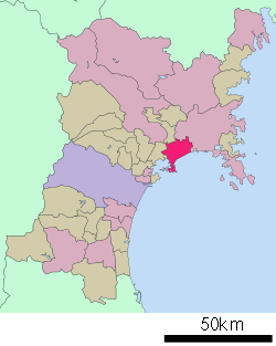

 Higashimatsushima
Coordinates: 38°25′N 141°12′E / 38.417°N 141.2°ECoordinates: 38°25′N 141°12′E / 38.417°N 141.2°E Country Japan Region Tōhoku Prefecture Miyagi Government – Mayor Hideo Abe Area – Total 101.86 km2 (39.3 sq mi) Population (June 1, 2010) – Total 42,762 – Density 420/km2 (1,087.8/sq mi) Time zone Japan Standard Time (UTC+9) City symbols - Tree Pine - Flower Sakura Phone number 0225-82-1111 Address 36-1 aza Kamikawado, Yamoto, Higashimatsushima-shi, Miyagi-ken
981-0503Website Higashimatsushima City Higashimatsushima (東松島市 Higashimatsushima-shi, lit. East Matsushima; "Matsushima" means "Pine Island") is a city located in Miyagi Prefecture, Japan. It was created on April 1, 2005, when the towns of Naruse and Yamoto, both formally of Monou District, merged to form the new city. As of 2010, the city had an estimated population of 42,762 and a population density of 420 persons per km². The total area is 101.86 km². The Satohama shell mound and museum is in the city.
Contents
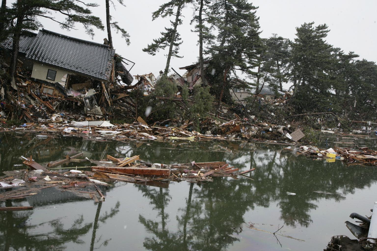
2011 earthquake disaster
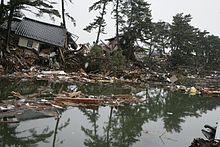 Houses inundated and collapsed by the tsunami in Nobiru, Higashimatsushima
On 11 March 2011 the town was hit by the 2011 Tōhoku earthquake and tsunami resulting in at least 1,039 deaths.[1] During the tsunami, a 45 metre ship, the Chōkai Maru, was hurled over a pier and left aground in the town. At the time of the disaster, Higashimatsushima had still not fully recovered from a previous major earthquake in 2003.[2][3] About 63% of the town was inundated by the tsunami.[4]
Transportation
Train stations
- Senseki Line: Rikuzen-Ōtsuka - Tōna - Nobiru - Rikuzen-Ono - Kazuma - Yamoto - Higashi-Yamoto - Rikuzen-Akai
Major roads
- Sanriku Expressway (Naruse-Okumatsushima, Yamoto, and Ishinomaki interchanges)
- Route 45
International relations
Main article: List of twin towns and sister cities in JapanReferences
- ^ NOAA Data 2 April 2011
- ^ Tsunami survivors face monstrous cleanup task, Japan Times, 26 March 2011
- ^ Gilhooly, Rob, "Tsunami-hit towns face dire future", Japan Times, 1 April 2011, p. 4.
- ^ NHK, "Tsunami flooded 100 square kilometers of city land", 29 March 2011.
 Miyagi Prefecture
Sendai (capital) Other cities Districts See also: Towns and villages by district2011 Tōhoku earthquake and tsunami Aftermath • Humanitarian response · Foreshocks and aftershocksAffected areas Geology: Japan Trench • Pacific Plate • North American Plate • Okhotsk Plate • Honshu Island (Oshika Peninsula) / Pacific Ocean
Cities and towns severely damaged:- Tōhoku Region [Iwate Prefecture (Kamaishi – Miyako – Ōfunato – Ōtsuchi – Rikuzentakata – Yamada) | Miyagi Prefecture (Higashimatsushima – Ishinomaki – Kesennuma – Kurihara – Minamisanriku – Sendai) | Fukushima Prefecture (Iwaki – Minamisōma – Ōkuma – Sōma)]
- Kantō Region [Ibaraki Prefecture (Hitachinaka – Itako – Kashima – Kitaibaraki – Ōarai) | Chiba Prefecture (Asahi – Chōshi – Ichihara – Urayasu)]
- Hokkaido [Oshima Subprefecture (Hakodate)]
Affected infrastructure Ichihara refinery • Fujinuma Dam • Ōarai-Kashima Line • Sendai Airport • Tōhoku Shinkansen • Joban Line (Shinchi Station) • Senseki Line • Kesennuma LineNuclear accidents Fukushima Daiichi nuclear disaster (Fukushima Daiichi Nuclear Power Plant • Timeline • International reaction • Japanese reaction • Radiation effects • Fukushima 50) • Fukushima Daini Nuclear Power Plant (Timeline) • Onagawa plant • Tōkai plant • Rokkasho plantAftershocks Miyagi, Japan (7.1, 7 April) • Fukushima, Japan (6.6, 11 April)People Fundraisers Artistes 311 Love Beyond Borders • Download to Donate: Tsunami Relief • Fight and Smile • Songs for JapanOther Impact on video game industry • Operation TomodachiSee also: Japanese earthquakes · Seismicity of the Sanriku coast · Historic tsunamis · Nuclear power in Japan, section Seismicity · Nuclear and radioactive incidentsCategories:
- Cities in Miyagi Prefecture
- Cities and towns devastated by the 2011 Tōhoku earthquake and tsunami
- Populated coastal places in Japan
- Populated places established in 2005
- Miyagi geography stubs

Wikimedia Foundation. 2010.