- Ōfunato, Iwate
-
Ōfunato
大船渡市— City — 
FlagLocation of Ōfunato in Iwate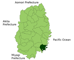

 Ōfunato
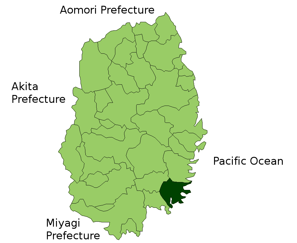
Coordinates: 39°4′N 141°43′E / 39.067°N 141.717°ECoordinates: 39°4′N 141°43′E / 39.067°N 141.717°E Country Japan Region Tōhoku Prefecture Iwate Government – Mayor Kimiaki Toda Area – Total 323.28 km2 (124.8 sq mi) Time zone Japan Standard Time (UTC+9) City symbols - Tree Pine - Flower Camellia - Bird Black-tailed Gull Phone number 0192-27-3111 Address 15, Sakarichō Aza Utsunosawa, Ōfunato-shi, Iwate-ken
022-8501Website Ōfunato City Ōfunato (大船渡市 Ōfunato-shi) is a coastal city located in Iwate, Japan. It was founded on April 1, 1952. On November 15, 2001, the town of Sanriku, from Kesen District, was merged into Ōfunato. In 2008, the city had an estimated population of 41,757 and a density of 129 persons per km². The total area is 323.28 km². Ōfunato faces the Pacific Ocean. Outside its bay, the warm and cold ocean currents meet, which allow a fishing industry to flourish. The city has been trying to establish itself as a major shipping port and receives regular visits by international freight ships. Kaminari-iwa on the city's Goishi coastline has been designated one of the 100 Soundscapes of Japan.
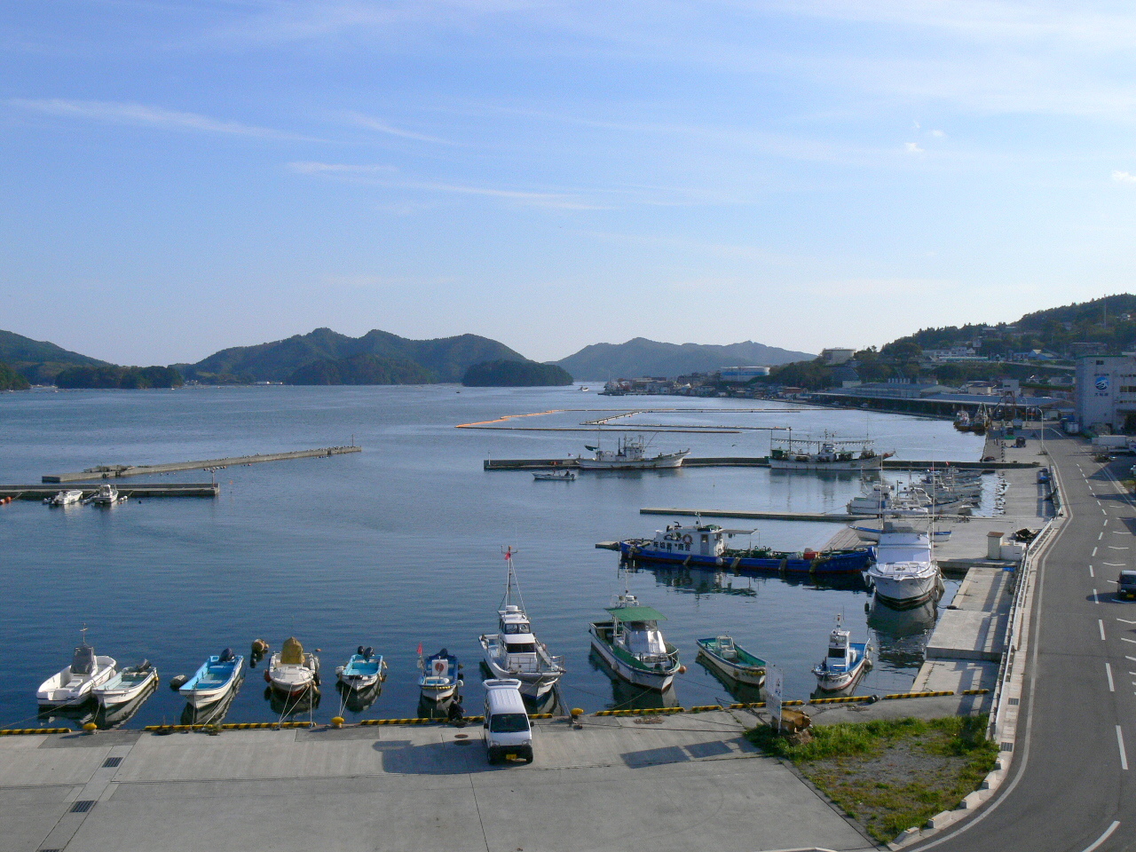
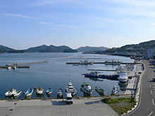 Ofunato port, 2006
A history of tsunami disasters
Ōfunato is situated fairly close to an undersea volcano, and suffers from frequent earthquakes of various scales.
The 1896 Meiji-Sanriku earthquake caused a 25 metre tsunami which killed 27,000 people in Sanriku.
The 1933 Sanriku earthquake had a magnitude of 8.4 and caused a 28 metre tsunami which killed 1522 people.
The city became internationally famous when it was hit by a tsunami caused by the Valdivia earthquake in Chile on 22 May 1960.
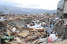 Downtown area of Ofunato following the 2011 tsunami
Ōfunato hit the headlines yet again when it was heavily damaged in the 2011 Tōhoku earthquake and tsunami.[1] The wave is estimated to have reached 23.6 meters in height.[2] Funnelled in by the narrow bay, the tsunami continued inland for 3 kilometres.[3] The town's theatre was one of very few buildings left standing (and remarkably, was undamaged) and gave shelter to about 250 survivors.[4][5] Provisional counts listed 3,498 houses out of 15,138 houses in the town destroyed by the tsunami and 305 lives were confirmed lost.[6][7] At least six of the town's 58 designated evacuation sites were inundated by the tsunami.[8]
References
- ^ Ofunato devastated by tsunami BBC report, 12 March 2011
- ^ 23.6-meter-high tsunami triggered by March 11 quake: survey Kyodo News, 23 March 2011
- ^ A thousand bodies a day will be recovered every day now The Age, 22 March 2011
- ^ Synopsis of a Channel 4 TV news bulletin on 15th March 2011
- ^ Tritten, Travis, J., and T. D. Flack, "U.S. rescue teams find devastation in northern city of Ofunato", Stars and Stripes, 15 March 2011, retrieved 16 March 2011.
- ^ NOAA tsunami data table
- ^ Gilhooly, Rob, "Survivors strive to start picking up the pieces", Japan Times, 27 March 2011, p. 7.
- ^ Kyodo News, "Tsunami hit more than 100 designated evacuation sites", Japan Times, 14 April 2011, p. 1.
External links
- (Japanese) Ōfunato official website
- Ofunato in ruins Channel 4 news report, 15 March 2011
- Searching for the lost in Ofunato BBC report by Damian Grammaticas, 23 March 2011
 Iwate Prefecture
Cities - Hachimantai
- Hanamaki
- Ichinoseki
- Kamaishi
- Kitakami
- Kuji
- Miyako
- Morioka (capital)
- Ninohe
- Ōfunato
- Ōshū
- Rikuzentakata
- Tōno

Districts See also: Towns and villages by districtCategories:- Cities in Iwate Prefecture
- Port settlements in Japan
- Populated coastal places in Japan
- Tsunamis in Japan
- Cities and towns devastated by the 2011 Tōhoku earthquake and tsunami
- Populated places established in 1952


Wikimedia Foundation. 2010.