- Moosseedorf
-
Moosseedorf 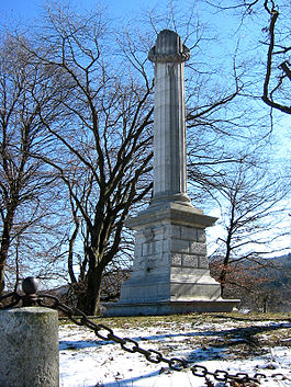
Country Switzerland 
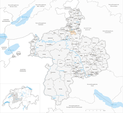
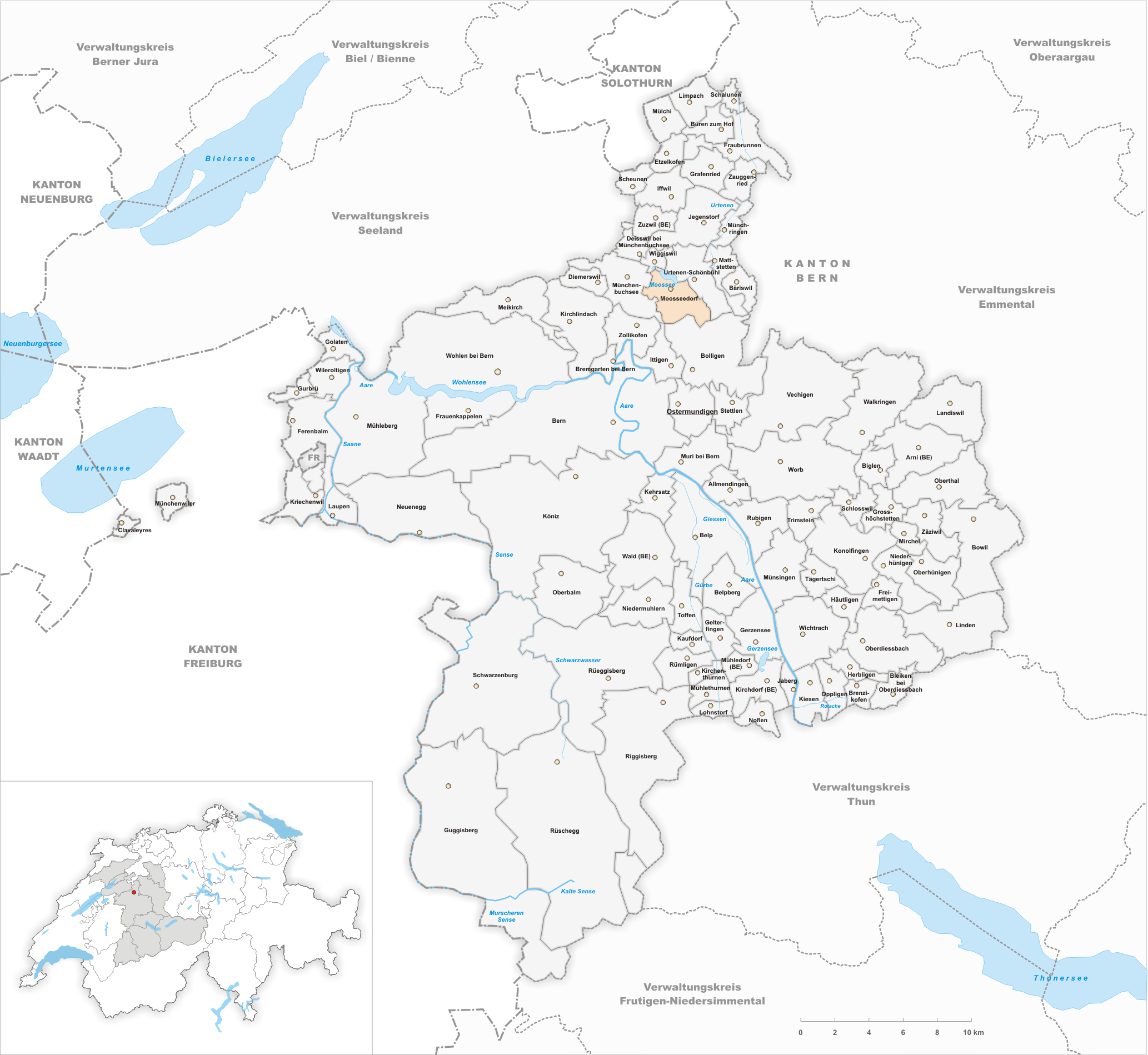
Canton Bern District Bern-Mittelland 47°1′N 7°29′E / 47.017°N 7.483°ECoordinates: 47°1′N 7°29′E / 47.017°N 7.483°E Population 3,571 (Dec 2010)[1] - Density 567 /km2 (1,468 /sq mi) Area 6.35 km2 (2.45 sq mi)[2] Elevation 532 m (1,745 ft) Postal code 3302 SFOS number 0544 Surrounded by Bolligen, Ittigen, Münchenbuchsee, Urtenen-Schönbühl, Wiggiswil Website www.moosseedorf.ch
SFSO statistics
 MoosseedorfMap of Moosseedorf
Moosseedorf is a municipality in the Bern-Mittelland administrative district in the canton of Bern in Switzerland. The village is located south of Moossee, the lake that gives it its name.
Contents
History
Moosseedorf is first mentioned in 1242 as Sedorf. In 1389 it was mentioned as Mossedorf. In the 18th and early 19th Century, it officially became Moosseedorf to avoid confusion with Seedorf in the District of Aarberg, which is also in the Canton of Bern.[3]
Geography
Moosseedorf has an area, as of 2009[update], of 6.35 square kilometers (2.45 sq mi). Of this area, 1.91 km2 (0.74 sq mi) or 30.1% is used for agricultural purposes, while 2.27 km2 (0.88 sq mi) or 35.7% is forested. Of the rest of the land, 1.93 km2 (0.75 sq mi) or 30.4% is settled (buildings or roads), 0.11 km2 (27 acres) or 1.7% is either rivers or lakes and 0.1 km2 (25 acres) or 1.6% is unproductive land.[4]
Of the built up area, industrial buildings made up 3.3% of the total area while housing and buildings made up 9.6% and transportation infrastructure made up 7.6%. while parks, green belts and sports fields made up 9.0%. Out of the forested land, all of the forested land area is covered with heavy forests. Of the agricultural land, 23.0% is used for growing crops and 6.3% is pastures. All the water in the municipality is in lakes. All of the unproductive area is unproductive vegetation.[4]
Moosseedorf is located in the Moossee valley south of the lake. The municipality includes the village of Moosseedorf and the hamlets of Sand, Tannacker and Anteil am See. It belongs to the parish church of Münchenbuchsee but has a resident preacher and a cemetery.
Demographics
Moosseedorf has a population (as of 31 December 2010) of 3,571.[1] As of 2007[update], 15.4% of the population was made up of foreign nationals. Over the last 10 years the population has grown at a rate of 1.8%. Most of the population (as of 2000[update]) speaks German (89.8%), with French being second most common ( 2.0%) and Albanian being third ( 1.5%).
In the 2007 election, the most popular party was the SVP, which received 38.6% of the vote. The next three most popular parties were the SPS (23.9%), the FDP (11.6%) and the Green Party (9.8%).
The age distribution of the population (as of 2000[update]) is children and teenagers (0–19 years old) make up 23.5% of the population, while adults (20–64 years old) make up 67% and seniors (over 64 years old) make up 9.5%. In Moosseedorf about 73.3% of the population (between age 25-64) have completed either non-mandatory upper secondary education or additional higher education (either university or a Fachhochschule).
Moosseedorf has an unemployment rate of 2.17%. As of 2005[update], there were 57 people employed in the primary economic sector and about 15 businesses involved in this sector. 746 people are employed in the secondary sector and there are 24 businesses in this sector. 2806 people are employed in the tertiary sector, with 129 businesses in this sector.[5]
The historical population is given in the following table:[3]
year population 1764 255 1850 584 1900 573 1950 819 1960 833 2000 3,584 External links
- Moosseedorf in German, French and Italian in the online Historical Dictionary of Switzerland.
References
- ^ a b Swiss Federal Statistical Office - STAT-TAB, online database – Datenwürfel für Thema 01.2 - Bevölkerungsstand und -bewegung (German) accessed 29 September
- ^ Arealstatistik Standard - Gemeindedaten nach 4 Hauptbereichen
- ^ a b Moosseedorf in German, French and Italian in the online Historical Dictionary of Switzerland.
- ^ a b Swiss Federal Statistical Office-Land Use Statistics 2009 data (German) accessed 25 March 2010
- ^ Swiss Federal Statistical Office accessed 10-Jun-2009
Categories:- Municipalities of Bern
- Municipalities of Switzerland


Wikimedia Foundation. 2010.