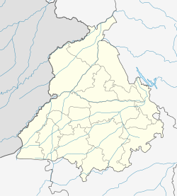
- Daulatpur, Punjab
-
Daulatpur — city — Coordinates 31°48′N 75°59′E / 31.8°N 75.98°ECoordinates: 31°48′N 75°59′E / 31.8°N 75.98°E Country India State Punjab District(s) Nawanshahr district Population 4,544 (2001[update]) Time zone IST (UTC+05:30) Area
• 521 metres (1,709 ft)
Daulatpur is a census town in Hoshiarpur district in the state of Punjab, India.
Geography
Daulatpur is located at 31°48′N 75°59′E / 31.8°N 75.98°E[1]. It has an average elevation of 521 metres (1709 feet).
Demographics
As of 2001[update] India census[2], Daulatpur had a population of 4544. Males constitute 53% of the population and females 47%. Daulatpur has an average literacy rate of 74%, higher than the national average of 59.5%: male literacy is 78% and, female literacy is 70%. In Daulatpur, 10% of the population is under 6 years of age.
References
- ^ Falling Rain Genomics, Inc - Daulatpur
- ^ "Census of India 2001: Data from the 2001 Census, including cities, villages and towns (Provisional)". Census Commission of India. Archived from the original on 2004-06-16. http://web.archive.org/web/20040616075334/http://www.censusindia.net/results/town.php?stad=A&state5=999. Retrieved 2008-11-01.
Cities and towns in Hoshiarpur district Hoshiarpur Chohal · Dasua · Gardhiwala · Garhshanker · Hajipur · Hariana · Hoshiarpur · Mahilpur · Mukerian · Shamchaurasi · Talwara · Urmar Tanda · Daulatpur
Cities and towns
in other districtsAmritsar · Barnala · Bathinda · Faridkot · Fatehgarh Sahib · Firozpur · Gurdaspur · Jalandhar · Kapurthala · Ludhiana · Mansa · Moga · Mohali · Muktsar · Nawanshahr · Patiala · Rupnagar · Sangrur · Tarn Taran
Categories:- Cities and towns in Hoshiarpur district
- Hoshiarpur
Wikimedia Foundation. 2010.


