- Charlottenburg-Wilmersdorf
-
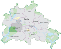
Arms Map 
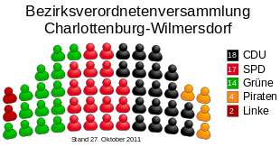
Area: 64.72 km² Inhabitants: 319,628 (2010-03-31) Population density: 4,938 inhabitants per km² Website: official homepage Politics Mayor of Borough: Reinhard Naumann (SPD) Parliament of Borough (BVV): CDU 18, SPD 17, Alliance '90/The Greens 14, Pirates 4, The Left 2, (last election 2011) Map of the localities 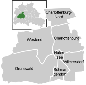

Charlottenburg-Wilmersdorf is the fourth borough of Berlin, formed in the 2001 administrative reform by merging the former boroughs of Charlottenburg and Wilmersdorf.
Contents
Overview
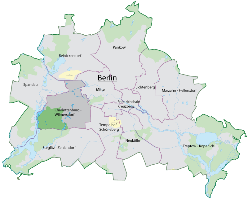
Charlottenburg-Wilmersdorf covers the western centre of the City of Berlin. It borders on the Mitte borough in the east, on Tempelhof-Schöneberg in the southeast, Steglitz-Zehlendorf in the south, Spandau in the west and on Reinickendorf in the north. The district includes the inner city localities of Charlottenburg, Wilmersdorf and Halensee.
After World War II and the city's division by the Berlin Wall, the area around Kurfürstendamm and Bahnhof Zoo was the centre of former West Berlin, with the Kaiser Wilhelm Memorial Church as its landmark. The Berlin Institute of Technology (Technische Universität Berlin), the Berlin University of the Arts (Universität der Künste), the Deutsche Oper Berlin as well as Charlottenburg Palace and the Olympic Stadium are also located in Charlottenburg-Wilmersdorf.
Subdivision
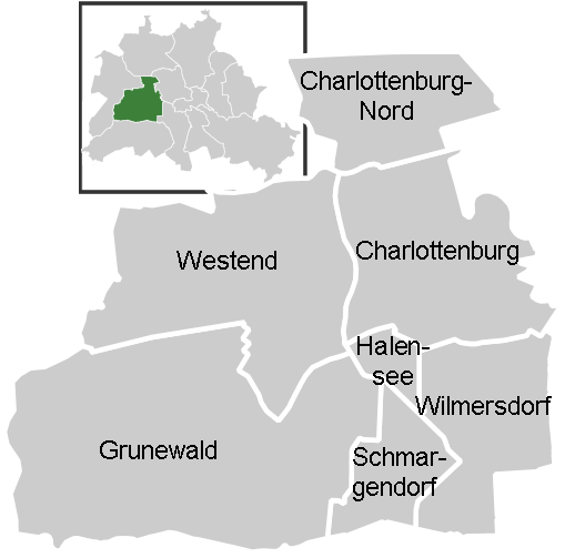
Charlottenburg-Wilmersdorf is divided into 7 localities:
- Former Charlottenburg borough:
- Former Wilmersdorf borough:
- Wilmersdorf
- Grunewald
- Halensee
- Schmargendorf
International relations
Twin towns — Sister cities
Charlottenburg is twinned with:
Wilmersdorf is twinned with:
 Karmiel, Israel since 1985
 Kulmbach district, Germany since 1991
 Pecherskyi Raion, Kiev, Ukraine since 1991
 Międzyrzecz, Poland since 1993
- Minden, Germany since 1968
- Rheingau-Taunus district, Germany since 1991
 Split (city), Croatia since 1970
 London Borough of Sutton since 1968
Economy
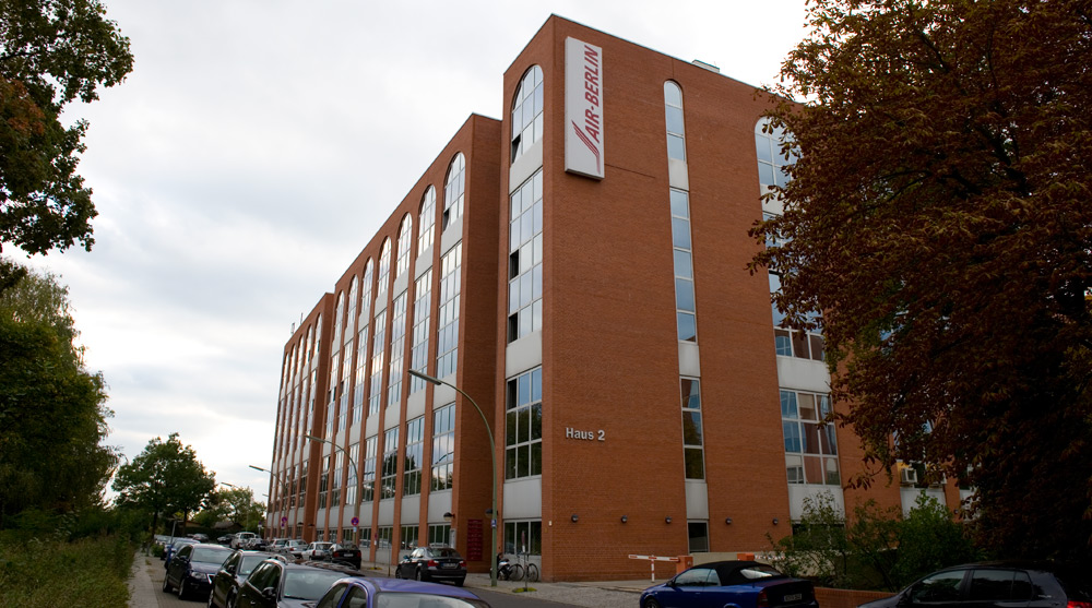
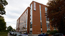 Air Berlin headquarters
The borough's economy largely depends on retail trade with supra-local importance. Air Berlin has its headquarters in Building 2 of the Airport Bureau Center in Charlottenburg-Nord.[1][2] As of 2006 Air Berlin employed 1,200 employees at its headquarters.[3] Germania has its headquarters in Charlottenburg-Nord.[4]
References
- ^ "Contact." Air Berlin. Retrieved on 12 May 2009.
- ^ "Approach map." Air Berlin. Retrieved on 12 May 2009.
- ^ Schulz, Stefan. "Ein Kandidat geht auf Tuchfühlung." Die Welt. 2 March 2006. Retrieved on 22 October 2009. "Am Saatwinkler Damm ist das Unternehmen mit 1200 Mitarbeitern (insgesamt 2700 Mitarbeiter) einer der größten Arbeitgeber der Hauptstadt."
- ^ "Contact." Germania Airline. Retrieved on October 12, 2009.
External links
 Media related to Charlottenburg-Wilmersdorf at Wikimedia Commons
Coordinates: 52°30′N 13°17′E / 52.5°N 13.283°E
Districts and localities of Berlin  Charlottenburg-Wilmersdorf
 Friedrichshain-Kreuzberg
 LichtenbergAlt-Hohenschönhausen • Falkenberg • Fennpfuhl • Friedrichsfelde • Karlshorst • Lichtenberg • Malchow • Neu-Hohenschönhausen • Rummelsburg • Wartenberg
 Marzahn-Hellersdorf
 Mitte
Mitte Neukölln
 PankowBlankenburg • Blankenfelde • Buch • Französisch Buchholz • Heinersdorf • Karow • Niederschönhausen • Pankow • Prenzlauer Berg • Rosenthal • Stadtrandsiedlung Malchow • Weißensee • Wilhelmsruh
 ReinickendorfFrohnau • Heiligensee • Hermsdorf • Konradshöhe • Lübars • Märkisches Viertel • Reinickendorf • Tegel • Waidmannslust • Wittenau
 SpandauFalkenhagener Feld • Gatow • Hakenfelde • Haselhorst • Kladow • Siemensstadt • Spandau • Staaken • Wilhelmstadt
 Steglitz-Zehlendorf
 Tempelhof-Schöneberg
 Treptow-KöpenickAdlershof • Alt-Treptow • Altglienicke • Baumschulenweg • Bohnsdorf • Friedrichshagen • Grünau • Johannisthal • Köpenick • Müggelheim • Niederschöneweide • Oberschöneweide • Plänterwald • Rahnsdorf • Schmöckwitz
Districts > Localities > Zones • Greater Berlin Act • Former boroughs Categories:- Charlottenburg-Wilmersdorf
- Districts of Berlin
- Populated places established in 2001


Wikimedia Foundation. 2010.