- Oberschöneweide
-
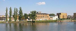
Oberschöneweide Quarter of Berlin Industrial buildings over the Spree river 
Coordinates 52°27′43″N 13°30′54″E / 52.46194°N 13.515°ECoordinates: 52°27′43″N 13°30′54″E / 52.46194°N 13.515°E Administration Country Germany State Berlin City Berlin Borough Treptow-Köpenick Basic statistics Area 6.18 km2 (2.39 sq mi) Elevation 34 m (112 ft) Population 17,094 (30 June 2008) - Density 2,766 /km2 (7,164 /sq mi) Founded 1598 Other information Time zone CET/CEST (UTC+1/+2) Licence plate B Postal codes (nr. 0909) 12459 Oberschöneweide (Upper Schöneweide) is a German locality (Ortsteil) within the Berlin borough (Bezirk) of Treptow-Köpenick. It is, with Niederschöneweide (Lower Schöneweide), part of the geographic area of Schöneweide. Until 2001 it was part of the former borough of Köpenick.
Contents
History
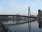
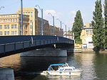
First mentioned in 1598 as Schöne Weyde, it became an industrial town at the end of 19th century. In 1920 it merged into Berlin with the "Greater Berlin Act". On April 16, 1945, during the Battle of Berlin (one of the last battles of World War II in Europe), before the German troops left Oberschöneweide, they tried to stop Red Army at the bridges "Kaisersteg" and "Treskowbrücke". On April 24 the zone was in the hands of the 8th Guards Army of the Soviet Union. Between 1949 and 1990 it was part of East Berlin, and all the industries were converted into Volkseigener Betrieb (VEB), the state-owned enterprises.[1]
Geography
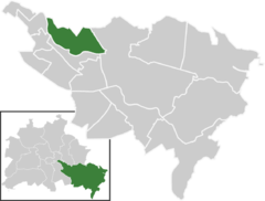
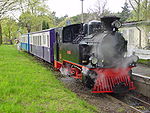
Located in the south-eastern side of the city and crossed by the river Spree, Oberschöneweide borders with the localities of Plänterwald, Baumschulenweg, Niederschöneweide, Köpenick, Karlshorst and Rummelsburg (both in Lichtenberg district). Its urban park is the Wuhlheide, in which is located the to ridable miniature railway Berliner Parkeisenbahn (BPE), used during the East German period by the Young Pioneer Organisation.
Culture
The Hochschule für Technik und Wirtschaft (HTW - translated as University of Applied Sciences for Engineering and Economy), the youngest and largest University of Applied Sciences of Berlin, has the Campus Wilhelminenhof [2] located in Oberschöneweide.
Transport
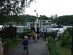
The locality is served, as urban rail, by the S-Bahn line S3, at Wuhlheide station, partly located in Köpenick. Located by the southern shore of the Spree in Niederschöneweide, it is the station of Schöneweide. The locality is also served by the tramway lines M17, 21, 27, 37, 63 and 67. At Wilhelmstrand, by the river, it is a short ferry service (line F11) that links it to Baumschulenstraße, in Baumschulenweg.
Photogallery
Personalities
- Emil Rathenau (1838–1915)
- Walther Rathenau (1867–1922)
References
Literature
- Judith Uhlig: "Köpenick – Geschichte der Berliner Verwaltungsbezirke". Stapp Verlag 1997, ISBN 3-87776-077-5
- Hans-Jürgen Rach: "Die Dörfer in Berlin". VEB Verlag für Bauwesen, Berlin 1988 ISBN 3-87776-211-5
External links
 Media related to Oberschöneweide at Wikimedia Commons
Districts and localities of Berlin  Charlottenburg-Wilmersdorf
 Friedrichshain-Kreuzberg
 LichtenbergAlt-Hohenschönhausen • Falkenberg • Fennpfuhl • Friedrichsfelde • Karlshorst • Lichtenberg • Malchow • Neu-Hohenschönhausen • Rummelsburg • Wartenberg
 Marzahn-Hellersdorf
 Mitte
Mitte Neukölln
 PankowBlankenburg • Blankenfelde • Buch • Französisch Buchholz • Heinersdorf • Karow • Niederschönhausen • Pankow • Prenzlauer Berg • Rosenthal • Stadtrandsiedlung Malchow • Weißensee • Wilhelmsruh
 ReinickendorfFrohnau • Heiligensee • Hermsdorf • Konradshöhe • Lübars • Märkisches Viertel • Reinickendorf • Tegel • Waidmannslust • Wittenau
 SpandauFalkenhagener Feld • Gatow • Hakenfelde • Haselhorst • Kladow • Siemensstadt • Spandau • Staaken • Wilhelmstadt
 Steglitz-Zehlendorf
 Tempelhof-Schöneberg
 Treptow-KöpenickAdlershof • Alt-Treptow • Altglienicke • Baumschulenweg • Bohnsdorf • Friedrichshagen • Grünau • Johannisthal • Köpenick • Müggelheim • Niederschöneweide • Oberschöneweide • Plänterwald • Rahnsdorf • SchmöckwitzDistricts > Localities > Zones • Greater Berlin Act • Former boroughsCategories:
- Populated places established in 1598
- Localities of Berlin
- Treptow-Köpenick
Wikimedia Foundation. 2010.

