- Chalfont St Giles
-
Coordinates: 51°37′55″N 0°34′34″W / 51.632°N 0.576°W
Chalfont St Giles 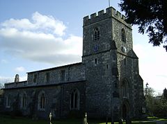
St Giles' parish church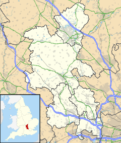
 Chalfont St Giles
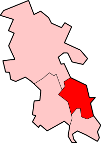
Chalfont St Giles shown within BuckinghamshirePopulation 6,696 [1] OS grid reference SU9893 Parish Chalfont St Giles District Chiltern Shire county Buckinghamshire Region South East Country England Sovereign state United Kingdom Post town Chalfont St Giles Postcode district HP8 Dialling code 01494 Police Thames Valley Fire Buckinghamshire Ambulance South Central EU Parliament South East England UK Parliament Chesham and Amersham Website The Chalfont St Giles village website List of places: UK • England • Buckinghamshire Chalfont St Giles is a village and civil parish within Chiltern district in south east Buckinghamshire, England, on the edge of the Chilterns, 25 miles from London, and near Seer Green, Jordans, Chalfont St Peter, Little Chalfont and Amersham.
Chalfont means chalk spring, in reference to the water carrying capacities of the local terrain. The village has a duck pond that is fed by River Misbourne.
Contents
History
The Church of England parish church of Saint Giles is Norman and dates from the 12th century.[2] It has a fine example of a lychgate. The Bishop Francis Hare is buried there.
In the Domesday Book in 1086 Chalfont St Giles and Chalfont St Peter are listed as separate Manors with different owners. They were separate holding before the Norman Conquest.
Like most other rural parishes it managed its civil affairs through the vestry until the Local Government Act 1894 required all parishes of over 300 people to have a Parish council independent of the Church.
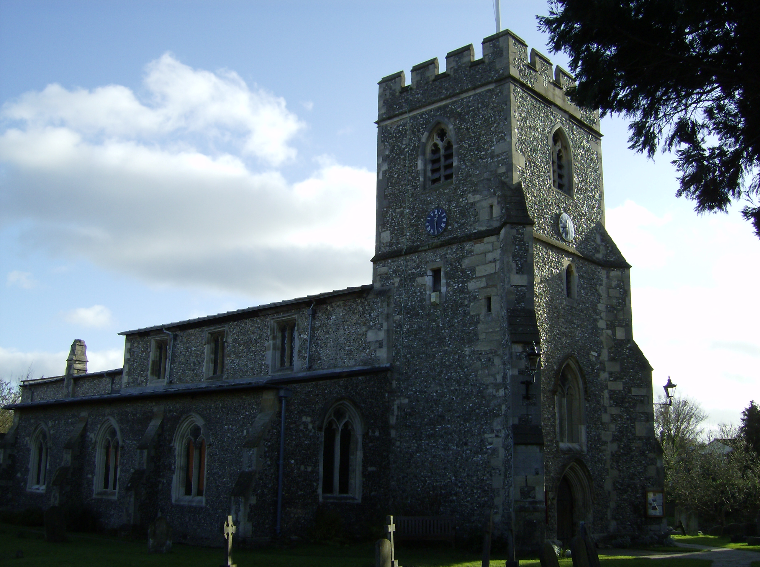
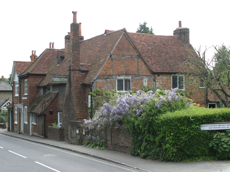
 Milton's Cottage
During the Great Plague of London in 1665, John Milton retired to Chalfont St Giles, which is where he completed his epic poem Paradise Lost.[3] Milton's Cottage is still in the village, and is open to the public. The inspiration for Paradise Regained is said to have been found in this parish from a conversation with a former pupil, Thomas Ellwood.
The birthplace of J.T. Hearne, one of the greatest bowlers of the 1890s and 1900s, who died there in 1944, and of the actress Alexandra Gilbreath.
Notable residents of the village have included Harry Golombek, Brian Connolly, Brian Cant, Chicane, Armando Iannucci, Noel Gallagher formerly of Oasis[4] and Nick Clegg who became the Liberal Democrats party leader in 2007[5] and Deputy Prime Minister of the United Kingdom in 2010.
The village has also given its name to Chalfont, Pennsylvania, which is a borough in Bucks County, Pennsylvania.
Amenities
The local football club is Chalfont Wasps, which was promoted to the Hellenic Football League Premier Division for the 2008-09 season. Chalfont St Giles has a tennis club, affiliated to the Lawn Tennis Association.[6]
The village is twinned with Graft-De Rijp in the Netherlands.
Film and television
Chalfont St Giles has been the location of several film and television programmes. It doubled as Walmington-on-Sea in the 1971 film version of Dad's Army. John Laurie, one of the main actors, lived in Chalfont St Peter. The Miller's Tale episode of the BBC Television drama The Canterbury Tales was filmed in and around Chalfont St Giles[7] as was an episode of the BBC Television sitcom As Time Goes By. It was the location for the filming of Episode 6 of Series 3 of Peep Show.[8]
Rhyming Slang
"Chalfonts" is one of many variations of Cockney rhyming slang for piles, this is derived from Chalfont St Giles but, as is typical with Cockney rhyming slang, the part of the phrase which rhymes with the derivative is omitted. There is a Viz comic strip named Nobby's Piles in which the protagonist, Nobby, uses a range of slang expressions when referring to his haemorrhoids including "Ooh, me chalfonts!"
Hamlets
Hamlets in Chalfont St Giles parish include:
- Bottrells Close, located along Bottrells Lane to the west of the village. Bottrells Close Cottage is the location of the ancient hamlet.
- Chalfont Grove, located to the south of the village along Narcot Lane. It is the location of the British Forces Broadcasting Service.
- Jordans, located south west of the main village, near Seer Green.
- Stratton Chase, located to the north of Mill Lane.
References
- ^ Neighbourhood Statistics 2001 Census
- ^ "'Parishes: Chalfont St. Giles', A History of the County of Buckingham: Volume 3 (1925), pp. 184-193.". British History Online. http://www.british-history.ac.uk/report.aspx?compid=42544. Retrieved 2009-06-15.
- ^ "A piece of Paradise in Bucks!". BBC. http://www.bbc.co.uk/threecounties/content/articles/2008/05/20/miltons_cottage_feature.shtml. Retrieved 2009-06-15.
- ^ http://www.buckinghamshireexaminer.co.uk/south-bucks-news/local-buckinghamshire-examiner-news/2010/02/26/oasis-s-noel-gallagher-to-build-home-in-chalfont-st-giles-114018-25923414/ Buckinghamshire Examiner article regarding Noel Gallagher
- ^ Family detective: Nick Clegg Daily Telegraph 22 Dec 2007
- ^ Chalfont St Giles Tennis Club
- ^ IMDB listing
- ^ IMDB listing
External links
Chiltern District Towns
(Component Areas
and Hamlets)Amersham (Woodrow) • Chesham (Botley, Chesham Vale, Chessmount, Codmore, Great Hivings, Hilltop, Lye Green, Newtown, Orchard Leigh, Pednormead End, Pond Park, Waterside)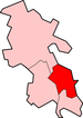
Other Civil Parishes
(Component Villages
and Hamlets)Ashley Green (Ashley Green, Whelpley Hill) • Chenies • Chalfont St Giles (Bottrells Close, Chalfont Grove, Chalfont St Giles, Jordans, Stratton Chase) • Chalfont St Peter (Austenwood, Chalfont Common, Gravel Hill, Layters Green) • Chartridge (Asheridge, Bellingdon, Chartridge, Hundridge, Pednor, Pednor Bottom) • Chesham Bois • Cholesbury-cum-St Leonards (Buckland Common, Cholesbury, Hawridge, St Leonards) • Coleshill • Great Missenden (Ballinger, Ballinger Bottom, Ballinger Common, Bryant's Bottom, Frith-hill, Great Missenden, Heath End, Hotley Bottom, Hyde End, Little Wood Corner, Mobwell, Prestwood, South Heath) • Latimer (Latimer, Ley Hill, Tyler's Hill) • Little Chalfont • Little Missenden (Beamond End, Holmer Green, Hyde Heath, Little Kingshill, Little Missenden, Mantles Green, Mop End, Spurlands End) • Penn (Beacon Hill, Forty Green, Knotty Green, Penn, Penn Bottom, Penn Street, Winchmore Hill) • Seer Green • The Lee (Lee Clump, Lee Common, Lee Gate, Hunt's Green, Swan Bottom, The Lee)Former Districts
and BoroughsFormer
ConstituenciesCategories:- Villages in Buckinghamshire
- Civil parishes in Buckinghamshire

Wikimedia Foundation. 2010.