- Cholesbury-cum-St Leonards
-
Cholesbury-cum-St Leonards Civil parish Governance: Parish Council Population: 979 (2001 census)[1] Main settlements: Buckland Common, Cholesbury, Hawridge, St Leonards Administration District council: Chiltern County: Buckinghamshire Region: South East Politics UK Parliament: Chesham and Amersham European Parliament: South East England Website
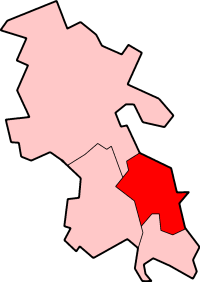
Cholesbury-cum-St Leonards is a civil parish in the Chiltern district of the English county of Buckinghamshire. It is located in the Chiltern Hills just to the north of Chesham and forms a boundary along its length with Hertfordshire.
It comprises the hamlet of Buckland Common, and the villages of Cholesbury, Hawridge and St Leonards which were brought together as part of the local government reorganisation in April 1934. The parish has since increased in size through the annexing of additional parcels of land which previously were part of Chesham, Ashley Green and Drayton Beauchamp.
Contents
History
In common with many other villages close to the scarp of the Chiltern Hills, the parishes formed from the ancient manors and estates ran from the fertile Vale of Aylesbury up the step wooded slope onto the Chiltern plateau and dip slope. They are collectively known by the social geographic term of strip parishes. Over time the upland communities, which had originally been temporary outposts connected to summer agricultural activity (transhumance), became distinct, permanent settlements.
Prior to 1934, the local government arrangements covering the area of the present-day parish were distributed across a number of separate civil parishes. Cholesbury has historical associations with Drayton Beauchamp, becoming an autonomous manor and parish from the 14th century. Meanwhile, Hawridge which has historic associations with Marsworth, despite the two settlements being separated by a narrow strip of land in Hertfordshire became an autonomous unit from around the 16th century. The other two main settlements of the modern-day parish, prior to 1934, were the upland portions of two other parishes. St Leonards had been part of a civil parish with Aston Clinton (also for a time known as Aston Clinton St Leonards). The hamlet of Buckland Common had been within the parish of Buckland. Additionally, as part of a contemporary county boundary changes, a narrow strip of mainly arable fields and woodland plantation which ran adjacent to the county boundary was also transferred from Drayton Beauchamp parish, as was part of the hamlet of Heath End, a small parcel of land previously in Wingginton parish in Hertfordshire. More recently, a section of land, formally part of Chesham parish has become incorporated at the Hawridge end of the parish.
Recreation and Culture
The relative remoteness of the villages and hamlets within the parish area together with their close geographic and historic associations which have strengthened their mutually-held independence from the nearest towns have resulted in a cultural identity developing across the parish. Locally, they are known as the Hilltop Villages'.[2] This is demonstrated by the existence of a number of long-established clubs and community organisations, which in similar fashion to the three local churches co-ordinate activities across the parish as a whole.[3]
Sport
The cricket club was formed in 1895 and leases its ground, located in Cholesbury from the Lord of the Manors of Hawridge and Cholesbury. There is a recreation ground associated with the parish hall in St Leonards, used for football, gymkhana and village sports events.
Social activity
The villages hold annual fêtes at St Leonards and on Hawridge and Cholesbury Commons. There are two community Halls, Cholesbury Village Hall, built in 1895 and St Leonards Parish Hall which opened in 1935, which host many of the parish-wide social activities such as; the Horticultural Society, Local History Group and Women's Institute.
Parishioners have a long-standing tradition of commemorating important anniversaries and participate in national celebrations by organising events such as parish race days; exhibitions, parish walks, and other cultural activities. The most recent of these took place in April 2009 when in the parish celebrated the parish's 75th Anniversary through a series of events comprising, in April a talk and exhibition entitled 'The first 75 years of Cholesbury-cum-St Leonards Parish'. In May, an inter-village 6-a-side cricket competition was held. In June, a Beating the Bounds ceremony took place when the was a perambulation of the original (1934), fourteen-mile parish boundary, which in contrast to similar events in other counties was conducted in the traditional clockwise direction. In July, there was a celebratory 'Flower Show' at St Marys Church and later that month a parish 'Families Fun Sports Day', including events such as children's and adult races and a Tug of War which had been a feature of several earlier celebrations in the parish relating to parish anniversaries and coronations. In August the Horticultural Show had classes celebrating the anniversary. In October there was a Civil Service led by the local priest. The year of commemoration concluded in February with a pantomime (Humpty-Dumpty).[4]
Governance
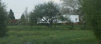
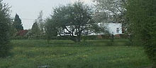 The Green at Buckland Common
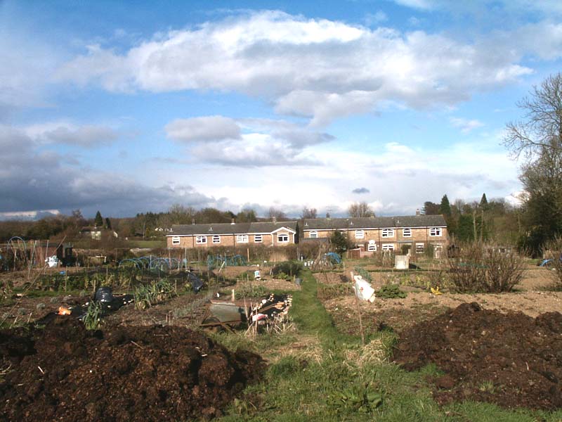
 The Allotments at Buckland Common
Governance for the civil parish is administered through a parish council. The parish is un-warded and comprises seven seats. The parish has been part of the local government area administered by Chiltern District Council since its inception in 1974 and is within the Chiltern Ridges ward of Buckinghamshire County Council. There are allotments and a village green at Buckland Common which are owned by the parish council. Key issues concerning parishioners include:- the increasingly poor condition and lack of maintenance of the local road network; lack in the availability of affordable housing; the negative impact on the Chilterns AONB of increased volumes of low-flying aircraft associated with Luton Airport; the impact of the proposed route through the Chilterns of the High Speed 2 the high speed railway between London and Birmingham which was announced in 2010 would be constructed from 2017 and be operational by 2025.
Religion
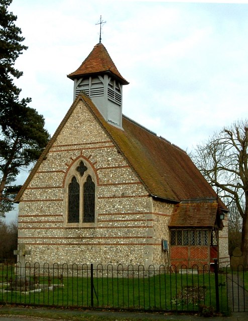
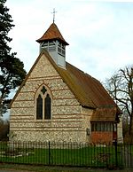 St Mary's Church, Hawridge
Today there are three Anglican churches:- St Mary's Hawridge; St Laurence, Cholesbury and St Leonards which are part of the Diocese of Oxford. There was a fourth church located adjacent to the Green at Buckland Common, which was deconsecrated in 1939 having fallen into disrepair. Nearby, there was also a Strict Baptist chapel which continued to serve the community until the end of the 1970s. In Hawridge a mission hall ran until the 1980s.Economy
Agriculture which formed the basis for most employment in the parish in the first part of the 20th century has ceased to be a significant source of work although there is employment for those supporting the remaining farming activities. There are no shops post offices in the parish. The majority of residents are employed in the surrounding towns; or further afield in London. Since the introduction of broadband a growing number of self employed and small businesses are run from home.
Education
Originally, there were two primary schools in the parish. The St Leonards School closed in the 1970s and today education for children up to year 6 is provided by Hawridge and Cholesbury Church of England School, located in Hawridge. The falling numbers of school age children has resuted in the school providing education to pupils living outside the catchment area, primarily on the outskirts of Chesham.
References
- ^ Neighbourhood Statistics 2001 Census
- ^ Hay, David and Joan (1994). Hilltop Villages of the Chilterns. England: Phillimore & Co Ltd. ISBN 0 85033 505 1.
- ^ Cholesbury-cum-St Leonards social activities diary Accessed 15 April 2010
- ^ Parish Newsletter and 75 Anniversary celebrations, Accessed 18 April 2010
Chiltern District Towns
(Component Areas
and Hamlets)Amersham (Woodrow) • Chesham (Botley, Chesham Vale, Chessmount, Codmore, Great Hivings, Hilltop, Lye Green, Newtown, Orchard Leigh, Pednormead End, Pond Park, Waterside)
Other Civil Parishes
(Component Villages
and Hamlets)Ashley Green (Ashley Green, Whelpley Hill) • Chenies • Chalfont St Giles (Bottrells Close, Chalfont Grove, Chalfont St Giles, Jordans, Stratton Chase) • Chalfont St Peter (Austenwood, Chalfont Common, Gravel Hill, Layters Green) • Chartridge (Asheridge, Bellingdon, Chartridge, Hundridge, Pednor, Pednor Bottom) • Chesham Bois • Cholesbury-cum-St Leonards (Buckland Common, Cholesbury, Hawridge, St Leonards) • Coleshill • Great Missenden (Ballinger, Ballinger Bottom, Ballinger Common, Bryant's Bottom, Frith-hill, Great Missenden, Heath End, Hotley Bottom, Hyde End, Little Wood Corner, Mobwell, Prestwood, South Heath) • Latimer (Latimer, Ley Hill, Tyler's Hill) • Little Chalfont • Little Missenden (Beamond End, Holmer Green, Hyde Heath, Little Kingshill, Little Missenden, Mantles Green, Mop End, Spurlands End) • Penn (Beacon Hill, Forty Green, Knotty Green, Penn, Penn Bottom, Penn Street, Winchmore Hill) • Seer Green • The Lee (Lee Clump, Lee Common, Lee Gate, Hunt's Green, Swan Bottom, The Lee)Former Districts
and BoroughsFormer
ConstituenciesCategories:- Civil parishes in Buckinghamshire
Wikimedia Foundation. 2010.