- Kaesong
-
Kaesŏng
개성시— Municipal City — Korean transcription(s) – Hangul 개성특급시 – Hanja 開城特級市 – McCune-Reischauer Kaesŏng-T'ŭkkŭpsi – Revised Romanization Gaeseong-Teukgeupsi Kaesong city center.
Nickname(s): Songdo (송도/松都) (Korean)
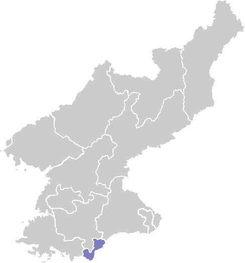
" City of Pines "Note: Map shows boundaries of former Kaesŏng Directly Governed City.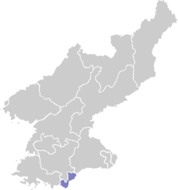
Country  North Korea
Region Haesŏ Settled c. 700 AD Administrative divisions 24 dong, 3 ri Area – Total 1,309 km2 (505.4 sq mi) Population (2008) – Total 308,440 – Dialect Seoul Flower Tree Bird Kaesŏng (Gaeseong; Korean pronunciation: [kɛsɔŋ]) is a city in North Hwanghae Province, southern North Korea (DPRK), a former Directly Governed City, and the capital of Korea during the Koryo Dynasty. The city is near Kaesŏng Industrial Region and it contains the remains of the Manwoldae palace. It was formally named Songdo while it was the ancient capital of Koryo. It prospered as a trade center that produced Korean ginseng, which is famous internationally. It is now the DPRK's light industry centre. It has a population of 308,440 as of 2008.[1]
Contents
History
The earliest archaeological signs of habitation in the Kaesong area date from the Neolithic Age. Artifacts such as Jeulmun pottery, stone ware, and stone axes have been excavated from Mount Osong and Kaesong Nasong (double-walled fortress of Kaesong). As Kaesong has been occupied by various states throughout centuries, its name has changed as well. It was realm of Mahan confederacy, and was referred to as Busogap during the rule of Goguryeo. Before the strength of Baekje was retreated to the southwest of Jungnyeong, Joryeong, and Asan Bay in 475, the area had been a part of Baekje for about 100 years. However, it became a territory of Silla since 555, the 16th year of King Jinheung and its name was changed to "Songak-gun" during the period. According to Samguk Sagi, when a castle was built in the site in 694, the third year of King Hyoso's reign, Kaesong was referred to as "Songak (송악; 松嶽)". Therefore, it is assumed that the name, Songak had been used at least before the time.[2]
Silla began to decline in late 9th century, and a period of rival warlords ensued. In 898, Kaesong fell under the hand of Gung Ye, the founder of his short-lived state, Later Goguryeo, and than subsequently became a part of Goryeo in 919 by its founder, Wang Geon. Wang Geon established the capital in the south of Songak, and incorporated Kaesong County into Songak under the name of "Gaeju". In 919, Kaesong became the national capital. In 960, the 11th year of King Gwangjong's reign, the city was renamed as Gaegyeong, and in 995, the 14th year of King Seongjong's reign, it was elevated as "Gaesong-bu". The Gaeseong-bu is a combined term of Songak-gun, and Gaesong-gun, which is different from the region of the pre-1945 Gaesong-ri, Seo-myeon, Kaepung-gun. In 1010, the first year of King Hyeonjong's reign, the palace and houses were almost burnt down during the Second Goryeo–Khitan War, so in 1018, Gaesong-bu was relegated for the "bu" system, and became to govern the three hyeon unites of Jeongju, Deoksu, and Gangeum.[2] In the late 12th century, there was a period of instability in both the government and the countryside. A slave named Manjǒk (or spelled as Manjeok) (만적; 萬積) led a group of slaves who gathered outside Kaesong in 1198. The revolt plot was suppressed by Choe Chung-heon.[3] When Yi Songgye overthrew the Koryo Dynasty in 1392 and established the Joseon Dynasty, he moved the Korean capital from Kaesŏng to Hanyang (modern-day Seoul) in 1394.[2]
Kaesŏng remained a part of Gyonggi Province until the Korean War. In 1951, the city (which had been part of South Korea) came under North Korean control, and the part of Kyonggi Province that came to be occupied was organized into "Kaesŏng Region" (Kaesŏng Chigu; 개성 지구; 開城 地區). In 1955, Kaesŏng became a "Directly Governed City" (Kaesŏng Chikhalsi; 개성 직할시; 開城 直轄市). In 2002, Kaesŏng Industrial Region was formed from part of Kaesŏng. In 2003, the remaining part of Kaesŏng (excluding the Industrial Region) became part of North Hwanghae Province. The city is close to the Demilitarized Zone that divides North and South Korea. When Korea was partitioned at the 38th parallel after World War Two, Kaesong was on the southern side of the line (within the Republic of Korea). Thus Kaesong was the only city to change control from South to North Korea after the Korean War.[2]
Geography
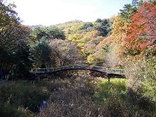 Mountains of Kaesong
Located in the center of Korea, Kaesong is the southernmost city of North Korea. It is bordered by Kaepung, Changpung, Panmun, and Kumchon counties. Kanghwa Island of Incheon Municipality lies just south, beyond a narrow channel. It covers an area of 1,309 km², the urban district is surrounded by Mts. Songak (Songak-san; 송악산; 松嶽山) (489 m) and Pongmyong. The city center surrounds the much smaller Mt. Janam (103 m), on which is located the city's iconic Kim Il Sung statue.
In the northern part of Kaesong, the end of the Ahobiryŏng range creates the northernmost border of Kaesong City. This range consists of Mts. Chŏnma (757 m), Sŏnggŏ, Myoji (764 m), Suryong (716 m), Chesŏk (749 m), Hwajang (558 m), and Ogwan. With the exception of the mountainous northeastern region, however, most areas of Kaesong consist of low hills with the height less than 100 meters.[4]
The Imjin River flows along the northeastern border line of the city and the Ryesong River (禮成江) (Ryeseong-gang; 례성강) (spelled in South Korea as Yeseong-gang; 예성강) runs along the western border to the mouth of the Han River. In addition to the two rivers, small and large rivers and streams such as Samich'ŏn, Wŏlamch'ŏn,, Chukbaech'ŏn, Kŭmsŏngch'ŏn and Sach'ŏn rivers drain into the Han. The river basin located in the southwest of Kaesong has spacious alluvial plains such as P'ungdŏkbŏl, Singwangbŏl, and Samsŏngbŏl.[4]
The geology consists of the Proterozoic, Cenozoic, and Paleozoic strata and Mesozoic intrusive granite. The underground resources include gold, zinc, copper, fluorspar, limestone, granite, and kaolin. The soil comprises generally brown forest soil while the areas drained by Yesŏng, Imjin, and Han rivers consist of mostly alluvial and saline soil. The climate is generally warm and moderate, so the average annual temperature is around 10 ℃. The coldest month is January, with an average temperature of ―5.9℃ while the hottest month is August, with the average temperature of 24.7℃. The average annual rainfall is 1,300~1,400 millimeters. The duration of frost-free period is 180 days which is the longest in North Korea. The forest area takes up about 55 percentage of Kaesong, among which forests of pine trees form the 80 percentage. Various types of species inhabit in Kaesong, with 40 different species of mammal, and 250 birds.[4]
Administrative divisions
Before 2002, Kaesŏng Directly Governed City was divided into one city (Kaesŏng itself) and three counties; Changp'ung-gun, Kaep'ung-gun and P'anmun-gun. In 2003, P'anmun-gun and part of Kaesŏng-si were separated from Kaesŏng Directly Governed City and merged to form Kaesŏng Industrial Region. The remaining part of Kaesŏng joined North Hwanghae in 2002. Kaesong is currently divided into 24 administrative districts known as Dong, as wells as three villages ("ri").[5]
- Koryo-dong (고려동/高麗洞)
- Haeun-dong (해운동/海雲洞)
- Janam-dong (자남동/子男洞)
- Kwanhun-dong (관훈동/冠訓洞
- Manwol-dong (만월동/滿月洞)
- Naesong-dong (내성동/內城洞)
- Naman-dong (남안동/南安洞)
- Nammun-dong (남문동/南門洞)
- Namsan-dong (남산동/南山洞)
- Pangjik-dong (방직동/紡織洞)
- Poson-dong (보선동/保善洞)
- Pukan-dong (북안동/北安洞)
- Pusan-dong (부산동/扶山洞)
- Ryonghung-dong (룡흥동/龍興洞)
Culture
Landmarks
 The Koryo Museum
Koryo Songgyungwan University (Light Industry), Communist University and Art College are located in Kaesŏng. The Koryo Museum, housed in the city's old Confucian academy, contains many priceless Koryo arts and cultural relics (although many are copies, with the originals held in the vaults of the Korean Central History Museum in Pyongyang. As the former capital of the Koryo dynasty, the tombs of almost all of the Koryo kings are located in the area, though most are not accessible; the heavily reconstructed Hyollung Royal Tomb, belonging to the dynasty's founder, Taejo, is located to the west of the city in Kaepung-gun. Other notable tombs include those of kings Hyejong (the Sollung Royal Tomb), Kyongjong (Yongrung), Songjong (Kangrung), Hyonjong (Sollung), Munjong (Kyongrung), and Kongmin (Hyonjongrung). Kaesong also contains north Korea's only two royal tombs dating to the Joseon dynasty; the Hurung Royal Tomb, belonging to the dynasty's second king, Jongjong, and the Cherung Royal Tomb, containing the remains of Queen Sinui, wife of the dynasty's founder, Yi Songgye. The two final tombs, despite belonging to members of the Joseon royal family, were excluded from the World Heritage listed "Royal Tombs of the Joseon Dynasty because of their location in North Korea.
Cuisine
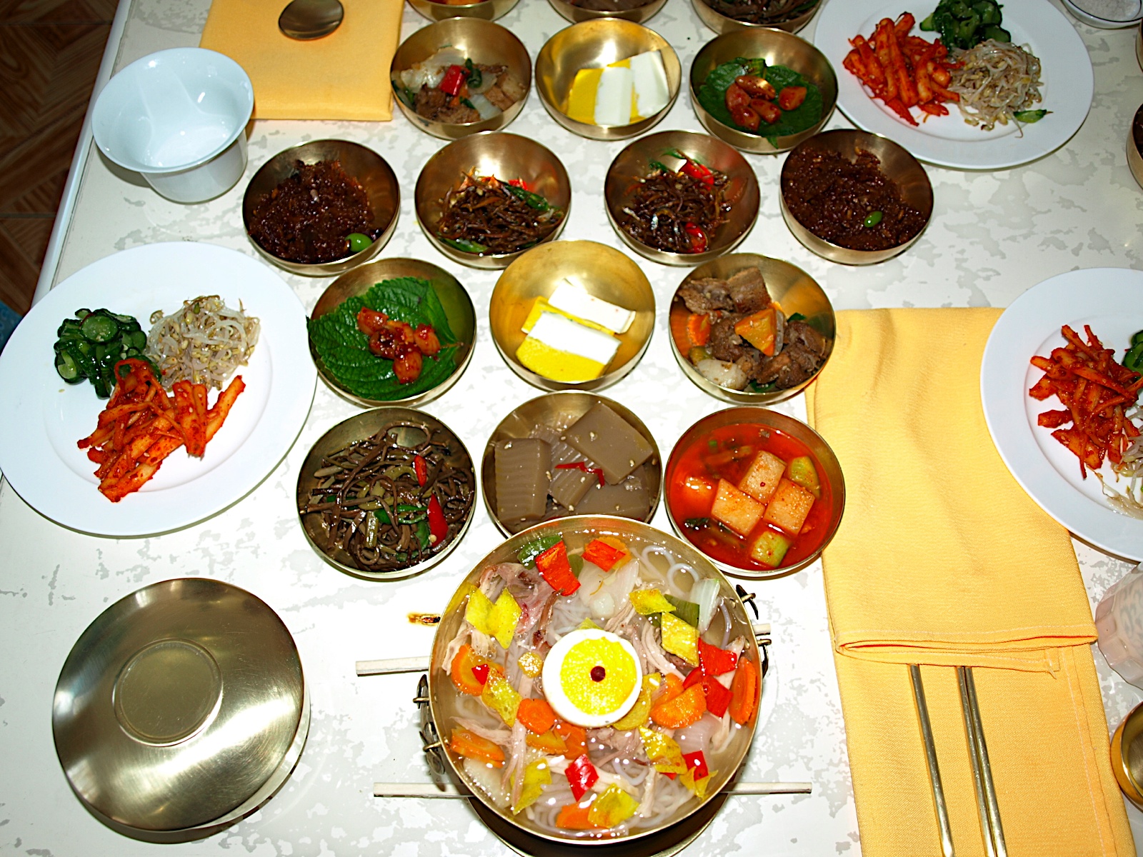
See also: Korean regional cuisine A meal for visitors at Tongil restaurant, Kaesong.
As Kaesong was the capital of Goryeo with almost 500 years of rule, its culinary culture was highly developed. The luxurious style of Kaesong cuisine is frequently compared with those of Seoul cuisine and Jeolla cuisine.[6] Kaesong cuisine was traditionally treated as part of Gyeonggi cuisine, since Kaesong belonged to Gyeonggi province until 1950. However, it has been incorporated into the administration of North Korea after the Korean War while Gyeonggi province is administered by South Korea. Bossam kimchi (wrapped kimchi), pyeonsu (summer mandu in square shape),[7] sinseollo (royal casserole), seolleongtang (beef tripe soup), chueotang (mudfish soup), joraengi tteokguk (rice cake soup), umegi (tteok covered with syrup), and gyeongdan (ball-shaped tteok) are representative Kaesong dishes. Umegi, also called Kaesong juak is a holiday food of Kaesong, and known for the delicate style with the sweet and nutty taste. The dish is made by kneading a mixture of rice flour and glutinous rice flour with warm water, by shaping the dough into balls with either one pine nut or jujube, by frying and coating them with syrup.[6][8]
Economy
With its topography, climate, soil conditions, Kaesong has advantageous natural conditions for agricultural productions. The water supply system is established with 18 reservoirs including Songdo Reservoir built for agricultural advances and about 150 pumping stations as well as hundreds of dammed pools. The cultivated land accounts for the 27 percentage of Kaesong, and rice, maize, soybeans, wheat, and barley are the main crops. Among them, rice production accounts for the 60 percentage of the whole grain production, and Kaepung and Panmun are the two primary regions, producing more than 70 percentage of the rice production. In addition, vegetable and fruit cultivation including peach, apple and persimmon, livestock farming, and sericulture are active. Peach is a local specialty of Kaesong, and especially white peach is famous, so the production of the latter accounts for more than 25 percentage of the gross fruit production. The counties of Kaepung-gun and Panmun-gun are also known for the good quality of Korean ginseng called Goryeo Insam, and the active ginseng cultivation. The processing and exporting the product take place around the counties.[9]
Kaesŏng is DPRK’s light industry centre. The urban district is equipped with a jewel processing factory, ginseng processing factory and an embroidery factory.[citation needed] Since the Goryeo period, Kaesong had been a center of handcrafts such as Goryeo porcelain, and commerce while the textile industry has been the primary business along with the production of grocery goods, daily general goods, and ginseng products after the division into the two states. The food processing industry ranks the right next to the textile business, mainly producing jang (soybean-based condiments), oil, canned foods, alcoholic beverages, soft drinks and others. In addition, resin, timber, handicrafts, pottery, shoes, school supplies, musical instruments, and glass are produced. Kaesong has factories for producing agricultural machines and tractor repair. As of 2002, the city had the headquarters of the Central Bank of North Korea and branches in Kapung and Panmun counties as financial institutions.[9]
Tourism
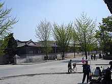 A side street in Kaesong
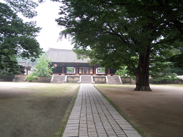
Kaesong is a major tourist destination for foreign visitors to North Korea, and one of only two locations in North Korea accessible from the south. Many Koryo-era sites are located in Kaesong, including the Kaesong Namdaemun gate, the Songgyungwan Confucian Academy, now the Koryo Museum, and the Sonjuk Bride and Pyochung Pavilion. Less-known sites include Kwandok Pavilion, the ruined Koryo-era Manwoldae Palace, Anhwa Temple, Sungyang Hall, Mokchong Hall, and the Kaesong Chomsongdae (개성 첨성대; 開城 瞻星臺) observatory. Located to the west of the city are the tombs of Kings Kongmin and Wanggon; twenty-four km north of Kaesong is Taehungsan Fortress, a Koguryo satellite fortress built to protect Pyongyang. This castle contains the Kwanum and Taehung Temples. The famous Pakyon Falls are located in the area, as well as a large, recently discovered Koryo-dynasty Buddha carved into the stone on Mt. Chonma. Most tourists to Kaesong are put in the traditional Kaesong Folk Hotel, housed in 19 traditional hanok courtyard houses.
Education
Seonggyungwan, one kilometer north of Seonjukgyo bridge is a representative traditional educational institution in Kaesong. It was founded in the neighborhood of Gukja-dong with the name of "Gukjagam (국자감; 國子監)" in 992 during the reign of King Seongjong of Goryeo, which ignited Confucian studies in Korea. Its name was changed to Gukhak (국학; 國學) in the reign of King Chungnyeol, and was referred to as Seonggyungwan. In 1367, the 16th year of King Gongmin's reign, the structure was revamped and Yi Saek, and Jeong Mong-ju, Confucian scholars of the time taught there as professors. In 1592, the 25th year of King Seonjo's reign during the Joseon Dynasty, Kim Yuk reconstructed the institution which was burned down by the Japanese during the Imjin War.[2]
The first modern school that appeared in Kaesong was Hanyeong Seowon (한영서원; 韓英書院), or Anglo-Korean School established by Yun Chi-ho in 1906, with the help of American missionary Mr. Wasson, and Mr. Candler. It obtained authorization as Songdo High School from Governor-General of Korea in 1917, and expanded to the Songdo School Foundation in 1950 with the accreditation for the establishment of Songdo Middle School and Songdo College of Pharmacy, the latter of which produced 40 graduates. However, when the Korean War occurred, the foundation was moved to Incheon, and reconstructed Songdo Middle and High Schools in 1953 which still exist to the present.[2]
As of 2002, Kaesong had 80 each public elementary schools which scattered in each unit of ri (village), 60 middle-high schools, 3 colleges and 3 universities such as Songdo University of Politics, Kaesong University of Education, and Kaesong Communist University.[10]
Transportation
Kaesŏng is connected to Pyongyang and other cities by rail, highways and a dual purpose military and civilian airport. The city's main railway station is Kaesong Station, which is on the Pyongbu Line.
Sister Cities
 Peru (Cusco) (1990)
 Brazil(Belém) (1994)
- Peru (Tacna) (1996)
 Nepal (Kathmandu) (1992)
 India (Mumbai) (1999)
 Colombia (Cartagena) (2002)
 Republic of Moldova (Bălţi) (1997)
People born in Kaesong
- Uichon (1055–1191), founder of the Chontae Buddhist sect
- Choe Chung-hon (1149–1219), a military ruler of Korea during the Koryo Dynasty
- Choe U (died 1249), general of the Koryo Dynasty, son of Choe Chung-Hon
- Hwang Hui (1363–1452), prime minister of the Choson Dynasty
- Hwang Jin-i (1515–1550), famous Kisaeng and poet
- K. W. Lee (1928-), American journalist
- Won Pyong Oh (1929-), zoologist
References
- ^ national census report.pdf United Nations Statistics Division; 2008 Census of Population of the Democratic People’s Republic of Korea conducted on 1–15 October 2008 (pdf-file) Retrieved on 2009-03-01.
- ^ a b c d e f 개성시 開城市 (Kaesong) (in Korean) Nate/ Encyclopedia of Korean Culture
- ^ Michael J. Seth. A concise history of Korea: from the neolithic period through the nineteenth century. pp. 99-102. Rowman & Littlefield, 2006.
- ^ a b c 개성직할시 자연환경 (Nature of Kaesong) (in Korean) Nate / Britannica
- ^ 개성시(開城市) KAESONGSI (in Korean) JoongAng Ilbo
- ^ a b "향토음식 鄕土飮食 [Hyangto eumsik]" (in Korean). Nate/Encyclopedia of Korean Culture. http://100.nate.com/dicsearch/pentry.html?s=K&i=241864&v=43.
- ^ 편수 (Pyeonsu) (in Korean) Nate / Encyclopedia of Korean Culture
- ^ "닮은 듯 색다른 매력을 간직한 북한의 음식 문화" (in Korean). Korea Knowledge Portal. 2009-06-19. http://www.knowledge.go.kr/jsp/theme/themeView.jsp?themeIdx=2872&dir=al&page=4&searchOption=all&searchValue=.
- ^ a b 개성직할시 산업과 교통 (Industry and transport of Kaesong) (in Korean) Nate / Britannica
- ^ 개성직할시 교육과 문화 (Education and Culture of Kaesong) (in Korean) Nate / Britannica
External links
- Kaesong travel guide from Wikitravel
- German website about the City of Kaesong
- BBC News North Korea opens hidden city to tourists
Metropolitan cities of North Korea Directly governed city Provincial capitals Cities (not included above) Regions and administrative divisions of North Korea Regions Provinces Chagang · Hamgyŏngbuk · Hamgyŏngnam · Hwangbuk · Hwangnam · Kangwŏn · P'yŏngbuk · P'yŏngnam · RyanggangDirectly governed city Categories:- Cities in North Hwanghae
- Kaesong
- Former national capitals


Wikimedia Foundation. 2010.