- Kangwon-do (North Korea)
Infobox Korean settlement
title = Kangwŏn Province
context = north
hangul = 강원도
hanja = 江原道
rr = Gangwon-do
mr = Kangwŏn-do
hangulshort = 강원
rrshort = Gangwon
mrshort = Kangwŏn
gov = Province
capital = Wŏnsan
divs = 2 cities (si), 15 counties (kun)
region =Gwandong
(Yeongseo : western Kangwŏn;Yeongdong : eastern Kangwŏn)
dialect = Kangwŏn, Hamgyŏng
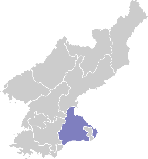
mapcaption = Map of North Korea highlighting the province.Kangwŏn (Kangwŏn-do) is a province of
North Korea , with its capital at Wŏnsan. Before thedivision of Korea in1945 , Kangwŏn and itsSouth Korea n neighbour Gangwon-do (also spelled "Kangwon-do") formed a single province that excludedWŏnsan .History
Kangwŏn was one of the Eight Provinces of Korea during the
Joseon Dynasty . The province was formed1395 , and derived its name from the names of the principal cities ofGangneung (or Kangnŭng; _ko. 강릉; _ko. 江陵) and the provincial capitalWonju (or Wŏnju; _ko. 원주; _ko. 原州).In
1895 , Kangwŏn was replaced by the Districts of Chuncheon ("Chuncheon-bu;" _ko. 춘천부; _ko. 春川府) in the west and Gangneung ("Gangneung-bu;" _ko. 강릉부; _ko. 江陵府) in the east. Wonju became part ofChungju District.In
1896 , Korea was redivided into thirteen provinces, and the two districts were merged to re-form Kangwŏn Province. Although Wonju rejoined Kangwŏn province, the provincial capital was moved to Chuncheon.In
1945 , Kangwŏn Province (along with the rest of Korea) was divided by the38th parallel north in 1945 into Soviet and American zones of occupation in the north and south respectively. In1946 , the northern province was expanded to include the North Korean portion ofGyeonggi Province, and the area around Wnsan in South Hamgyŏng Province. The provincial capital of the North Korean portion of the province was established at Wŏnsan, as Kangwŏn's traditional capitals Wonju and Chuncheon both were south of the 38th parallel. In1948 , the province became part of the new Democratic People's Republic of Korea. As a result of theKorean War ceasefire of1953 , the boundary between the North and South Korean portions of the province was shifted northward to the Military Demarcation Line.In
2002 , Kŭmgangsan Tourist Region was split off from the rest of the province to form a separately-administered region.Geography
The province is bordered by South Hamgyŏng to the north, South P'yŏngan and
North Hwanghae to the west, and Kaesŏng to the south. Additionally, the province is across theKorean Demilitarized Zone from its South Korean counterpart Gangwon. To the east is theSea of Japan (East Sea of Korea).The province is dominated by the T'aebaek Mountains, the highest peak of which is Kŭmgang-san ("Diamond Mountain").
Kangwŏn and Gangwon Provinces are together referred to as the
Gwandong region. The region west of the Taebaek Mountains is called Yŏngsŏ, while the region east of the mountains is called Yŏngdong.Administrative divisions
Kangwŏn Province is divided into 2 cities ("si") and 15 counties ("kun").
Cities
* Munchŏn-si ( _ko. 문천시; _ko. 文川市)
* Wŏnsan-si ( _ko. 원산시; _ko. 元山市)Counties
* Anbyŏn-gun ( _ko. 안변군; _ko. 安邊郡)
* Ch'angdo-gun ( _ko. 창도군; _ko. 昌道郡)
* Ch'ŏrwŏn-gun ( _ko. 철원군; _ko. 鐵原郡; formerly Anhyŏp-gun; not to be confused with the ROK's neighboringCheorwon -gun)
* Ch'ŏnnae-gun ( _ko. 천내군; _ko. 川內郡)
*Hoeyang -gun ( _ko. 회양군; _ko. 淮陽郡)
* Ichŏn-gun ( _ko. 이천군; _ko. 伊川郡)
*Kimhwa -gun ( _ko. 김화군; _ko. 金化郡)
*Kosan -gun ( _ko. 고산군; _ko. 高山郡)
* Kosŏng-gun ( _ko. 고성군; _ko. 高城郡)
* Kŭmgang-gun ( _ko. 금강군; _ko. 金剛郡)
* P'an'gyo-gun ( _ko. 판교군; _ko. 板橋郡)
* Pŏptong-gun ( _ko. 법동군; _ko. 法洞郡)
* P'yŏnggang-gun ( _ko. 평강군; _ko. 平康郡)
* Sep'o-gun ( _ko. 세포군; _ko. 洗浦郡)
* T'ongch'ŏn-gun ( _ko. 통천군; _ko. 通川郡)External links
* [http://seoul600.visitseoul.net/seoul-history/sidaesa/txt/5-3-2-1.html Seoul City history article on Hanseong and 22 other late 19th-century districts (in Korean)]
Wikimedia Foundation. 2010.