- Changdo
-
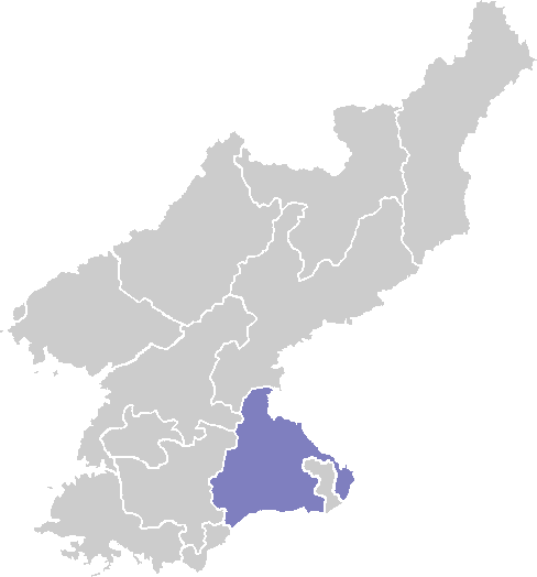
Changdo 
Korean name Chosŏn'gŭl 창도군 Hancha 昌道郡 McCune–Reischauer Ch'angdo kun Revised Romanization Changdo-gun Statistics Area 696 km2 (268.7 sq mi) Population (1991) 33,000 (est.) Population density 47.4/km2 (122.8/sq mi) Administrative divisions 1 ŭp, 23 ri Changdo is a kun, or county, in Kangwon province, North Korea. Originally part of Kimhwa, it was split off as a separate county in 1952.
Changdo lies to the west of the Taebaek Mountains, in the Ryongso region of Kangwon, but is nonetheless quite rugged. The highest point is Okpatbong (옥밭봉), 1240 m above sea level. Changdo lies just north of the Korean Demilitarized Zone. The chief stream is the Pukhan River, which flows southward across the DMZ into South Korea. Roughly 80% of the county's area is forestland.
The chief local industry is agriculture, including sericulture and livestock farming. Lumbermills have also been developed, but there is little other industry. There are deposits of copper, zinc, nickel, and lead.
Changdo is connected to the rest of North Korea by road, but not by rail.
See also
- Geography of North Korea
- Administrative divisions of North Korea
- Kangwon (North Korea)
External links
- (Korean) In Korean language online encyclopedias:
Kangwŏn Capital 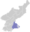
Cities SAR Counties Categories:- Counties of Kangwon

Wikimedia Foundation. 2010.