- Moorsholm
-
Coordinates: 54°31′14″N 0°56′12″W / 54.52061°N 0.93674°W
Moorsholm
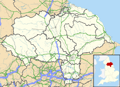
 Moorsholm shown within North Yorkshire
OS grid reference NZ571197 Unitary authority Redcar and Cleveland Ceremonial county North Yorkshire Region North East Country England Sovereign state United Kingdom Police Cleveland Fire Cleveland Ambulance North East EU Parliament North East England List of places: UK • England • Yorkshire Moorsholm is a village in the borough of Redcar and Cleveland and the ceremonial county of North Yorkshire, England.
The village lies 5 miles from Saltburn-by-the-Sea between the North York Moors and the North Sea. Because of its proximity to the North Sea coast the area was vulnerable, historically, to attack by invaders from Scandinavia. The name of Moorsholm is of Viking origin with the suffix holm, which meant a settlement, being affixed to the location of the village by the moors: so meaning settlement by the moors. The village used to be called Great Moorsholm to distinguish it from a farm called Little Moorsholm, which is the other side of the Hagg Beck Valley to the north. 'Little Moorsholm' is a title now more commonly applied to a more modern housing estate between that farm and Lingdale. The settlement was mentioned in the Domesday book as Morehusum, belonging to Robert de Brus, ancestor to the kings of Scotland.[1] It was a planned medieval village built along a main street with crofts and their associated tofts on each side. The church of St Mary, Moorsholm, was built in 1892 and is of stone in 12th-century style. It consists of chancel, nave and west tower.[2]
 St Mary's Church
The Memorial Hall was built as a war memorial in 1957 and is used as the doctors’ surgery and meeting room.[3] About a mile to the south of Moorsholm is the landmark of Freebrough Hill Hill, a detached natural hill which is conical in shape.[4]
Sport
Whilst only being a small village Moorsholm has a few sports available, with some ventures having to recruit better players from local teams like Loftus and Guisborough
Moorsholm Athletic is the village football team. It is for under 15's and is currently in Division 5 in the Teeside Junior Football Alliance (TJFA). In recent years villagers have started their own tournament which pits the under 30's population of the village against the over 30's, as an 11 a side extension of the popular summer 5 a side fixture.
A Cricket team is ever present in the summer playing on the Recreation field.
Quoits and Darts are ever popular in the rural village, and have proved to be two of their most successful sports.
Whilst only being a small village Moorsholm has a few sports available, with some ventures having to recruit better players from local teams like Loftus and Guisborough
Moorsholm Athletic is the village football team. It is for under 15's and is currently in Division 5 in the Teeside Junior Football Alliance (TJFA). In recent years villagers have started their own tournament which pits the under 30's population of the village against the over 30's, as an 11 a side extension of the popular summer 5 a side fixture.
A Cricket team is ever present in the summer playing on the Recreation field. In 2011 the team is playing in the Langbaurgh Cricket League division 1. The team is currently going through a transitional period and are on the look out for new players and people interested in helping with organisational issues, especailly with regard to fundraising to build a new pavilion. With the help of Guisborough CC the club are running an under 14 team in 2011 and again are looking for interest especially from people with connections to the village. Please see notices on the clubhouse for more information and for a list of fixtures.
References
- ^ "GENUKI: Skelton In Cleveland Parish information from National Gazetteer 1868.". www.genuki.org.uk. http://www.genuki.org.uk/big/eng/YKS/NRY/Skeltonincleveland/Skeltonincleveland68.html. Retrieved 2008-07-23.
- ^ "Parishes - Skelton". www.british-history.ac.uk. http://www.british-history.ac.uk/report.aspx?compid=64681. Retrieved 2008-07-23.
- ^ "WISH: Moorsholm Memorial Hall (TS12 - Saltburn & East Cleveland)". ts12.gazettelive.co.uk. http://ts12.gazettelive.co.uk/2007/09/wish_moorsholm_memorial_hall.html. Retrieved 2008-07-23.[dead link]
- ^ "Moorhouse - Morebath". www.british-history.ac.uk. http://www.british-history.ac.uk/report.aspx?compid=51158#s5. Retrieved 2008-07-23.
External links
Locations in the Unitary authority of Redcar and Cleveland Towns Villages Boosbeck • Boulby • Brotton • Carlin How • Charltons • Coatham • Dormanstown • Dunsdale • Easington • Handale • Kilton • Kilton Thorpe • Kirkleatham • Lazenby • Lingdale • Liverton • Margrove Park • Marske-by-the-Sea • Moorsholm • New Marske • Newton under Roseberry • Normanby • North Skelton • Ormesby • Pinchinthorpe • Scaling • Skinningrove • Stanghow • Teesville • Upleatham • Warrenby • Wilton • YearbyParish & Town Councils See also Cleveland • Greater Eston • Langbaurgh (wapentake) • Langbaurgh East • Eston Nab • Schools in Redcar and Cleveland • South Gare • Teesport • Teesside • Tees Valley
Categories:- Villages in North Yorkshire
- Locations in the Tees Valley
- Redcar and Cleveland
- Redcar and Cleveland geography stubs
Wikimedia Foundation. 2010.


