- Maryland Route 284
-
Maryland Route 284
Hemphill Street 
Route information Maintained by MDSHA Length: 0.25 mi[1] (0.40 km) Major junctions South end:  MD 285 in Chesapeake City
North end: MD 285 in Chesapeake CityLocation Counties: Cecil Highway system Maryland highway system
Interstate • US • State • Minor • Former • Turnpikes←  MD 283
MD 285 →Maryland Route 284 (MD 284) is a state highway in the U.S. state of Maryland. Known as Hemphill Street, the state highway runs 0.25 miles (0.40 km) between two intersections with MD 285 in Chesapeake City in southern Cecil County. MD 284 was paved in the mid 1910s as part of the original state road between Cecilton and Elkton that crossed the Chesapeake and Delaware Canal. The state highway was bypassed when a new bridge was constructed to crossed the expanded canal in the mid 1920s.
Contents
Route description
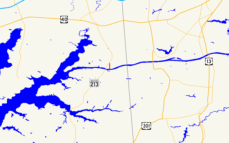
MD 284 begins at MD 285 (Biddle Street) in the town of Chesapeake City. The state highway heads north as a two-lane road through a residential area. Just after leaving the town limits of Chesapeake City, MD 284 curves to the west and reaches its northern terminus at MD 285 (Lock Street). MD 285 heads north to a junction with MD 213.[1][2]
History
Hemphill Street was part of the original Cecilton–Elkton highway passing through Chesapeake City that was designated for improvement by the Maryland State Roads Commission in 1909.[3][4] This highway, which was paved through Chesapeake City in 1915, followed Hemphill Street south to the canal, where it turned west and crossed a wooden, one-lane bridge to the south side of the town.[3][5] The wooden bridge across the canal was dismantled ahead of the expansion and straightening of the Chesapeake and Delaware Canal in the 1920s. A vertical lift bridge was constructed by the U.S. Army Corps of Engineers connecting Lock Street on the north side with George Street on the south side of the town in 1926, bypassing Hemphill Street, which was later designated MD 284.[6][7][8]
Junction list
The entire route is in Chesapeake City in Cecil County.
Mile[1] Destinations Notes 0.00 MD 285 (Biddle Street)Southern terminus 0.25  MD 285 (Lock Street) to MD 213
Northern terminus 1.000 mi = 1.609 km; 1.000 km = 0.621 mi References
- ^ a b c "Highway Location Reference: Cecil County" (PDF). Maryland State Highway Administration. 2009. http://www.marylandroads.com/Location/2009_CECIL.pdf. Retrieved 2010-10-19.
- ^ Google, Inc. Google Maps – Maryland Route 284 (Map). Cartography by Google, Inc. http://maps.google.com/maps?f=d&source=s_d&saddr=Hemphill+St&daddr=MD-284+N%2FHemphill+St&hl=en&geocode=FQYuWwIdSEZ7-w%3BFYA7WwId9ER7-w&mra=ls&sll=39.53137,-75.807381&sspn=0.003798,0.009645&ie=UTF8&ll=39.531717,-75.807273&spn=0.003798,0.009645&t=h&z=17. Retrieved 2010-10-20.
- ^ a b United States Geological Survey. Elkton, MD quadrangle (Map). 1:48,000. 15 Minute Series (Topographic) (1898 ed.). http://historical.mytopo.com/quad.cfm?quadname=Elkton&state=MD&series=15. Retrieved 2010-10-20.
- ^ Maryland Geological Survey. Map of Maryland (Map) (1910 ed.).
- ^ Report of the State Roads Commission of Maryland. 1912-1915. Baltimore: Maryland State Roads Commission. May 1915. p. 110. http://www.archive.org/details/annualreportsofs1912mary. Retrieved 2010-10-20.
- ^ Report of the State Roads Commission of Maryland. 1924-1926. Baltimore: Maryland State Roads Commission. January 1927. p. 30. http://www.archive.org/details/annualreportsofs1924mary. Retrieved 2010-10-20.
- ^ Maryland Geological Survey. Map of Maryland: Showing State Road System and State Aid Roads (Map) (1927 ed.).
- ^ United States Geological Survey. Elkton, MD quadrangle (Map). 1:48,000. 15 Minute Series (Topographic) (1942 ed.). http://historical.mytopo.com/quad.cfm?quadname=Elkton&state=MD&series=15. Retrieved 2010-10-20.
External links
Roads in Cecil County, Maryland State highways 
U.S. Highways Interstate Highways Categories:- State highways in Maryland
- Roads in Cecil County, Maryland


Wikimedia Foundation. 2010.