NEXRAD Radar at the WSR-88D Radar Operations Center
NEXRAD or Nexrad (Next-Generation Radar) is a network of 159 high-resolution Doppler weather radars operated by the National Weather Service, an agency of the National Oceanic and Atmospheric Administration (NOAA) within the United States Department of Commerce. Its technical name is WSR-88D, which stands for Weather Surveillance Radar, 1988, Doppler. NEXRAD detects precipitation and atmospheric movement or wind. It returns data which when processed can be displayed in a mosaic map which shows patterns of precipitation and its movement. The radar system operates in two basic modes, selectable by the operator – a slow-scanning clear-air mode for analyzing air movements when there is little or no activity in the area, and a precipitation mode, with a faster scan for tracking active weather. NEXRAD has an increased emphasis on automation, including the use of algorithms and automated volume scans.
Deployment
|
|

Alaska, Hawaii, territories, and military base sites
|
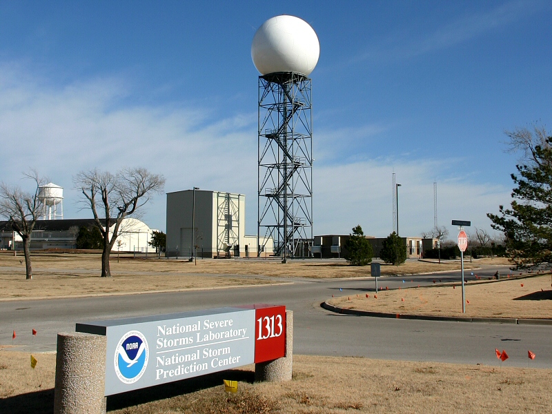
In the 1970s, the US Department of Commerce, Department of Defense, and the Transportation Department found the need to replace the existing national radar network, consisting of non-Doppler WSR-74 and WSR-57 radars developed in 1974 and 1957, respectively, to better serve their operational needs. The Joint Doppler Operational Project (JDOP) was formed in 1976 at the National Severe Storms Laboratory to study the usefulness of using Doppler radar to identify severe and tornadic thunderstorms. Tests over the next three years, conducted by the National Weather Service and the US Air Force Weather Service, found that Doppler radar provided much improved early detection of severe thunderstorms. A working group that included the JDOP published a paper providing the concepts for the development and operation of a national weather radar network. In 1979, the NEXRAD JSOP was formed to move forward with the development and deployment of the proposed NEXRAD radar network. The JSOP group needed to select a contractor to develop and produce the radars that would be used for the national network. Radar systems developed by Raytheon and Unisys were tested during the 1980s. Unisys was selected as the contractor, and was awarded a full-scale production contract in January 1990.[1]
Installation of a prototype was completed in the Fall of 1990 in Norman, Oklahoma. The first installation of a WSR-88D for operational use in everyday forecasts was in Sterling, Virginia on June 12, 1992. The last system was installed in North Webster, Indiana on August 30, 1997. The site locations were strategically chosen to provide the most overlapping coverage between radars in case one failed during a severe weather event. Where possible, they were co-located with NWS Weather Forecast Offices to permit quicker access to maintenance technicians.[2]
The NEXRAD radars incorporated a number of improvements over the radar systems previously in use. The new system provided Doppler velocity, improving tornado prediction ability. It provided improved resolution and sensitivity, allowing operators to see features such as cold fronts, thunderstorm gust fronts, and mesoscale features of thunderstorms that had never been visible on radar. The NEXRAD radars also provided volumetric scans of the atmosphere allowing operators to interrogate the vertical structure of storms and provide detailed wind profiles above the radar site. The radars also had a much increased range allowing detection of weather features at much greater distances from the radar site.[3]
Scan strategies
Unlike its predecessors, the WSR-88D antenna is not directly controllable by the user. Instead, the radar system continually refreshes its three-dimensional database via one of several predetermined scan patterns. Since the system samples the atmosphere in three dimensions, there are many variables that can be changed, depending on the desired output. There are currently nine Volume Coverage Patterns (VCP) available to NWS meteorologists. Each VCP is a predefined set of instructions given to the antenna that control the rotation speed, transmit/receive mode, and elevation angles. The radar operator chooses from the VCPs based on the type of weather occurring:
- Clear Air or Light Precipitation: VCP 31 and 32
- Shallow Precipitation: VCP 21
- Convection: VCP 11, 12, 121, 211, 212, and 221 [4]
| VCP |
Scan Time (min) |
Elevation scans |
Elevation angles (°) |
Usage |
Special attributes |
| 11 |
5 |
14 |
0.5, 1.5, 2.4, 3.4, 4.3, 5.3, 6.2, 7.5, 8.7, 10, 12, 14, 16.7, 19.5 |
Convection, especially when close to the radar |
Has the best overall volume coverage. |
| 211 |
Convection, especially when close to the radar |
Improves range-obscured velocity data over VCP 11 |
| 12 |
4.5 |
14 |
0.5, 0.9, 1.3, 1.8, 2.4, 3.1, 4.0, 5.1, 6.4, 8.0, 10.0, 12.5, 15.6, 19.5 |
Convection, especially activity at longer ranges |
Focuses on lower elevations to better sample the lower levels of storms. |
| 212 |
Widespread severe convective events |
Improves range-obscured velocity data over VCP 12 |
| 121 |
6 |
9 |
0.5, 1.5, 2.4, 3.4, 4.3, 6.0, 9.9, 14.6, 19.5 |
Large number of rotating storms, tropical systems, or when better velocity data is needed. |
Scans lower cuts multiple times with varying pulse repetitions to greatly enhance velocity data. |
| 21 |
5 |
Shallow precipitation |
Rarely used for convection due to sparse elevation data and long completion time. |
| 221 |
Widespread precipitation with embedded convection. (i.e., tropical systems) |
Improves range-obscured velocity data over VCP 121 |
| 31 |
10 |
5 |
0.5, 1.5, 2.5, 3.5, 4.5 |
Detecting subtle boundaries or wintry precipitation |
Long-pulse |
| 32 |
Slow rotation speed allows for increased sensitivity. Default clear-air mode, reduces wear on antenna. |
Short-pulse |
Enhancements
Super resolution
Deployed from March to August 2008,[5] the Super Resolution upgrade is the capability of the radar to produce much higher resolution data. Under legacy resolution, the WSR-88D provides reflectivity data at 1 km by 1 degree to 460 km range, and velocity data at 0.25 km by 1 degree to a range of 230 km. Super Resolution provides reflectivity data with a sample size of 0.25 km by 0.5 degree, and increase the range of Doppler velocity data to 300 km. Initially the increased resolution is only available in the lower scan elevations. Super resolution makes a compromise of slightly decreased noise reduction for a large gain in resolution.[6]
The improvement in azimuthal resolution increases the range at which tornadic mesoscale rotations can be detected. This allows for faster lead time on warnings and extends the useful range of the radar. The increased resolution (in both azimuth and range) increases the detail of such rotations, giving a more accurate representation of the storm. Super Resolution also provides additional detail to aid in other severe storm analysis. Super Resolution extends the range of velocity data and provides it faster than before, also allowing for faster lead time on potential tornado detection and subsequent warnings.[7]
Future enhancements
Dual polarization
The next major upgrade is polarimetric radar, which adds vertical polarization to the current horizontal radar waves, in order to more accurately discern what is reflecting the signal. This so-called dual polarization allows the radar to distinguish between rain, hail and snow, something the horizontally polarized radars cannot accurately do. Early trials have shown that rain, ice pellets, snow, hail, birds, insects, and ground clutter all have different signatures with dual-polarization, which could mark a significant improvement in forecasting winter storms and severe thunderstorms.[8] The deployment of the dual polarization capability (Build 12) to NEXRAD sites will begin in 2010 and last until 2012. The Vance AFB radar is the first operational WSR-88D to be modified to Dual Polarization. The modified radar went operational on 3 March 2011.[9]
Phased array
Beyond dual-polarization, the advent of phased array radar will probably be the next major improvement in severe weather detection. Its ability to rapidly scan large areas would give an enormous advantage to radar meteorologists. Any large-scale installation by the NWS is unlikely to occur before 2020. Such a system would more likely be installed separate from the existing WSR-88D network, perhaps only in areas like the Great Plains where tornadoes are more common.[10]
Applications
Usage
NEXRAD data are used in multiple ways. It is used by National Weather Service meteorologists and is freely available to users outside of the NWS, including researchers, media, and private citizens. The primary goal of NEXRAD data is to aid NWS meteorologists in operational forecasting. The data allows them to accurately track precipitation and anticipate its development and track. More importantly, it allows the meteorologists to track and anticipate severe weather and tornadoes. Combined with ground reports, tornado and severe thunderstorm warnings can be issued to alert the public about dangerous storms. NEXRAD data also provides information about rainfall and aids in hydrology forecasting. Data is provided to the public in several different forms. The most basic form is graphics published to the NWS website. Data is also available in two similar, but different, raw formats. Available directly from the NWS is Level III data. Level III data consists of reduced resolution, low-bandwidth, base products as well as many derived, post-processed products. Level II data consists of only the base products, but at their original resolution. Because of the higher bandwidth costs, Level II data is not available directly from the NWS. The NWS distributes this data freely to several top-tier universities who in turn distribute the data to private organizations.[citation needed]
Operational Locations
List of NEXRAD sites and their coordinates[11]
| State |
City or Place Name |
ICAO Location Identifier |
Coordinates |
| PR |
San Juan |
TJUA |
18°06′56″N 66°04′41″W / 18.1155998°N 66.0780644°W / 18.1155998; -66.0780644 (TJUA – San Juan, PR) |
| ME |
Loring AFB |
KCBW |
46°02′21″N 67°48′24″W / 46.0391944°N 67.8066033°W / 46.0391944; -67.8066033 (KCBW – Loring AFB, ME) |
| ME |
Portland |
KGYX |
43°53′29″N 70°15′24″W / 43.8913555°N 70.2565545°W / 43.8913555; -70.2565545 (KGYX – Portland, ME) |
| VT |
Burlington |
KCXX |
44°30′40″N 73°09′59″W / 44.5109941°N 73.166424°W / 44.5109941; -73.166424 (KCXX – Burlington, VT) |
| MA |
Boston |
KBOX |
41°57′21″N 71°08′13″W / 41.9558919°N 71.1369681°W / 41.9558919; -71.1369681 (KBOX – Boston, MA) |
| NY |
Albany |
KENX |
42°35′12″N 74°03′50″W / 42.5865699°N 74.0639877°W / 42.5865699; -74.0639877 (KENX – Albany, NY) |
| NY |
Binghamton |
KBGM |
42°11′59″N 75°59′05″W / 42.1997045°N 75.9847015°W / 42.1997045; -75.9847015 (KBGM – Binghamton, NY) |
| NY |
Buffalo |
KBUF |
42°56′56″N 78°44′13″W / 42.9488055°N 78.7369108°W / 42.9488055; -78.7369108 (KBUF – Buffalo, NY) |
| NY |
Montague |
KTYX |
43°45′20″N 75°40′48″W / 43.7556319°N 75.6799918°W / 43.7556319; -75.6799918 (KTYX – Fort Drum, NY) |
| NY |
New York City |
KOKX |
40°51′56″N 72°51′50″W / 40.8655093°N 72.8638548°W / 40.8655093; -72.8638548 (KOKX – New York City, NY) |
| DE |
Dover AFB |
KDOX |
38°49′33″N 75°26′24″W / 38.8257651°N 75.4400763°W / 38.8257651; -75.4400763 (KDOX – Dover AFB, NJ) |
| PA |
Philadelphia |
KDIX |
39°56′50″N 74°24′39″W / 39.9470885°N 74.4108027°W / 39.9470885; -74.4108027 (KDIX – Philadelphia, PA) |
| PA |
Pittsburgh |
KPBZ |
40°31′54″N 80°13′05″W / 40.5316842°N 80.2179515°W / 40.5316842; -80.2179515 (KPBZ – Pittsburgh, PA) |
| PA |
State College |
KCCX |
40°55′22″N 78°00′14″W / 40.9228521°N 78.0038738°W / 40.9228521; -78.0038738 (KCCX – State College, PA) |
| WV |
Charleston |
KRLX |
38°18′40″N 81°43′22″W / 38.3110763°N 81.7229015°W / 38.3110763; -81.7229015 (KRLX – Charleston, WV) |
| VA |
Norfolk/Richmond |
KAKQ |
36°59′03″N 77°00′26″W / 36.9840475°N 77.007342°W / 36.9840475; -77.007342 (KAKQ – Norfolk/Richmond, VA) |
| VA |
Roanoke |
KFCX |
37°01′27″N 80°16′25″W / 37.0242098°N 80.2736664°W / 37.0242098; -80.2736664 (KFCX – Roanoke, VA) |
| VA |
Sterling |
KLWX |
38°58′31″N 77°28′40″W / 38.9753957°N 77.4778444°W / 38.9753957; -77.4778444 (KLWX – Sterling, VA) |
| NC |
Morehead City |
KMHX |
34°46′33″N 76°52′35″W / 34.7759313°N 76.8762571°W / 34.7759313; -76.8762571 (KMHX – Morehead City, NC) |
| NC |
Raleigh/Durham |
KRAX |
35°39′56″N 78°29′23″W / 35.6654967°N 78.4897855°W / 35.6654967; -78.4897855 (KRAX – Raleigh/Durham, NC) |
| NC |
Wilmington |
KLTX |
33°59′21″N 78°25′45″W / 33.9891631°N 78.4291059°W / 33.9891631; -78.4291059 (KLTX – Wilmington, NC) |
| SC |
Charleston |
KCLX |
32°39′20″N 81°02′32″W / 32.6554866°N 81.0423124°W / 32.6554866; -81.0423124 (KCLX – Charleston, SC) |
| SC |
Columbia |
KCAE |
33°56′56″N 81°07′06″W / 33.9487579°N 81.1184281°W / 33.9487579; -81.1184281 (KCAE – Columbia, SC) |
| SC |
Greer |
KGSP |
34°53′00″N 82°13′12″W / 34.8833435°N 82.2200757°W / 34.8833435; -82.2200757 (KGSP – Greer, SC) |
| GA |
Atlanta |
KFFC |
33°21′49″N 84°33′57″W / 33.3635771°N 84.565866°W / 33.3635771; -84.565866 (KFFC – Atlanta, GA) |
| GA |
Moody AFB |
KVAX |
30°53′25″N 83°00′07″W / 30.8903853°N 83.0019021°W / 30.8903853; -83.0019021 (KVAX – Moody AFB, GA) |
| GA |
Robins AFB |
KJGX |
32°40′32″N 83°21′03″W / 32.6755239°N 83.3508575°W / 32.6755239; -83.3508575 (KJGX – Robins AFB, GA) |
| FL |
Eglin AFB |
KEVX |
30°33′54″N 85°55′18″W / 30.5649908°N 85.921559°W / 30.5649908; -85.921559 (KEVX – Eglin AFB, FL) |
| FL |
Jacksonville |
KJAX |
30°29′05″N 81°42′07″W / 30.4846878°N 81.7018917°W / 30.4846878; -81.7018917 (KJAX – Jacksonville, FL) |
| FL |
Key West |
KBYX |
24°35′51″N 81°42′12″W / 24.5974996°N 81.7032355°W / 24.5974996; -81.7032355 (KBYX – Key West, FL) |
| FL |
Melbourne |
KMLB |
28°06′47″N 80°39′15″W / 28.1131808°N 80.6540988°W / 28.1131808; -80.6540988 (KMLB – Melbourne, FL) |
| FL |
Miami |
KAMX |
25°36′40″N 80°24′46″W / 25.6111275°N 80.412747°W / 25.6111275; -80.412747 (KAMX – Miami, FL) |
| FL |
Tallahassee |
KTLH |
30°23′51″N 84°19′44″W / 30.397568°N 84.3289116°W / 30.397568; -84.3289116 (KTLH – Tallahassee, FL) |
| FL |
Tampa |
KTBW |
27°42′20″N 82°24′06″W / 27.7054701°N 82.40179°W / 27.7054701; -82.40179 (KTBW – Tampa, FL) |
| AL |
Birmingham |
KBMX |
33°10′20″N 86°46′11″W / 33.1722806°N 86.7698425°W / 33.1722806; -86.7698425 (KBMX – Birmingham, AL) |
| AL |
Fort Rucker |
KEOX |
31°27′38″N 85°27′33″W / 31.4605622°N 85.4592401°W / 31.4605622; -85.4592401 (KEOX – Fort Rucker, AL) |
| AL |
Huntsville |
KHTX |
34°55′50″N 86°05′01″W / 34.930508°N 86.0837388°W / 34.930508; -86.0837388 (KHTX – Huntsville, AL) |
| AL |
Maxwell AFB |
KMXX |
32°32′12″N 85°47′23″W / 32.5366608°N 85.7897848°W / 32.5366608; -85.7897848 (KMXX – Maxwell AFB, AL) |
| AL |
Mobile |
KMOB |
30°40′46″N 88°14′23″W / 30.6795378°N 88.2397816°W / 30.6795378; -88.2397816 (KMOB – Mobile, AL) |
| MS |
Brandon/Jackson |
KDGX |
32°16′47″N 89°59′05″W / 32.2797358°N 89.9846309°W / 32.2797358; -89.9846309 (KDGX – Brandon/Jackson, MS) |
| MS |
Columbus AFB |
KGWX |
33°53′48″N 88°19′46″W / 33.8967796°N 88.3293915°W / 33.8967796; -88.3293915 (KGWX – Columbus AFB, MS) |
| TN |
Knoxville/Tri Cities |
KMRX |
36°10′07″N 83°24′06″W / 36.168538°N 83.401779°W / 36.168538; -83.401779 (KMRX – Knoxville/Tri Cities, TN) |
| TN |
Memphis |
KNQA |
35°20′41″N 89°52′24″W / 35.3447802°N 89.8734534°W / 35.3447802; -89.8734534 (KNQA – Memphis, TN) |
| TN |
Nashville |
KOHX |
36°14′50″N 86°33′45″W / 36.2472389°N 86.5625185°W / 36.2472389; -86.5625185 (KOHX – Nashville, TN) |
| KY |
Fort Campbell |
KHPX |
36°44′13″N 87°17′08″W / 36.7368894°N 87.2854328°W / 36.7368894; -87.2854328 (KHPX – Fort Campbell, KY) |
| KY |
Jackson |
KJKL |
37°35′27″N 83°18′47″W / 37.590762°N 83.313039°W / 37.590762; -83.313039 (KJKL – Jackson, KY) |
| KY |
Louisville |
KLVX |
37°58′31″N 85°56′38″W / 37.9753058°N 85.9438455°W / 37.9753058; -85.9438455 (KLVX – Louisville, KY) |
| KY |
Paducah |
KPAH |
37°04′06″N 88°46′19″W / 37.0683618°N 88.7720257°W / 37.0683618; -88.7720257 (KPAH – Paducah, KY) |
| OH |
Wilmington |
KILN |
39°30′30″N 83°49′04″W / 39.5083314°N 83.8176925°W / 39.5083314; -83.8176925 (KILN – Cincinnati, OH) |
| OH |
Cleveland |
KCLE |
41°24′47″N 81°51′35″W / 41.4131875°N 81.8597451°W / 41.4131875; -81.8597451 (KCLE – Cleveland, OH) |
| MI |
Detroit/Pontiac |
KDTX |
42°42′00″N 83°28′19″W / 42.6999677°N 83.471809°W / 42.6999677; -83.471809 (KDTX – Detroit/Pontiac, MI) |
| MI |
Gaylord |
KAPX |
44°54′26″N 84°43′11″W / 44.907106°N 84.719817°W / 44.907106; -84.719817 (KAPX – Gaylord, MI) |
| MI |
Grand Rapids |
KGRR |
42°53′38″N 85°32′42″W / 42.893872°N 85.5449206°W / 42.893872; -85.5449206 (KGRR – Grand Rapids, MI) |
| MI |
Marquette |
KMQT |
46°31′52″N 87°32′55″W / 46.5311443°N 87.5487131°W / 46.5311443; -87.5487131 (KMQT – Marquette, MI) |
| IN |
Evansville |
KVWX |
38°15′37″N 87°43′29″W / 38.2603901°N 87.7246553°W / 38.2603901; -87.7246553 (KVWX – Evansville, IN) |
| IN |
Indianapolis |
KIND |
39°42′27″N 86°16′49″W / 39.7074962°N 86.2803675°W / 39.7074962; -86.2803675 (KIND – Indianapolis, IN) |
| IN |
North Webster |
KIWX |
41°21′31″N 85°42′00″W / 41.3586356°N 85.7000488°W / 41.3586356; -85.7000488 (KIWX – North Webster, IN) |
| IL |
Chicago |
KLOT |
41°36′16″N 88°05′04″W / 41.6044264°N 88.084361°W / 41.6044264; -88.084361 (KLOT – Chicago, IL) |
| IL |
Lincoln |
KILX |
40°09′02″N 89°20′13″W / 40.150544°N 89.336842°W / 40.150544; -89.336842 (KILX – Lincoln, IL) |
| WI |
Green Bay |
KGRB |
44°29′54″N 88°06′40″W / 44.4984644°N 88.111124°W / 44.4984644; -88.111124 (KGRB – Green Bay, WI) |
| WI |
La Crosse |
KARX |
43°49′22″N 91°11′30″W / 43.822766°N 91.1915767°W / 43.822766; -91.1915767 (KARX – La Crosse, WI) |
| WI |
Milwaukee |
KMKX |
42°58′04″N 88°33′02″W / 42.9678286°N 88.5506335°W / 42.9678286; -88.5506335 (KMKX – Milwaukee, WI) |
| MN |
Duluth |
KDLH |
46°50′13″N 92°12′35″W / 46.8368569°N 92.2097433°W / 46.8368569; -92.2097433 (KDLH – Duluth, MN) |
| MN |
Minneapolis/St. Paul |
KMPX |
44°50′56″N 93°33′56″W / 44.8488029°N 93.5654873°W / 44.8488029; -93.5654873 (KMPX – Minneapolis/St. Paul, MN) |
| IA |
Davenport |
KDVN |
41°36′42″N 90°34′52″W / 41.611556°N 90.5809987°W / 41.611556; -90.5809987 (KDVN – Davenport, IA) |
| IA |
Des Moines |
KDMX |
41°43′52″N 93°43′23″W / 41.7311788°N 93.7229235°W / 41.7311788; -93.7229235 (KDMX – Des Moines, IA) |
| MO |
Kansas City |
KEAX |
38°48′37″N 94°15′52″W / 38.8102231°N 94.2644924°W / 38.8102231; -94.2644924 (KEAX – Kansas City, MO) |
| MO |
Springfield |
KSGF |
37°14′07″N 93°24′02″W / 37.235223°N 93.4006011°W / 37.235223; -93.4006011 (KSGF – Springfield, MO) |
| MO |
St. Louis |
KLSX |
38°41′55″N 90°40′58″W / 38.6986863°N 90.682877°W / 38.6986863; -90.682877 (KLSX – St. Louis, MO) |
| AR |
Fort Smith |
KSRX |
35°17′26″N 94°21′43″W / 35.2904423°N 94.3619075°W / 35.2904423; -94.3619075 (KSRX – Fort Smith, AR) |
| AR |
Little Rock |
KLZK |
34°50′11″N 92°15′44″W / 34.8365261°N 92.2621697°W / 34.8365261; -92.2621697 (KLZK – Little Rock, AR) |
| LA |
Fort Polk |
KPOE |
31°09′20″N 92°58′35″W / 31.1556923°N 92.9762596°W / 31.1556923; -92.9762596 (KPOE – Fort Polk, LA) |
| LA |
Lake Charles |
KLCH |
30°07′31″N 93°12′58″W / 30.125382°N 93.2161188°W / 30.125382; -93.2161188 (KLCH – Lake Charles, LA) |
| LA |
New Orleans |
KLIX |
30°20′12″N 89°49′32″W / 30.3367133°N 89.8256618°W / 30.3367133; -89.8256618 (KLIX – New Orleans, LA) |
| LA |
Shreveport |
KSHV |
32°27′03″N 93°50′29″W / 32.450813°N 93.8412774°W / 32.450813; -93.8412774 (KSHV – Shreveport, LA) |
| TX |
Amarillo |
KAMA |
35°14′01″N 101°42′33″W / 35.2334827°N 101.7092478°W / 35.2334827; -101.7092478 (KAMA – Amarillo, TX) |
| TX |
Austin/San Antonio |
KEWX |
29°42′14″N 98°01′43″W / 29.7039802°N 98.028506°W / 29.7039802; -98.028506 (KEWX – Austin/San Antonio, TX) |
| TX |
Brownsville |
KBRO |
25°54′58″N 97°25′08″W / 25.9159979°N 97.4189526°W / 25.9159979; -97.4189526 (KBRO – Brownsville, TX) |
| TX |
Corpus Christi |
KCRP |
27°47′02″N 97°30′40″W / 27.7840203°N 97.511234°W / 27.7840203; -97.511234 (KCRP – Corpus Christi, TX) |
| TX |
Dallas/Ft. Worth |
KFWS |
32°34′23″N 97°18′11″W / 32.5730186°N 97.3031911°W / 32.5730186; -97.3031911 (KFWS – Dallas/Ft. Worth, TX) |
| TX |
Dyess AFB |
KDYX |
32°32′19″N 99°15′15″W / 32.5386009°N 99.2542863°W / 32.5386009; -99.2542863 (KDYX – Dyess AFB, TX) |
| TX |
El Paso |
KEPZ |
31°52′23″N 106°41′53″W / 31.8731115°N 106.697942°W / 31.8731115; -106.697942 (KEPZ – El Paso, TX) |
| TX |
Fort Hood |
KGRK |
30°43′18″N 97°22′59″W / 30.7217637°N 97.3829627°W / 30.7217637; -97.3829627 (KGRK – Fort Hood, TX) |
| TX |
Houston/Galveston |
KHGX |
29°28′19″N 95°04′44″W / 29.4718835°N 95.0788593°W / 29.4718835; -95.0788593 (KHGX – Houston/Galveston, TX) |
| TX |
Laughlin AFB |
KDFX |
29°16′23″N 100°16′49″W / 29.2730823°N 100.2802312°W / 29.2730823; -100.2802312 (KDFX – Laughlin AFB, TX) |
| TX |
Lubbock |
KLBB |
33°39′15″N 101°48′51″W / 33.6541242°N 101.814149°W / 33.6541242; -101.814149 (KLBB – Lubbock, TX) |
| TX |
Midland/Odessa |
KMAF |
31°56′36″N 102°11′22″W / 31.9433953°N 102.1894383°W / 31.9433953; -102.1894383 (KMAF – Midland/Odessa, TX) |
| TX |
San Angelo |
KSJT |
31°22′17″N 100°29′33″W / 31.3712815°N 100.4925227°W / 31.3712815; -100.4925227 (KSJT – San Angelo, TX) |
| OK |
Frederick |
KFDR |
34°21′43″N 98°58′36″W / 34.3620014°N 98.9766884°W / 34.3620014; -98.9766884 (KFDR – Frederick, OK) |
| OK |
Oklahoma City |
KTLX |
35°20′00″N 97°16′40″W / 35.3333873°N 97.2778255°W / 35.3333873; -97.2778255 (KTLX – Oklahoma City, OK) |
| OK |
Tulsa |
KINX |
36°10′30″N 95°33′51″W / 36.1750977°N 95.5642802°W / 36.1750977; -95.5642802 (KINX – Tulsa, OK) |
| OK |
Vance AFB |
KVNX |
36°44′26″N 98°07′41″W / 36.7406166°N 98.1279409°W / 36.7406166; -98.1279409 (KVNX – Vance AFB, OK) |
| KS |
Dodge City |
KDDC |
37°45′39″N 99°58′08″W / 37.7608043°N 99.9688053°W / 37.7608043; -99.9688053 (KDDC – Dodge City, KS) |
| KS |
Goodland |
KGLD |
39°22′00″N 101°42′02″W / 39.3667737°N 101.7004341°W / 39.3667737; -101.7004341 (KGLD – Goodland, KS) |
| KS |
Topeka |
KTWX |
38°59′49″N 96°13′57″W / 38.996998°N 96.232618°W / 38.996998; -96.232618 (KTWX – Topeka, KS) |
| KS |
Wichita |
KICT |
37°39′16″N 97°26′35″W / 37.6545724°N 97.4431461°W / 37.6545724; -97.4431461 (KICT – Wichita, KS) |
| NE |
Grand Island/Hastings |
KUEX |
40°19′15″N 98°26′31″W / 40.320966°N 98.4418559°W / 40.320966; -98.4418559 (KUEX – Grand Island/Hastings, NE) |
| NE |
North Platte |
KLNX |
41°57′29″N 100°34′33″W / 41.9579623°N 100.5759609°W / 41.9579623; -100.5759609 (KLNX – North Platte, NE) |
| NE |
Omaha |
KOAX |
41°19′13″N 96°22′00″W / 41.3202803°N 96.3667971°W / 41.3202803; -96.3667971 (KOAX – Omaha, NE) |
| SD |
Aberdeen |
KABR |
45°27′21″N 98°24′48″W / 45.4558185°N 98.4132046°W / 45.4558185; -98.4132046 (KABR – Aberdeen, SD) |
| SD |
Rapid City |
KUDX |
44°07′29″N 102°49′47″W / 44.1248485°N 102.8298157°W / 44.1248485; -102.8298157 (KUDX – Rapid City, SD) |
| SD |
Sioux Falls |
KFSD |
43°35′16″N 96°43′46″W / 43.5877467°N 96.7293674°W / 43.5877467; -96.7293674 (KFSD – Sioux Falls, SD) |
| ND |
Bismarck |
KBIS |
46°46′15″N 100°45′38″W / 46.7709329°N 100.7605532°W / 46.7709329; -100.7605532 (KBIS – Bismarck, ND) |
| ND |
Grand Forks (Mayville) |
KMVX |
47°31′41″N 97°19′32″W / 47.5279417°N 97.3256654°W / 47.5279417; -97.3256654 (KMVX – Grand Forks, ND) |
| ND |
Minot AFB |
KMBX |
48°23′35″N 100°51′52″W / 48.39303°N 100.8644378°W / 48.39303; -100.8644378 (KMBX – Minot AFB, ND) |
| MT |
Billings |
KBLX |
45°51′14″N 108°36′25″W / 45.8537632°N 108.6068165°W / 45.8537632; -108.6068165 (KBLX – Billings, MT) |
| MT |
Glasgow |
KGGW |
48°12′23″N 106°37′31″W / 48.2064536°N 106.6252971°W / 48.2064536; -106.6252971 (KGGW – Glasgow, MT) |
| MT |
Great Falls |
KTFX |
47°27′34″N 111°23′08″W / 47.4595023°N 111.3855368°W / 47.4595023; -111.3855368 (KTFX – Great Falls, MT) |
| MT |
Missoula |
KMSX |
47°02′29″N 113°59′11″W / 47.0412971°N 113.9864373°W / 47.0412971; -113.9864373 (KMSX – Missoula, MT) |
| WY |
Cheyenne |
KCYS |
41°09′07″N 104°48′22″W / 41.1519308°N 104.8060325°W / 41.1519308; -104.8060325 (KCYS – Cheyenne, WY) |
| WY |
Riverton |
KRIW |
43°03′58″N 108°28′39″W / 43.0660779°N 108.4773731°W / 43.0660779; -108.4773731 (KRIW – Riverton, WY) |
| CO |
Denver |
KFTG |
39°47′12″N 104°32′45″W / 39.7866156°N 104.5458126°W / 39.7866156; -104.5458126 (KFTG – Denver, CO) |
| CO |
Grand Junction |
KGJX |
39°03′43″N 108°12′49″W / 39.0619824°N 108.2137012°W / 39.0619824; -108.2137012 (KGJX – Grand Junction, CO) |
| CO |
Pueblo |
KPUX |
38°27′34″N 104°10′54″W / 38.4595034°N 104.1816223°W / 38.4595034; -104.1816223 (KPUX – Pueblo, CO) |
| NM |
Albuquerque |
KABX |
35°08′59″N 106°49′26″W / 35.1497579°N 106.8239576°W / 35.1497579; -106.8239576 (KABX – Albuquerque, NM) |
| NM |
Cannon AFB |
KFDX |
34°38′03″N 103°37′07″W / 34.6341569°N 103.6186427°W / 34.6341569; -103.6186427 (KFDX – Cannon AFB, NM) |
| NM |
Holloman AFB |
KHDX |
33°04′37″N 106°07′12″W / 33.0768844°N 106.1200923°W / 33.0768844; -106.1200923 (KHDX – Holloman AFB, NM) |
| AZ |
Flagstaff |
KFSX |
34°34′28″N 111°11′54″W / 34.574449°N 111.198367°W / 34.574449; -111.198367 (KFSX – Flagstaff, AZ) |
| AZ |
Phoenix |
KIWA |
33°17′21″N 111°40′12″W / 33.289111°N 111.6700092°W / 33.289111; -111.6700092 (KIWA – Phoenix, AZ) |
| AZ |
Tucson |
KEMX |
31°53′37″N 110°37′50″W / 31.8937186°N 110.6304306°W / 31.8937186; -110.6304306 (KEMX – Tucson, AZ) |
| AZ |
Yuma |
KYUX |
32°29′43″N 114°39′24″W / 32.4953477°N 114.6567214°W / 32.4953477; -114.6567214 (KYUX – Yuma, AZ) |
| UT |
Cedar City |
KICX |
37°35′35″N 112°51′50″W / 37.5931771°N 112.8637719°W / 37.5931771; -112.8637719 (KICX – Cedar City, UT) |
| UT |
Salt Lake City |
KMTX |
41°15′46″N 112°26′53″W / 41.2627795°N 112.4480081°W / 41.2627795; -112.4480081 (KMTX – Salt Lake City, UT) |
| ID |
Boise |
KCBX |
43°29′25″N 116°14′10″W / 43.4902104°N 116.2360436°W / 43.4902104; -116.2360436 (KCBX – Boise, ID) |
| ID |
Pocatello/Idaho Falls |
KSFX |
43°06′20″N 112°41′10″W / 43.1055967°N 112.6860487°W / 43.1055967; -112.6860487 (KSFX – Pocatello/Idaho Falls, ID) |
| NV |
Elko |
KLRX |
40°44′23″N 116°48′09″W / 40.7396933°N 116.8025529°W / 40.7396933; -116.8025529 (KLRX – Elko, NV) |
| NV |
Las Vegas |
KESX |
35°42′05″N 114°53′31″W / 35.7012894°N 114.8918277°W / 35.7012894; -114.8918277 (KESX – Las Vegas, NV) |
| NV |
Reno |
KRGX |
39°45′15″N 119°27′43″W / 39.7541931°N 119.4620597°W / 39.7541931; -119.4620597 (KRGX – Reno, NV) |
| CA |
Beale AFB |
KBBX |
39°29′45″N 121°37′54″W / 39.4956958°N 121.6316557°W / 39.4956958; -121.6316557 (KBBX – Beale AFB, CA) |
| CA |
Edwards AFB |
KEYX |
35°05′53″N 117°33′39″W / 35.0979358°N 117.5608832°W / 35.0979358; -117.5608832 (KEYX – Edwards AFB, CA) |
| CA |
Eureka |
KBHX |
40°29′55″N 124°17′31″W / 40.4986955°N 124.2918867°W / 40.4986955; -124.2918867 (KBHX – Eureka, CA) |
| CA |
Los Angeles |
KVTX |
34°24′42″N 119°10′46″W / 34.4116386°N 119.1795641°W / 34.4116386; -119.1795641 (KVTX – Los Angeles, CA) |
| CA |
Sacramento |
KDAX |
38°30′04″N 121°40′40″W / 38.5011529°N 121.6778487°W / 38.5011529; -121.6778487 (KDAX – Sacramento, CA) |
| CA |
San Diego |
KNKX |
32°55′08″N 117°02′31″W / 32.9189891°N 117.041814°W / 32.9189891; -117.041814 (KNKX – San Diego, CA) |
| CA |
San Francisco |
KMUX |
37°09′19″N 121°53′54″W / 37.155152°N 121.8984577°W / 37.155152; -121.8984577 (KMUX – San Francisco, CA) |
| CA |
San Joaquin Valley |
KHNX |
36°18′51″N 119°37′56″W / 36.3142088°N 119.6320903°W / 36.3142088; -119.6320903 (KHNX – San Joaquin Valley, CA) |
| CA |
Santa Ana Mountains |
KSOX |
33°49′04″N 117°38′10″W / 33.8176452°N 117.6359743°W / 33.8176452; -117.6359743 (KSOX – Santa Ana Mountains, CA) |
| CA |
Vandenberg AFB |
KVBX |
34°50′18″N 120°23′52″W / 34.8383137°N 120.3977805°W / 34.8383137; -120.3977805 (KVBX – Vandenberg AFB, CA) |
| HI |
Kauai |
PHKI |
21°53′38″N 159°33′09″W / 21.8938762°N 159.5524585°W / 21.8938762; -159.5524585 (PHKI – Kauai, HI) |
| HI |
Kohala |
PHKM |
20°07′32″N 155°46′41″W / 20.1254606°N 155.778054°W / 20.1254606; -155.778054 (PHKM – Kohala, HI) |
| HI |
Molokai |
PHMO |
21°07′58″N 157°10′49″W / 21.1327531°N 157.1802807°W / 21.1327531; -157.1802807 (PHMO – Molokai, HI) |
| HI |
South Shore |
PHWA |
19°05′42″N 155°34′08″W / 19.0950155°N 155.5688846°W / 19.0950155; -155.5688846 (PHWA – South Shore, HI) |
| OR |
Medford |
KMAX |
42°04′52″N 122°43′02″W / 42.0810766°N 122.7173334°W / 42.0810766; -122.7173334 (KMAX – Medford, OR) |
| OR |
Pendleton |
KPDT |
45°41′26″N 118°51′11″W / 45.6906118°N 118.8529301°W / 45.6906118; -118.8529301 (KPDT – Pendleton, OR) |
| OR |
Portland |
KRTX |
45°42′54″N 122°57′54″W / 45.7150308°N 122.9650542°W / 45.7150308; -122.9650542 (KRTX – Portland, OR) |
| WA |
Langley Hill |
KLGX |
47°06′40″N 124°06′07″W / 47.111°N 124.102°W / 47.111; -124.102 (KLGX – Seattle/Tacoma, WA) |
| WA |
Seattle/Tacoma |
KATX |
48°11′40″N 122°29′45″W / 48.1945614°N 122.4957508°W / 48.1945614; -122.4957508 (KATX – Seattle/Tacoma, WA) |
| WA |
Spokane |
KOTX |
47°40′49″N 117°37′36″W / 47.6803744°N 117.6267797°W / 47.6803744; -117.6267797 (KOTX – Spokane, WA) |
| AK |
Bethel |
PABC |
60°47′31″N 161°52′36″W / 60.791987°N 161.876539°W / 60.791987; -161.876539 (PABC – Bethel, AK) |
| AK |
Fairbanks/Pedro Dome |
PAPD |
65°02′06″N 147°30′05″W / 65.0351238°N 147.5014222°W / 65.0351238; -147.5014222 (PAPD – Fairbanks/Pedro Dome, AK) |
| AK |
Kenai |
PAHG |
60°36′56″N 151°17′00″W / 60.6156335°N 151.2832296°W / 60.6156335; -151.2832296 (PAHG – Kenai, AK) |
| AK |
King Salmon |
PAKC |
58°40′46″N 156°37′46″W / 58.6794558°N 156.6293335°W / 58.6794558; -156.6293335 (PAKC – King Salmon, AK) |
| AK |
Middleton Island |
PAIH |
59°27′43″N 146°18′04″W / 59.46194°N 146.30111°W / 59.46194; -146.30111 (PAIH – Middleton Island, AK) |
| AK |
Nome |
PAEC |
64°30′41″N 165°17′42″W / 64.5114973°N 165.2949071°W / 64.5114973; -165.2949071 (PAEC – Nome, AK) |
| AK |
Sitka/Biorka Island |
PACG |
56°51′08″N 135°33′09″W / 56.85214°N 135.552417°W / 56.85214; -135.552417 (PACG – Sitka/Biorka Island, AK) |
| GU |
Andersen AFB |
PGUA |
13°27′21″N 144°48′40″E / 13.455965°N 144.8111022°E / 13.455965; 144.8111022 (PGUA – Andersen AFB, GU) |
| NA |
Lajes Field, Azores |
LPLA |
38°43′49″N 27°19′18″W / 38.73028°N 27.32167°W / 38.73028; -27.32167 (LPLA – Lajes Field, Azores) |
| NA |
Kunsan Air Base, South Korea |
RKJK |
35°55′27″N 126°37′20″E / 35.92417°N 126.62222°E / 35.92417; 126.62222 (RKJK – Kusan Air Base, South Korea) |
| NA |
Camp Humphreys, South Korea |
RKSG |
36°57′35″N 127°01′06″E / 36.95972°N 127.01833°E / 36.95972; 127.01833 (RKSG – Camp Humpreys, South Korea) |
| NA |
Kadena Air Base, Japan |
RODN |
26°18′07″N 127°54′35″E / 26.30194°N 127.90972°E / 26.30194; 127.90972 (RODN – Kadena AB, Japan) |
See also
| v · d · eEarth-based meteorological equipment and instrumentation |
|
|
|
|
| v · d · eUS Weather radars |
|
| Military weather radars |
|
|
| Weather Surveillance Radars |
|
|
| Research radars |
ADRAD · ARMOR · Cimarron · CASA · CORAD · CSU-CHILL · CSU-Pawnee · DOW · JPOLE · KPOL · NOAA/ETL · NOAA Ron Brown's Doppler · NPOL · NSSL 10 cm Doppler · OU-PRIME · PAR at NSSL · SKYWATER · SMART-R · TOGA · UND
|
|
Bibliography
References
External links
- Theory of Doppler Weather Radar
- Real time data
- Research

 Continental US sites