- North American blizzard of 2003
-
North American blizzard of 2003 Plowing the streets of Washington, DC during the Blizzard of 2003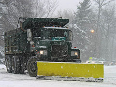
Storm type: Winter storm Formed: February 14, 2003 Dissipated: February 19, 2003 Maximum
amount:*112 cm/44 in Garrett County, Maryland Lowest
pressure:1011 mb Damages: Over 14.1 million[1] Fatalities: 2 direct, 25 indirect Areas affected: Eastern North America ^* Maximum snowfall or ice accretion
The Blizzard of 2003, also known as the Presidents' Day Storm II or simply PDII, was a historical and record-breaking snowstorm on the East Coast of the United States and Canada, which lasted from February 14 to February 19, 2003. It spread heavy snow across the major cities of the Northeastern US, making it the defining snowstorm of the very snowy winter of 2002-2003. All cities from Washington DC to Boston were covered in 15 to 36 inches (38-76 cm) of snow,[citation needed] and those cities were brought to a standstill due to problems caused by temperatures and the snow. In Baltimore and Boston, this was the biggest snowstorm on record, with 28.2 and 27.5 inches, (71.6 and 69.9 cm) respectively.
Contents
Synoptic setup
The severity of the Blizzard of 2003 can be attributed to the unusually favorable atmospheric conditions surrounding the storm (synoptic conditions). Most notably, the storm allowed for cyclogenesis off of the coastal Carolinas, a feature that is common to most major winter storms in the eastern parts of North America. This secondary system fed off the moisture of the Atlantic Ocean and enhanced precipitation totals from North Carolina to Massachusetts. Secondly, a high pressure system was in place over eastern portions of Canada, allowing for cold air to be brought down into the coastal areas in a process known as cold air advection. This cold air ensured that many areas where storms typically produce mixed precipitation received most or all precipitation in the form of snow.[2]
The life of the storm
The storm developed in the southern Rockies on February 14, and moved through southern Missouri and the Lower Tennessee Valley during the next few days. It brought heavy rain and severe weather to the Deep South, including the nation's first tornado of the year. Farther north, snow and ice affected the Midwest. Southern Iowa and eastern Illinois also got significant snow, with 11 inches (28 cm) in Des Moines. In central Kentucky the storm produced mostly ice, with some locations including Frankfort, Lexington, and nearby Cynthiana in Harrison County receiving up to 3/4" (2 cm) of ice. Much of Ohio received heavy snowfall, with Mansfield receiving 21 inches and Columbus receiving about a foot.
 A snowplow in Boston at the beginning of the storm
However, early on February 16, heavy snow started falling in those two cities, and the snow later developed in Philadelphia. Heavy snow was continuously reported, falling at rates of up to 4 inches (10 cm) per hour.[citation needed] In addition, temperatures were frigid, around 15°F (-10°C). The heavy snow continued all day, and it developed in New York City by the evening. At about the same time, the snow changed to sleet in Washington, D.C., and significantly lowered the accumulation. Throughout the rest of the Northeast, however, the snow continued for much of the night. The sleet changed back to snow by the next morning in Washington, D.C., and soon ended. By that time, a secondary low pressure system formed off the North Carolina coast and traveled north, turning the storm into a nor'easter for New York City and Boston. Blizzard Warnings were issued, and the snow began in Boston that day. In the evening, the heavy snow ended in New York City, and ended in Boston the morning of February 18. After that, the storm weakened and brought a few inches of snow to other parts of New England.
-
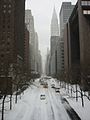
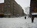
42nd street, NYC, near the UN, looking West during the February 2003 winter storm.
-
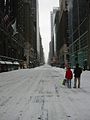
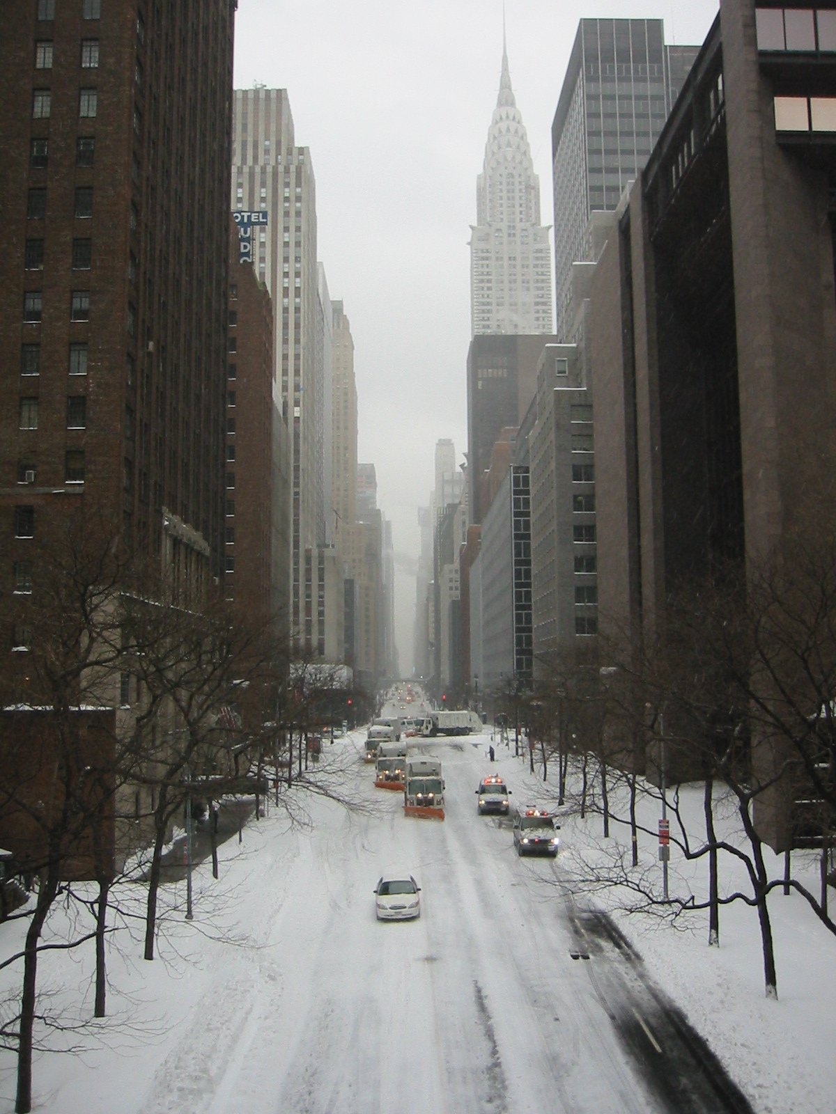
Madison Avenue, NYC, near Grand Central Station, looking South during the February 2003 winter storm.
-
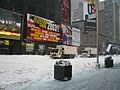
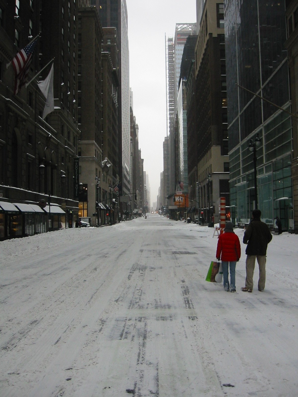
Times Square, NYC, during the February 2003 winter storm. Image shows the city garbage collection trucks outfitted with snow plows and scoops.
-
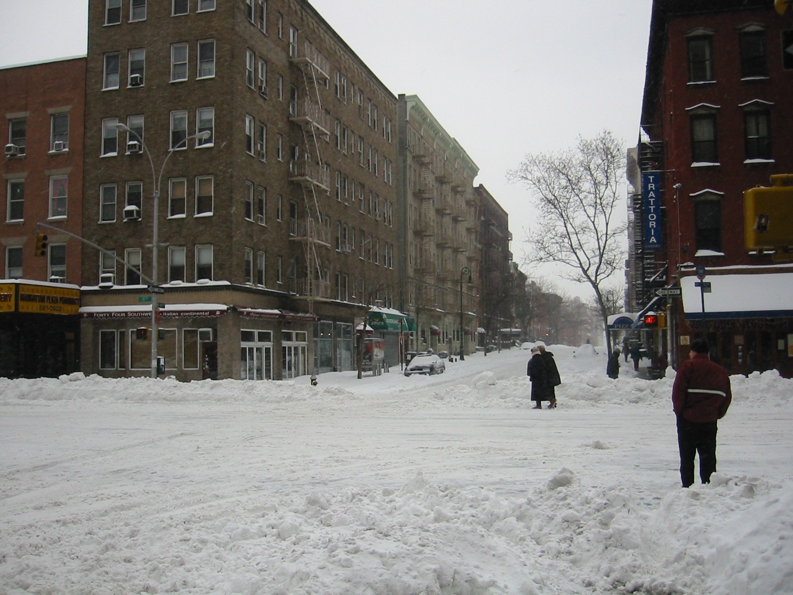
Corner in Hells Kitchen neighborhood, NYC, during the February 2003 winter storm.
Impact
This snowstorm paralyzed much of the East Coast with its heavy snow. All in all, it was the most significant and powerful storm to affect the major cities of the Northeast since the Blizzard of 1996. Washington's Reagan National Airport, Baltimore-Washington International Airport, Philadelphia International Airport, and LaGuardia Airport in New York were shut down completely, and Dulles Airport had one runway open. With snow continually accumulating, road travel was nearly impossible.
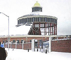 The B&O Railroad Museum in Baltimore on February 17, 2003, shortly after its roof collapsed
In Baltimore, the roof of the historic B&O Railroad Museum built in 1884 collapsed, damaging many valuable engines, historic railroad cars, and train exhibits. Although the structure's central support columns remained standing, the supporting iron struts and ties of the destroyed roofing sections failed under the heavy snow load. Some items in the museum's collection were damaged beyond repair. Reporting on the devastation the following day, The Baltimore Sun said, "...hours after the collapse, columns of mangled steel stuck out from the roundhouse ... Locomotives and passenger cars in the museum's collection, some dating from the 1830s, could be seen covered with snow and debris".[3]
Parts of the Baltimore suburbs were some of the hardest hit areas of the blizzard. Snowfall totals in the towns immediately north of the city were estimated at between 38"-40" while the downtown city center recorded only 28" of snow. The difference in reported totals resulted in conflicting reports received by the Department of Transportation. This confusion in communications resulted in the towns with the highest amounts of snow receiving delayed assistance in the cleanup while the major roadways into and out of the city were cleared.
Most Washington, DC area television stations had wall-to-wall coverage from Saturday morning through Monday evening, only stopping briefly overnight. Even overnight, they had constant information bars on the screen with the latest forecasts and emergency information. The University of Maryland baseball team was "stranded" in Florida for an extra 3 days following a tournament at Stetson University due to all flights being canceled in the Baltimore/DC area. The city of Albany, New York was shut down for three days.
Many school districts affected by the blizzard closed schools for the week. The amount of snow accumulating on the roads forced some snowplows to plow the snow into parking lots, further contributing to school closures. Many schools announced during the storm that their facilities would be closed for the duration of the week following the storm. The University of Maryland school system announced on Sunday, February 16th that their campuses would not reopen until Monday, February 24th. The extended closure of school districts due to this storm exacerbated the task of scheduling make-up days for the affected students, as most of these districts had already used all of their previously allocated days on storms earlier in the winter. Some districts in New Jersey ended the school year as late as June 30, 2003.
In Pennsylvania, Governor Ed Rendell declared a state of emergency early on the 17th which made state agencies available for assistance. It also freed counties from spending restrictions and allowed routes to be closed to non-emergency vehicles. The state also issued a travel advisory asking people to stay off the roads. Many municipalities (including Philadelphia) declared their own snow emergencies which banned non-essential travel and parking on snow emergency routes. There were two snow related deaths within Philadelphia. In the southeastern part of the state, area malls closed early on the 16th and churches cancelled services.
The weight of the snow caused several roof and porch collapses throughout the region, particularly around Philadelphia where the snow mixed with sleet. Most malls and shopping centers were closed on the 17th as many employees could not get to work. Funerals and elective surgical procedures were cancelled. Businesses, universities and government offices started to reopen on Tuesday the 18th, but most schools remained closed. Organizers had to postpone scheduled events. Even the girl scouts could not deliver their cookies. Life returned closer to normal as the week continued. Volunteers helped hospital personnel get to and from work. Blood supplies though were down to about one day. Numerous accidents occurred in the southeast part of the state during the morning of the 16th.
After that, the timing of the storm (during the holiday weekend) kept the number of accidents and rescues down. The fluffy nature of the snow led to few power outages. Most were caused by vehicles crashing into utility poles. In Philadelphia, a partially buried man was found in a snow pile on the 17th. On the 21st, a 79-year-old woman was killed after a snow packed aluminum patio roof collapsed on her. On the 19th, a 24-year-old man was injured when his leg was trapped under the debris of a porch collapse. The worst building collapse occurred to a warehouse near the old Navy Yard. Damage to the roof and goods was 3.5 million dollars. Philadelphia International Airport remained open on the 16th, but closed on the 17th and stranded about 600 passengers at the airport. The Greyhound bus terminal closed on the 17th.
SEPTA regional rail lines ran on weekend schedules through Tuesday the 18th. About 400,000 tons of snow was dumped into the Schuylkill River. The city estimated snow removal cost about 8 million dollars. It took until the 18th to plow side streets. The worst accident of the storm occurred early on the 16th as six vehicles collided near Academy Drive on Interstate 95. In Delaware County, all trolley and bus routes were closed through the 18th as were schools and county offices. Snowmobiles were used to rescue trapped motorists. In Chester County, a major accident during the early afternoon of the 16th closed the eastbound lanes of the Pennsylvania Turnpike between Morgantown and Downingtown for three hours. In Montgomery County, in Conshohocken, two people were killed in an early morning fire on the 17th. Firefighters were hampered by the ongoing storm. Lengthy delays occurred on the 16th on U.S. Route 422, the Pennsylvania Turnpike and the Northeast Extension to the Pennsylvania Turnpike. A string of porch collapses occurred on the 19th in Norristown.
In Bucks County, a woman died of a heart attack. Emergency personnel could not reach her. The eastbound lanes of the Pennsylvania Turnpike near the Philadelphia Interchange was shut down during the afternoon of the 16th because of a multi-vehicle accident that set a couple of them ablaze. In Nockamixon and Bridgeton Townships, an avalanche closed a mile of River Road. Several drivers were stranded and had to be rescued. The snow was 10 feet high on the roadway. In the Lehigh Valley, even police cruisers were getting stuck in the snow. Non-four wheel drive vehicles could not move. The Lehigh Valley International Airport remained opened, but most flights were canceled. There was no public transportation on the 17th.
The blizzard was part of a winter remarkable for its snowstorms in the affected states, where total snowfall for the season ranked in the top ten and even higher in some areas. In sections of the coastal northeast, 75 inches of total snowfall occurred that year. Some Maryland communities getting more than three feet of snow in the President's Day blizzard, such as Kingsville and Perry Hall,[citation needed] experienced more than 80 inches of snow for the entire winter season.[citation needed]
Other Effects
This storm was part of the same system that caused that year's Daytona 500 to be rain-shortened. Michael Waltrip won the race.
See also
- December 2003 New England snowstorm
References
- ^ NWS Sterling. "NWS Sterling Storm Reports, February 2003". http://www.erh.noaa.gov/lwx/Storms/Strmdata/storm0203.pdf. Retrieved 2007-02-15.
- ^ Robert Wevodau. "The President's Day Snowstorm II - A Case History". http://dewx.easternuswx.com/index.html. Retrieved 2007-02-16.
- ^ Jamie Siegel and Frederick Rasmussen (2003-02-18). "Snow causes roof of railroad museum to partially cave in". The Baltimore Sun. p. 9A. http://pqasb.pqarchiver.com/baltsun/access/290328621.html?dids=290328621:290328621&FMT=ABS&FMTS. Retrieved 2008-10-27.
External links
- CNN Article of the Storm
- CBS Article of the Storm
- The Presidents’ Day Weekend Snowstorm of 2003
- Snow storm, February 16-17, 2003
- Digital Snow Museum
Blizzards in the United States 19th century 20th century 21st century Categories:- 2003 meteorology
- 2003 natural disasters in the United States
- Blizzards in the United States
- Natural disasters in Kentucky
- Blizzards in Canada
-


Wikimedia Foundation. 2010.