- Dhar District
-
- for the district of Yemen see Dhar District (Yemen)
Dhar district
धार जिला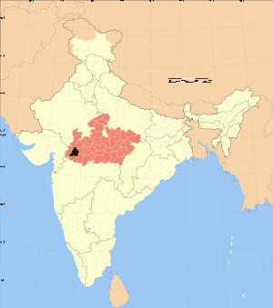
Location of Dhar district in Madhya PradeshState Madhya Pradesh,  India
IndiaAdministrative division Indore Headquarters Dhar Area 8,153 km2 (3,148 sq mi) Population 1,740,577 (2001) Lok Sabha Constituencies Dhar Assembly Seats 7 Official website Dhar district (Hindi: धार जिला) is a district of Madhya Pradesh state in central India. The historic town of Dhar is administrative headquarters of the district.
The district has an area 8,153 km². It is bounded by the districts of Ratlam to the north, Ujjain to the northeast, Indore to the east, Khargone (West Nimar) to the southeast, Barwani to the south, and Jhabua to the west. It is part of the Indore Division of Madhya Pradesh. The population of the district is 1,740,577 (2001 census), an increase of 24% from its 1991 population of 1,367,412. Pithampur is a large industrial area comes under Dhar District.
Contents
Geography
The Vindhya Range runs east and west through the district. The northern part of the district lies on the Malwa plateau. The northwestern portion of the district lies in the watershed of the Mahi River and its tributaries, while the northeastern part of the district lies in the watershed of the Chambal River, which drains into the Ganges via the Yamuna River. The portion of the district south of the ridge of the Vindhyas lies in the watershed of the Narmada River, which forms the southern boundary of the district. Physiographic Regions
The district extends over three physiographic divisions. They are the Malwa in the north, the Vindhyachal range in central zone and the Narmada valley along the southern boundary. However, the valley is again closed up by the hills in the south-western part. Malwa Plateau
The northern half of the district lies on the Malwa plateau. It covers the northern parts of Dhar, Sardarpur and Badnawar tahsils. The average elevation of the plateau is 500 metres above the mean sea level. The land is undulation with a few scattered flat topped hills roughly aligned between the valleys from south to north. The general slope is towards the north. The valleys are covered with black cotton soil of varying thickness, mostly adapted for cultivation. The mounds may bear gravels or the underlaying sandstone rocks may have been exposed. The plateau covers an area of about 466,196 hectares in the district. Vindhyachal Range
A part of the range extends in the district in a crescentic belt generally from south-east to north-west. The range is represented by a strip of hilly area 5 to 20 kilometres in width. It is about 5 km wide near village Dhani near the south-eastern boundary. Near Mograbav in the centre, it is about 10 km further widening to 20 km west of Tanda. To the west of Bagh and Kukshi the range stands disconnected by the valleys of the Mahi and Hatni.
It restarts along the Narmada in the south-west. The northern spur (peak 543.76 metres) froms the boundary between the Sardarpur tahsil and Jhabua district. It extends from the peak of Gomanpur a (556.26 metres) to Bajrangarh in Jhabua. Another spur extends to wards Jhabua in the north-west. The great Vindhyachal range extends generally from west to east and scarps at most of its length towards the south. In Dhar also the south-ward escarps are well marked, the wall rising from 400 to 600 metres. However, in the western part their faces have been eroded back into long and deep rugged valleys of the tributary hills of the Narmada. In fact the strong currents of the small streams on the steep southern side have cut back at their heads. The numerous streams of the Narmada valley find their sources on the Malwa plateau. The main line of the highest peaks has been left to the south of their present courses.
In the eastern and central parts of the Vindhyachal in Dhar the main hill range is continuous but in the west it is dissected by deep channels of the rivulets. The range slopes towards the north and gradually meets the Malwa plateau. Numerous spurs also extend over the Malwa plateau in the north. But in the western half in the district one may also find a series of denuded ridges alternating with the parallel stream-channels and running for some kilometres from local confusion, unless one tries to trace the line of the main peaks.
The hightest peak of the district, Mograba (751.03 metres) lies in the central part. Nilkanth (702.26 metres) lies further east and the Shikarpura hill rises up to 698.91 metres. The famous historical fort of Mandugarh towers the flat-topped hill about 600 metres, from the mean sea level. Narmada Valley
Below the Vindhyachal scarps lies the narrow valley of the Narmada. It occupies the sourthern part of the district in Manawar tahsil and the south-eastern part of Kukshi tahsil. The width of the valley is 15 to 30 kilometres. The elavation varies from 275 metres in the northern part of Manawar tahsil to 150 metres in the low plain of Nisarpur in the south-west. To the east between Khalghat and Bakaner the valley is undulation wider, more open and fertile with alluvial cover. Proceeding westwards the valley is studded with hills alternatively cut up by numerous streams which join the Narmada along the southern boundary of the district. The result is that there are few stretches and pockets of alluvium along the streams.
History
Historically and culturally, Dhar District has occupied an important place through its epoch-ancient, mediaeval and morden. Dhar, known as Dhar Nagari in ancient period and Piran Dhar in mediaeval period, has had the privilege of being of the capital city, both in the ancient and in the early mediaeval periods.
Map of the Malwa Region and its neigbhours The Paramaras ruled over a vast territory around Malwa for 400 years from the 9th to the 13th centuries. Vakpati Munja and Bhojadeva were the most famous rurlers of this dynasty. Munja was a great general, a poet of repute and a great patron of art and literature. His court was adorned by poets like Dhananjaya, Halayudha, Dhanika, Padmagupta, the author of Navasahasankacharita, Amitagati, etc. He excavated the Munja Sagar at Dhar and Mandu and built beautiful temples at a number of places.
Bhojadeva, the most illustrious of the Parmaras, was one of the greatest kings of ancient India. His name became a household word in India not only as a soldier but also as a builder, a scholar and a writer. Authorship of a large number of books on a variety of subjects like gramer, astronomy, poetics, architecture and asceticism is ascribed to him. He shifted his capital from Ujjain to Dhar, where the established a university for Sanskrit studies. It is known as the Bhoja Shala in which was enshrined the image of Goddes Saraswati. He rebuilt temples, including the magnificent temple at Bhojapur. Bhoja also created a large lake near Bhojapur.
In the year 1305, A.D. the whole of Malwa passed into the hands of Al-ud-din Khalji when Dhar and Mandu were also captured. Dhar continued to be under Delhi Sultans until the reign of Muhammed II. At that time, Dilawar Khan Ghuri was the Governor of Malwa. In 1401 A.D. he assumed royalty and established an independent Kingdom of Malwa, with his capital at Dhar. His son and successor, Hoshang Shah moved the capital to Mandu. Hoshang Shah died in 1435 A.D. and was entomed in the splendid mausoleum which is still existing at Mandu. On Hoshang's death his son, Ghazni Khan, succeeded him. He ordered his capital Mandu to be called "Shadiabad (the City of Joy). He, however, had a very short reign, as he was poisoned to death by Mahmud Khalji in 1436 A.D. Mahmud Khan ascended the throne and inaugurated the reign of the Khalji Sultans in Malwa. Khalji Sultans continued to rule Malwa till 1531 A.D. Later Malwa was captured by Sher Shah and was placed under the charge of Shujat Khan. Shujat Khan was succeeded by his son Baz Bahadur. Mandu and its environs reverberated with the stories of romance of Rupmati and Baz Bahadur. When Baz Bahadur was defeated and put to fight by the Mugal army, his beloved Rupmati took poison and put an end to her life to escape dishonour.
Map of the Malwa RegionIn the administrative organisation of Akbar, Dhar was the Chief town of a Mahal in Mandu Sarkar of the Subah of Malwa. Akbar stayed at Dhar for seven days, while directing the invasion of the Deccan. He also visited Mandu a number of times. Mandu was also a favourite resort of Emperor Jahangir, who stayed here for over six months in 1616 A.D. In his memoirs, Jahangir has payed glowing tributes to the pleasant climate and prety scenery at Mandu Noorjahan shot four tigers with six bullets, from the back of an elephant, near Mandu.
When Baji Rao Peshwa divided Malwa among Sindhia, Holkar and the three Pawar Chief, in 1832 A.D. Dhar was bestwed on Anand Rao Pawar. The rulers of Dhar held away over this area till 1948, except for a brief period of three years, following the great Revolt of 1857.
Dhar was an important centre of Revolt, during the First War of Independence in 1857. Freedom fighters captured the Fort of Dhar which remained in their possession from July to October, 1857. The Bhils also took active part in the Revolt. The rebels paralysed the authority of the State and opposed the British. Consequently, a large force marched against Dhar under Colonel Durand, and captured the town. Just because three or four rounds were fired on the British troops by rebels, the British soldiers took a tribal revenge on the local people. They dragged civilians from their houses, killed them and looted their property ladies were dishonoured. The rebels defended the fort, till 31 October 1857 when breach was caused. They, therefore, escaped through an underground passage.
As an aftermath of the Revolt, Dhar State was annexed to the British territory. The British Government however, changed the decision of Government of India, and restored Dhar to Anand Rao III, on the 1st May 1860.
Mandu, clothed in green, with turbulent brooks and torrents rushing down into the encircling ravines, presents a magnificent spectacle. Thousands of tourists are drawn to Mandu, to have a glimpse of the splendid movements there.
Another place of great national importance is Bagh, where the caves have been excavated on the rockface of a lofty hill, on he bank of the Bagh river. The paintings at Bagh date back to a period between the 5th and the 7th centuries A.D., the Golden Age of Indian Art. Together with the Ajanta paintings, the Bagh paintings represent the finest traditions of Indian Art, which had a far-reaching influence on the Buddhist Art, not only in India, but on the entire Buddhist Art in Asia.
The majority of the population in Dhar District belongs to the Scheduled Tribes. The main tribes in the District are Bhils and Bhilalas. Their highest concentration is in Kukshi Tahsil.
Economy
In 2006 the Ministry of Panchayati Raj named Dhar one of the country's 250 most backward districts (out of a total of 640).[1] It is one of the 24 districts in Madhya Pradesh currently receiving funds from the Backward Regions Grant Fund Programme (BRGF).[1]
Divisions
Dhar district is divided into 5 sub-divisions: Dhar, Sardarpur, Badnawar, Manawar and Kukshi. These sub-divisions are further divided in to 7 tehsils: Dhar, Badnawar, Dharampuri, Sardarpur, Manawar, Kukshi and Gandhwani.
There are seven Vidhan Sabha constituencies in this district: Sardarpur, Gandhwani, Kukshi, Manawar, Dharampuri, Dhar and Badnawar. All of these are part of the only Lok Sabha constituency in this district: Dhar.
Demographics
According to the 2011 census Dhar District has a population of 2,184,672,[2] roughly equal to the nation of Latvia[3] or the US state of New Mexico.[4] This gives it a ranking of 208th in India (out of a total of 640).[2] The district has a population density of 268 inhabitants per square kilometre (690 /sq mi) .[2] Its population growth rate over the decade 2001-2011 was 25.53 %.[2] Dhar has a sex ratio of 961 females for every 1000 males,[2] and a literacy rate of 60.57 %.[2]
Languages
Languages spoken include Bareli Rathwi, a Bhil language with approximately 64 000 speakers, written in the Devanagari script;[5] and Bhilali, with 1 150 000 speakers.[6]
References
- ^ a b Ministry of Panchayati Raj (September 8, 2009). "A Note on the Backward Regions Grant Fund Programme". National Institute of Rural Development. http://www.nird.org.in/brgf/doc/brgf_BackgroundNote.pdf. Retrieved September 27, 2011.
- ^ a b c d e f "District Census 2011". Census2011.co.in. 2011. http://www.census2011.co.in/district.php. Retrieved 2011-09-30.
- ^ US Directorate of Intelligence. "Country Comparison:Population". https://www.cia.gov/library/publications/the-world-factbook/rankorder/2119rank.html. Retrieved 2011-10-01. "Latvia 2,204,708 July 2011 est."
- ^ "2010 Resident Population Data". U. S. Census Bureau. http://2010.census.gov/2010census/data/apportionment-pop-text.php. Retrieved 2011-09-30. "New Mexico - 2,059,179"
- ^ M. Paul Lewis, ed (2009). "Bareli, Rathwi: A language of India". Ethnologue: Languages of the World (16th edition ed.). Dallas, Texas: SIL International. http://www.ethnologue.com/show_language.asp?code=bgd. Retrieved 2011-09-28.
- ^ M. Paul Lewis, ed (2009). "Bhilali: A language of India". Ethnologue: Languages of the World (16th edition ed.). Dallas, Texas: SIL International. http://www.ethnologue.com/show_language.asp?code=bhi. Retrieved 2011-09-30.
External links
Divisions & Districts of Madhya Pradesh · 
Bhopal Division: Chambal Division: Gwalior Division: Ashoknagar · Datia · Guna · Gwalior · Shivpuri
Indore Division: Jabalpur Division: Narmadapuram Division: Betul · Harda · Hoshangabad
Rewa Division: Sagar Division: Chhatarpur · Damoh · Panna · Sagar · Tikamgarh
Shahdol Division: Ujjain Division: Cities and towns in Indore Division Alirajpur district Barwani district Burhanpur district Dhar district Indore district Jhabua district Khandwa district Khargone district Related topics Cities and towns
in other DivisionsCategories:

Wikimedia Foundation. 2010.