- Narsinghpur District
-
This article is about the district. For its eponymous headquarters, see Narsinghpur.
Narsinghpur district
नरसिंहपुर जिला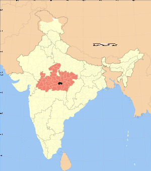
Location of Narsinghpur district in Madhya PradeshState Madhya Pradesh,  India
IndiaAdministrative division Jabalpur Headquarters Narsinghpur Area 5,125.55 km2 (1,978.99 sq mi) Population 957,399 (2001) Population density 187 /km2 (480 /sq mi) Urban population YES Literacy 78.3 per cent Sex ratio 909 Lok Sabha Constituencies Hoshangabad Official website Narsinghpur district (also referred to Narsimhapur district) is a district of Madhya Pradesh state in central India. The town of Narsinghpur is administrative headquarters of the district.
Contents
Geography
The district has an area 5,125.55 km². The district is part of the Jabalpur Division. It is bounded on the north by Sagar and Damoh districts, on the east by Jabalpur District, on the southeast by Seoni District, on the south by Chhindwara District, on the west by Hoshangabad District, and on the northwest by Raisen District. The administrative seat is Narsinghpur.[1]
The district sits in the basin of the Narmada River. The Vindhya Range skirts the northern end of the district. The Satpura Range forms the district's southern boundary. It is located between 220 55’ and 230 15’ north latitude, and 780 38’ and 790 38’ east longitudes. It has an average elevation of 359.8 m above mean sea level.[2]
History
At the beginning of the 19th century, Narsinghpur District in the domain of the Maratha Bhonsle Maharajas of Nagpur, but was ceded to the British Raj in 1818. Narsinghpur District was part of the Nerbudda (Narmada) Division of the Central Provinces and Berar, which became the state of Madhya Bharat (later Madhya Pradesh) after India's independence in 1947.
Demographics
According to the 2011 census Narsinghpur District has a population of 1,092,141,[3] roughly equal to the nation of Cyprus[4] or the US state of Rhode Island.[5] This gives it a ranking of 418th in India (out of a total of 640).[3] The district has a population density of 213 inhabitants per square kilometre (550 /sq mi) .[3] Its population growth rate over the decade 2001-2011 was 14.04 %.[3] Narsimhapur has a sex ratio of 917 females for every 1000 males,[3] and a literacy rate of 76.79 %.[3]
Literacy
With a literacy rate of 78.3 per cent, Narsinghpur district had the highest literacy rates amongst the districts of Madhya Pradesh.[6]
Transport
The main rail line from Mumbai to Calcutta (Kolkata), which follows the Narmada River valley, runs through the district from west to east.
References
- ^ "Narsinghpur". mponline. http://www.mponline.in/Profile/districts/Narsinghpur.asp. Retrieved 2010-08-19.
- ^ "Narsinghpur". District administration. http://narsinghpur.nic.in/. Retrieved 2010-08-19.
- ^ a b c d e f "District Census 2011". Census2011.co.in. 2011. http://www.census2011.co.in/district.php. Retrieved 2011-09-30.
- ^ US Directorate of Intelligence. "Country Comparison:Population". https://www.cia.gov/library/publications/the-world-factbook/rankorder/2119rank.html. Retrieved 2011-10-01. "Cyprus 1,120,489 July 2011 est."
- ^ "2010 Resident Population Data". U. S. Census Bureau. http://2010.census.gov/2010census/data/apportionment-pop-text.php. Retrieved 2011-09-30. "Rhode Island 1,052,567"
- ^ "Seminar On Progress Of Literacy In India: What The Census 2001 Preveals, Niepa, New Delhi, October 05, 2002". India’s Literacy Panorama. educationforallinindia.com. http://www.educationforallinindia.com/page172.html. Retrieved 2010-08-17.
External links

Raisen district Sagar district Damoh district 
Jabalpur district  Narsinghpur district

Hoshangabad district Chhindwara district Seoni district Divisions & Districts of Madhya Pradesh · 
Bhopal Division: Chambal Division: Gwalior Division: Ashoknagar · Datia · Guna · Gwalior · Shivpuri
Indore Division: Jabalpur Division: Narmadapuram Division: Betul · Harda · Hoshangabad
Rewa Division: Sagar Division: Chhatarpur · Damoh · Panna · Sagar · Tikamgarh
Shahdol Division: Ujjain Division: Template:Jabalpur Division Narsinghpur
Categories:

Wikimedia Foundation. 2010.