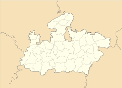
- Manawar
-
Manawar — city — Coordinates 22°14′N 75°05′E / 22.23°N 75.08°ECoordinates: 22°14′N 75°05′E / 22.23°N 75.08°E Country India State Madhya Pradesh District(s) Dhar Population 25,460 (2001[update]) Time zone IST (UTC+05:30) Area
• 180 metres (590 ft)
Manawar is a city and a municipality in Dhar district in the Indian state of Madhya Pradesh.
Geography
Manawar is located at 22°14′N 75°05′E / 22.23°N 75.08°E[1].It has an average elevation of 180 metres (590 feet). biggest tempel in Manawar.ex. shri pashvnath jain mandir,shri manta ganesh mandir,shri guru mandir etc.
Demographics
As of 2001[update] India census[2], Manawar had a population of 25,460. Males constitute 52% of the population and females 48%. Manawar has an average literacy rate of 59%, lower than the national average of 59.5%: male literacy is 66%, and female literacy is 52%. In Manawar, 15% of the population is under 6 years of age.
The name Manawar came from river MAN, flowing near Manawar.The Ashram of famous saint Shri Shri 1008 Shri Babaji, also located near Manawar at Balipur. Its a religious and peaceful city biggest tempel in Manawar.ex. shri pashvnath jain mandir,shri manta ganesh mandir,shri guru mandir etc.and gytri mandir in patel colony
References
- ^ Falling Rain Genomics, Inc - Manawar
- ^ "Census of India 2001: Data from the 2001 Census, including cities, villages and towns (Provisional)". Census Commission of India. Archived from the original on 2004-06-16. http://web.archive.org/web/20040616075334/http://www.censusindia.net/results/town.php?stad=A&state5=999. Retrieved 2008-11-01.
Cities and towns in Indore Division Alirajpur district Barwani district Burhanpur district Dhar district Indore district Jhabua district Khandwa district Khargone district Related topics Cities and towns
in other DivisionsNearest Railway station and airport is Indore which is 129 km from Manawar.
Categories:- Cities and towns in Dhar district
- Madhya Pradesh geography stubs
Wikimedia Foundation. 2010.


