- Xishuangbanna Dai Autonomous Prefecture
-
Xishuangbanna Dai Autonomous Prefecture
西双版纳

— Autonomous prefecture — 西双版纳傣族自治州
 Location of Xishuangbanna Prefecture within Yunnan province of China
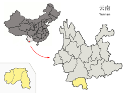 Location within China
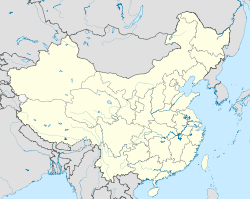
 Xishuangbanna Dai Autonomous Prefecture
Coordinates: 22°00′N 100°48′E / 22°N 100.8°E Country China Province Yunnan GB/T 2260 CODE[1] 532800 Admin HQ Jinghong Admin units Area – Total 19,700 km2 (7,606.2 sq mi) Population – Total 993,397 – Density 50.4/km2 (130.6/sq mi) Time zone China Standard Time (UTC+8) Postal code 666100[2] Area code(s) 0691[2] Website xsbn.gov.cn 1Yunnan Statistics Bureau [1]
2Yunnan Portal [2]Xishuangbanna Dai Autonomous Prefecture Chinese name Simplified Chinese 西双版纳傣族自治州 Traditional Chinese 西雙版納傣族自治州 Transcriptions Mandarin - Hanyu Pinyin Xīshuāngbǎnnà dǎizú Zìzhìzhōu Cantonese (Yue) - Jyutping saai1 soeng1 baan2 naap6 Former Chinese names Simplified Chinese 1. 车里
2. 允景洪Traditional Chinese 1. 車里
2. 允景洪Transcriptions Mandarin - Hanyu Pinyin 1. Chēlǐ
2. YǔnjǐnghóngThai name Thai สิบสองพันนา
or สิบสองปันนา
([sìpsɔ̌ːŋpānnāː])Tai Lü name Tai Lü 
([sípsɔ́ŋpǎnnǎː])Hani name Hani Xisual banaq Akha name Akha Sǐsǎwpâna Xishuangbanna (or Sibsongbanna, Tai Lü:
[tsɯ˧˥tsɯ˧˥tsəu˧ pʰaː˥˩saː˥tai˥˩ sip˥sɔŋ˥ pan˥˩naː˥˩]; Chinese: 西双版纳傣族自治州) is an autonomous prefecture in Yunnan Province, China. The capital city is Jinghong, the largest settlement in the area and one that straddles the Mekong River, called the Lancang River in Chinese.Contents
Name
The native Thai name Sípsɔ́ng literally means "twelve" and Pǎnnǎ literally means "thousand rice fields (千亩)". So Sípsɔ́ŋpǎnnǎ = "twelve thousand rice fields".
Administrative subdivisions
Xishuangbanna governs one county-level city and two counties.
Map 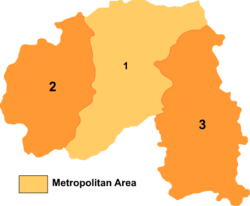
# Name Hanzi Hanyu Pinyin Population
(2003 est.)Area (km²) Density
(/km²)1 Jinghong City 景洪市 Jǐnghóng Shì 370,000 7,133 52 2 Menghai County 勐海县 Měnghǎi Xiàn 300,000 5,511 54 3 Mengla County 勐腊县 Měnglà Xiàn 200,000 7,056 28 Geography
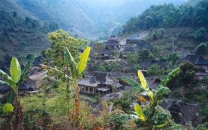
The prefecture has an area of 19,700 km². Xishuangbanna is the home of the Dai people. The region sits at a lower altitude than most of Yunnan, and has a tropical climate. It is fast becoming a sought after tourist destination.
Biodiversity
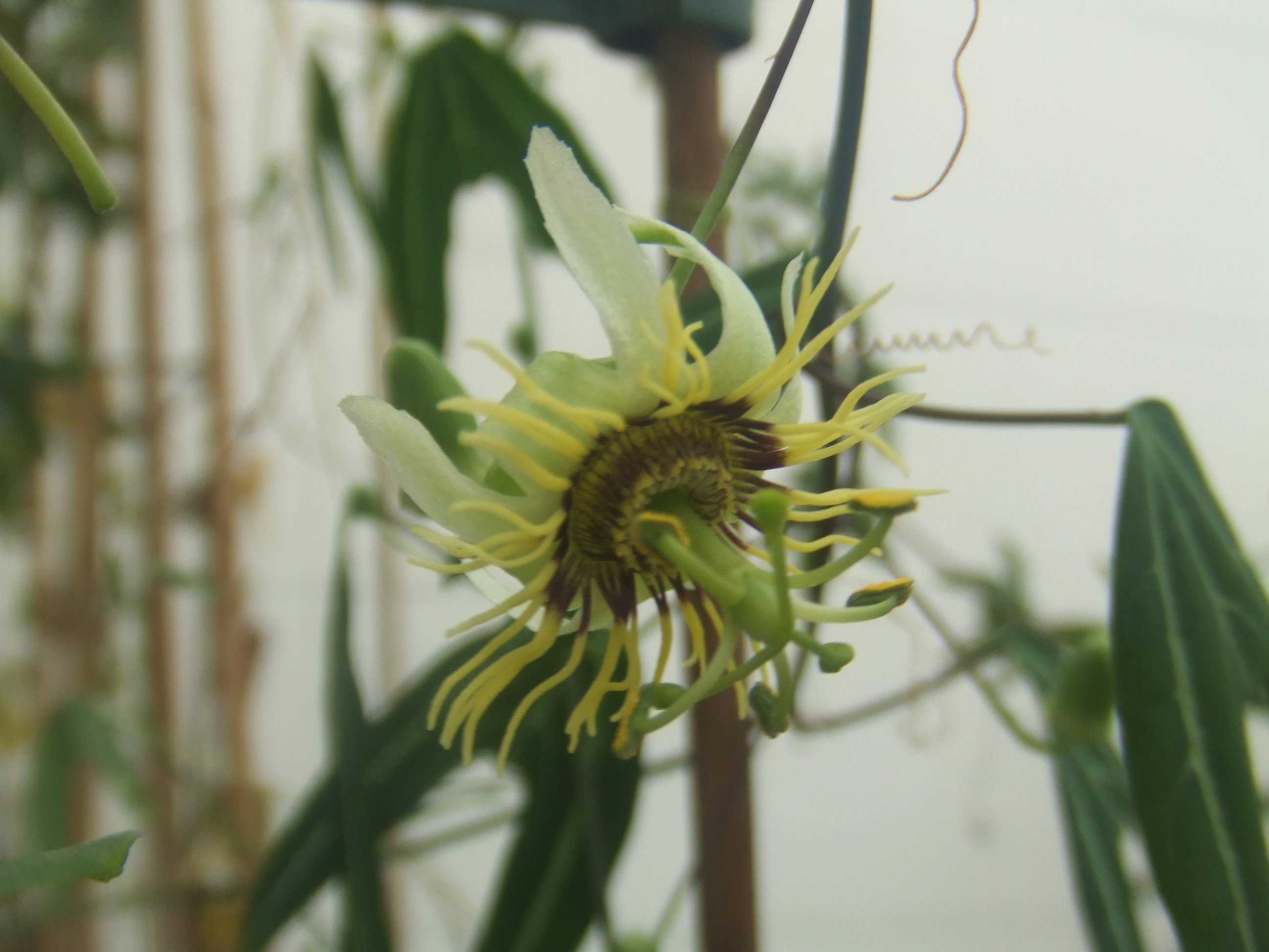
 Passiflora xishuangbannaensis
Xishuangbanna harbors much of the biodiversity of Yunnan Province, which harbors much of the biodiversity of China. Its tropical climate and its remoteness until recent times accounts for this. In addition to an abundance of plants, Xishuangbanna is home to the last few Asian elephants still in China; the species roamed over a large part of the country even as late as a few hundred years ago. The elephants are protected in a reserve, but the plant diversity is threatened by, and has for five decades been threatened by, the proliferation of rubber plantations which completely destroy the rainforest and replace it with a monoculture of trees originally from Brazil.[4]
Passiflora xishuangbannaensis is a recently discovered passionflower species that is endemic to Xishuangbanna.
Demographics
With censuses in the year 2000 Xishuangbanna had 993,397 inhabitants with a population density of 50.43 inhabitants per km².
In the early 1950s, the Han population of Sipsongpanna was less than 10% of the total; today the Han population may soon overtake the local Dai people.[3] Most of the businesses had been bought by the Han, and commercial signs, which were earlier Tai/Chinese bilingual, are now almost solely in Chinese. However, the Dai villagers have also prospered as landlords, often renting out their livestock quarters to Han migrants as the area undergoes rapid urbanization.
Ethnic groups
Ethnic groups in Xishuangbanna, 2000 census
Ethnicity Population Percentage Dai 296,930 29.89% Han 289,181 29.11% Hani 186,067 18.73% Yi 55,772 5.61% Lahu 55,548 5.59% Blang 36,453 3.67% Jino 20,199 2.03% Yao 18,679 1.88% Miao 11,037 1.11% Bai 5,931 0.6% ethnic background not given 5,640 0.57% Hui 3,911 0.39% Va 3,112 0.31% Zhuang 2,130 0.21% Others 2,807 0.3% Culture
The Six famous tea mountains region (六大茶山; pinyin: Liù Dà Chá Shān; literally, "Six major tea mountain") located in the prefecture produce some of the most highly regarded Pu-erh tea in the 20th century.
Xishuangbanna is rich in nature, historical and cultural resources, noted for its folklore, rain forests, rare plants and wildlife. Its major tourist attractions include Menglun Tropical Botanical Garden, Manfeilong Pagodas (Tanuozhuanglong), Jingzhen Pavilion, Wild Elephant Gully, Dai people's village at Ganlanba.
The well-known traditional festival is the ethnic Dai's Water-Splashing Festival. It lasts for three days from April 13 to 15. Besides the water festival event it also consists of some other events such as Dragon boat races, firing of indigenous missiles, flying Kongming Lamps.
Transport
Since the opening of the Xishuangbanna Gasa Airport (formerly "Jinghong International Airport") in 1990, traveling to Xishuangbanna by air has become more popular and convenient and there are daily flights connecting Xishuangbanna with Kunming City. The area also has air connections with Dali, Chengdu and Bangkok. The Xishuangbanna Airport is 6 km south of Jinghong City.
There are also bus routes to places all over Yunnan and neighboring provinces.
In October 2010, plans were announced for a 530 km railway linking Xishuangbanna to Vientiane in Laos;[5] connections to Thailand are also possible.[6]
History
Its local commanders (土司) were the Dao family (刀氏) during the Ming Dynasty and Qing Dynasty.[7]
See also
- Xishuangbanna Tropical Botanical Garden
References
- ^ http://www.stats.gov.cn/tjbz/xzqhdm/index.htm
- ^ a b Area Code and Postal Code in Yunnan Province
- ^ a b Lionel M. Jensen, Timothy B. Weston (2007). China's transformations: the stories beyond the headlines. Rowman & Littlefield. http://books.google.co.in/books?id=OKNTJXvle9wC&pg=216. Sandra Teresa Hyde, Ch. 11: Jinghong is a piaocheng or city of prostitution. It provides Han Chinese male tourists with a sex-oriented tourist destination.
- ^ Corruption 'threatens China rainforest'
- ^ "NEW CHINA-LAOS LINK". http://www.railwaysafrica.com/blog/2010/10/new-china-laos-link/. Retrieved 2010-11-09.
- ^ "STANDARD GAUGE FOR THAILAND". http://www.railwaysafrica.com/blog/2010/12/standard-gauge-for-thailand/. Retrieved 2010-12-19.
- ^ 西双版纳傣族文史资料的翻译整理和研究
External links
- Xishuangbanna Prefecture government website
- Xishuangbanna-Jinghong city government website
- Xishuangbanna-Mengbalanaxi
- Xishuangbanna Daily
- Xishuangbanna travel information
- Xishuangbanna Biodiversity Centre and Guide
- Xishuangbanna Tropical Botanical Garden
- Xishuangbanna guide and photos
Categories:- Xishuangbanna Prefecture
- Autonomous prefectures of the People's Republic of China
- Biosphere reserves of China
- Yi people
- Tourism in Yunnan


Wikimedia Foundation. 2010.