- Shangri-La County
-
Shangri-La County
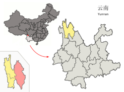
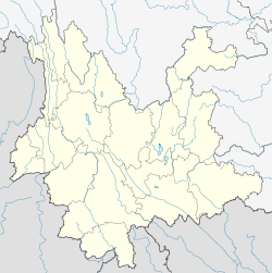
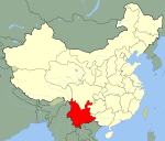
Zhongdian County · 中甸县Chinese transcription(s) – Simplified 香格里拉县 – Traditional 香格里拉縣 – Pinyin Xiānggélǐlā Xiàn Tibetan transcription(s) – Tibetan script རྒྱལ་ཐང་རྫོང་། – Wylie rgyal thang rdzong – Tibetan pinyin Gyaitang Zong Location of Shangri-La County (pink) and Diqing prefecture (yellow) within Yunnan province of China Location within Yunnan Coordinates: 27°50′N 99°42′E / 27.833°N 99.7°E Country People's Republic of China Province Yunnan Prefecture Dêqên Area – Total 11,613 km2 (4,483.8 sq mi) Population – Total 130,000 – Density 11.2/km2 (29/sq mi) Time zone China Standard (UTC+8) Postal code 674400 Area code(s) 0887 Website http://www.xianggelila.org/ Shangri-La County (Chinese: 香格里拉县; Tibetan: རྒྱལ་ཐང་རྫོང་།)is a primarily Tibetan county in northwestern Yunnan province, Southwest China and is the location of the seat of the Dêqên Tibetan Autonomous Prefecture.
Contents
Name
The county was formerly called Zhongdian County (Chinese: 中甸县 Zhōngdiàn Xiàn) but was renamed in 2001 after the fictional land of Shangri-La in the 1933 James Hilton novel Lost Horizon, in an effort to promote tourism in the area. The local Tibetan population refers to it by the name Gyalthang (Tibetan: རྒྱལ་ཐང་རྫོང་), which is the Tibetan name for Jiantang Town (建塘镇 Jiàntáng Zhèn), the county seat.
Towns
- Jiantang Town
- Zhongdian Town
- Hutiaoxia Town
- Jinjiang Town
- Luoji Township
Climate
Shangri-La has a humid continental climate (Köppen Dwb), with influences from the monsoon and the high elevation. Winters are chilly but sunny, with nighttime lows often dropping below −15 °C (5 °F), while summers are cool, with daytime highs of around 19 °C (66 °F), and feature frequent rain; more than 70% of the annual precipitation is delivered from June to September. Except during the summer, nights are usually sharply cooler than the days. Despite the dryness of the winter, the small amount of precipitation is generally sufficient to cause major transportation dislocations and isolate the area between November and March.
Climate data for Shangri-La (1971−2000) Month Jan Feb Mar Apr May Jun Jul Aug Sep Oct Nov Dec Year Record high °C (°F) 18.3
(64.9)16.2
(61.2)21.5
(70.7)22.7
(72.9)24.2
(75.6)25.6
(78.1)25.4
(77.7)25.1
(77.2)23.8
(74.8)20.9
(69.6)18.8
(65.8)17.9
(64.2)25.6
(78.1)Average high °C (°F) 6.3
(43.3)6.7
(44.1)9.2
(48.6)12.5
(54.5)17.0
(62.6)19.2
(66.6)19.3
(66.7)18.9
(66.0)17.4
(63.3)14.7
(58.5)11.0
(51.8)8.2
(46.8)13.4 Average low °C (°F) −11.2
(11.8)−7.4
(18.7)−3.6
(25.5)−0.5
(31.1)3.4
(38.1)8.4
(47.1)9.8
(49.6)9.1
(48.4)7.4
(45.3)1.3
(34.3)−5.8
(21.6)−10.6
(12.9)0.0 Record low °C (°F) −23.9
(−11.0)−20.2
(−4.4)−17.5
(0.5)−10
(14)−7.4
(18.7)−2.1
(28.2)1.1
(34.0)1.0
(33.8)−3
(27)−11.1
(12.0)−16.5
(2.3)−27.4
(−17.3)−27.4
(−17.3)Precipitation mm (inches) 7.8
(0.307)14.4
(0.567)34.8
(1.37)32.4
(1.276)25.9
(1.02)80.2
(3.157)157.4
(6.197)151.3
(5.957)80.6
(3.173)44.5
(1.752)12.7
(0.5)4.9
(0.193)646.9
(25.469)Avg. precipitation days (≥ 0.1 mm) 4.2 6.6 9.3 11.1 11.5 17.9 23.2 23.1 19.3 10.1 4.0 2.1 142.4 Source: Weather China National park
- Pudacuo National Park, the first national park in China to meet IUCN standards, also incorporates the Three Parallel Rivers of Yunnan Protected Areas World Heritage Site.
Transport
- The town's airport is Diqing Airport. Covering an area of 225 hectares, it is one of the biggest airports in the northwest of Yunnan Province. There are flights to Kunming, Chengdu, Lhasa, Guangzhou and Shenzhen.
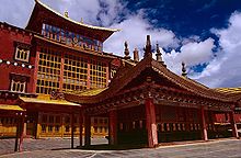
- Many travelers use the county town as a gateway into Tibet, either travelling many days overland by jeep to Lhasa, or by flying from the city's airport. However, the town itself is a tourist destination, primarily due to the nearby Gandan Sumtseling Monastery (Chinese: 松赞林寺 Sōngzànlín Sì), Pudacuo National Park, and Tiger Leaping Gorge.
- China National Highway 214
See also
- Shangri-La
- Three Parallel Rivers of Yunnan Protected Areas - UNESCO World Heritage Site
External links
- Shangri-La County Official Website
- Shangrila from Wikitravel
Coordinates: 27°50′N 99°42.1′E / 27.833°N 99.7017°E
Categories:- County-level divisions of Dêqên Tibetan Autonomous Prefecture
- Tourism in Yunnan
- Yunnan geography stubs
Wikimedia Foundation. 2010.


