- Ning'er Hani and Yi Autonomous County
-
Ning'er County
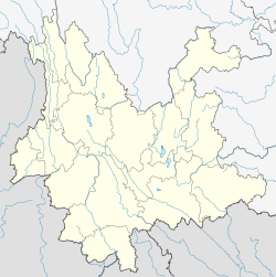
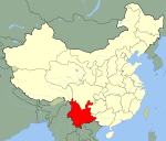
宁洱哈尼族彝族自治县— Autonomous county — Location of Ning'er County (pink) and Pu'er Prefecture (yellow) within Yunnan province of China Location within Yunnan, China Coordinates: 23°05′N 101°03′E / 23.083°N 101.05°E Country China Province Yunnan Prefecture Pu'er GB/T 2260 CODE[1] 530821 Area – Total 3,670 km2 (1,417 sq mi) Population – Total 184,235 – Density 50.2/km2 (130/sq mi) Time zone China Standard Time (UTC+8) Postal code 665100[2] Area code(s) 0879[2] Website Ning-er Information Network 1Yunnan Statistics Bureau [1]
2Puer Gov. [2]
3Yunnan Portal [3]The Ning'er Hani and Yi Autonomous County (simplified Chinese: 宁洱哈尼族彝族自治县; traditional Chinese: 寧洱哈尼族彝族自治縣; pinyin: Níng'ěr Hānízú Yízú Zìzhìxiàn) is an autonomous county under the jurisdiction of Pu'er Prefecture, Yunnan Province, China.
Contents
Demography
The population of the county has a large proportion of native Hani and Yi people in a predominately Han Chinese population. As of 2003 the county records a population of approximately 190,000 people.
Transport
History
This county gives its name to Pu-erh tea, due to its historical role in the tea trade in Ancient China.
References
External links
Coordinates: 23°05′N 101°03′E / 23.083°N 101.05°E
Categories:- County-level divisions of Pu'er City
- Autonomous counties of the People's Republic of China
- Yi people
- Yunnan geography stubs
Wikimedia Foundation. 2010.


