- Tikrit
-
Tikrit
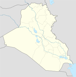
تكريت— Town — Looking north along the Tigris towards Saddam's Presidential palace in April 2003 Tikrit's location inside Iraq Coordinates: 34°36′36″N 43°40′48″E / 34.61°N 43.68°E Country Iraq Governorate Salah ad Din Population (2002) – Total 260,000 Tikrit (Arabic: تكريت, Tikrīt also transliterated as Takrit or Tekrit) is a town in Iraq, located 140 km northwest of Baghdad on the Tigris river (at 34.61°N, 43.68°E). The town, with an estimated population in 2002 of about 260,000 is the administrative center of the Salah ad Din Governorate.[1]
Contents
History
Ancient times
As a fort along the Tigris (Akkadian: Idiqlat), the town is first mentioned in the Fall of Assyria Chronicle as being a refuge for the Babylonian king Nabopolassar during his attack on the city of Assur in 615 BC.[2]
Tikrit is usually identified with the Hellenistic settlement Birtha.[3] As Tagrit, it was the seat of the Maphrian of the Monophysites.
Over a thousand years ago, it possessed a fortress and a large Christian monastery. It was renowned as a centre for the production of woolen textiles. The Arab Uqaylid Dynasty took hold of Tikrit in 1036.
Around 1138,[4] the legendary leader Saladin was born there; his many achievements include defending Egypt against the Christian Crusaders and recapturing Jerusalem in 1187. The modern province of which Tikrit is the capital is named after him.
The town, and much of Iraq with it, was devastated in the 13th century by the Mongol invasion under Hulagu.
20th century
In September 1917, British forces captured the town during a major advance against the Ottoman Empire during World War I.
The town is among westerners perhaps best known for being the birthplace, in 1937, of Saddam Hussein, who frequently liked to compare himself with Saladin, despite the fact that Saladin was Kurdish. Many senior members of the Iraqi government during his rule were drawn from Saddam's own Tikriti tribe, the Al Bu Nasir, as were members of his Iraqi Republican Guard, chiefly because Saddam apparently felt that he was most able to rely on relatives and allies of his family. The Tikriti domination of the Iraqi government became something of an embarrassment to Hussein and, in 1977, he abolished the use of surnames in Iraq to conceal the fact that so many of his key supporters bore the same surname, al-Tikriti (as did Saddam himself). Saddam Hussein was buried near Tikrit in his hometown of Owja following his hanging on December 30, 2006.
Iraq War (2003)
In the opening weeks of the 2003 US-led invasion, many observers speculated that Saddam would return to Tikrit as his "last stronghold". The town was subjected to intense aerial bombardment meant to throw Saddam's elite Republican Guard troops out of the city. On April 13, 2003 several thousand US Marines and other coalition members aboard 300 armored vehicles converged on the town, meeting little or no resistance. With the fall of Tikrit, U.S. Major General Stanley McChrystal said, "I would anticipate that the major combat operations are over."
However, during the subsequent occupation Tikrit became the scene of a number of insurgent attacks against the occupation forces. It is commonly regarded as being the northern angle of the "Sunni Triangle" within which the National Resistance is at its most intense. In June 2003, Abid Hamid Mahmud, Saddam Hussein's Presidential Secretary and the Ace of Diamonds on the most wanted 'Deck of Cards,' was captured in a joint raid by special operations forces and the 1st Battalion, 22nd Infantry Regiment of 1st Brigade, 4th Infantry Division.
After the fall of Baghdad, Saddam Hussein was on the run in and around Tikrit. He was hidden by relatives and supporters for a period of about six months. During his final period in hiding, he sought refuge in a small hole just outside the town of ad-Dawr, fifteen kilometres south of Tikrit on the eastern bank of the Tigris, a few kilometers southeast of his hometown of Al-Awja. The missions which resulted in the capture of Saddam Hussein were assigned to the 1st Brigade Combat Teams of the 4th Infantry Division, commanded by Colonel James Hickey of the 4th Infantry Division. The US Army finally captured Saddam Hussein on December 13, 2003 during Operation Red Dawn.
During the 2003 invasion of Iraq, AFN Iraq ("Freedom Radio") broadcast news and entertainment within Tikrit, among other locations.
On November 22, 2005, HHC 42nd Infantry Division New York Army National Guard , handed over control of Saddam Hussein's primary palace complex in Tikrit to the governor of Salah Ah Din Province, who represented the Iraqi government. Discontinuing the existence of what once was FOB Danger. The palace complex had served as a headquarters for U.S. 4th Infantry Division, U.S. 1st Infantry Division, and 42nd Infantry Division. The palace complex now serves several purposes for the Iraqi police and army, including headquarters and jails. The U.S. Military has subsequently moved their operations to al Sahra Airfield, now COB Speicher, northwest of Tikrit.
Saddam Hussein's primary palace complex contained his own palace, one built for his mother and his sons and also included a beautiful man made lake, all enclosed with a wall and towers. Some small exclusives included a solid gold toilet for his mother and a torture room for his son.
Plans for the palace grounds when originally returned to the Iraqi people included turning it into an exclusive and lush resort. However, within weeks of turning over the palace, it was ravaged, and its contents, (furniture, columns, even light switches), were stolen and sold on the streets of Tikrit. The thieves were said to be the Iraqi police charged with protecting it.
The 402nd Civil Affairs Detachment of the US Army, and the government of Salah Ah Din province, began plans to improve local economic conditions. One of the many projects they are working on is building an industrial vocational school in the Tikrit area. The school will teach local people skills in different fields of technology, which will help to build and improve Iraq’s economic stability. [5] The curriculum will educate men and women in multiple occupational fields such as the production of high-tech products, plastic production technology, masonry, carpentry, petroleum equipment maintenance and repair, farm machinery and automotive repair. This self-supporting educational institution owns a textile mill where many of the graduates will work producing uniforms. The mill is scheduled to begin producing and selling products within the year, with the profits from the mill going to fund the school.
The vocational school’s operation, support and funding are modeled after a system South Korea used in another part of Iraq. [5] On April 18 Abu Ayyub al-Masri and Abu Abdullah al-Rashid al-Baghdadi were killed in a raid six miles (10 kilometers) of Tikrit in a safe house.
Geography
Climate
Climate data for Tikrit, Iraq Month Jan Feb Mar Apr May Jun Jul Aug Sep Oct Nov Dec Year Average high °C (°F) 14
(57)18
(64)24
(75)29
(84)36
(97)41
(106)44
(111)44
(111)39
(102)32
(90)23
(73)17
(63)30 Average low °C (°F) 2
(36)6
(43)11
(52)15
(59)22
(72)27
(81)28
(82)29
(84)24
(75)18
(64)10
(50)0
(32)16 Source: [6] References
- ^ "Iraqis � With American Help � Topple Statue of Saddam in Baghdad". Fox News. April 9, 2003. http://www.foxnews.com/story/0,2933,83580,00.html.
- ^ Bradford, Alfred S. & Pamela M. With Arrow, Sword, and Spear: A History of Warfare in the Ancient World. Greenwood Publishing Group, 2001. Accessed 18 Dec 2010.
- ^ Smith, Dictionary of Greek and Roman Geography, s.v. Birtha
- ^ Malcolm Lyons and D.E.P. Jackson, "Saladin: The Politics of the Holy War", pg. 2.
- ^ a b New Vocational School and Textile Mill Boost Economy - DefendAmerica News Article
- ^ "Tikrit". http://www.sunmap.eu/weather/asia/iraq/muhafazat-salah-ad-din/tikrit. Retrieved 2011-01-0529.
External links
- Iraq Image - Tikrit Satellite Observation
- BBC NEWS: Tikrit: Iraq's last stronghold
- Google Local Satellite Photo of Tikrit
- GlobalSecurity.org: Tikrit
- Al Sahra Airfield
The Tigris Countries 
Cities Tributaries Ambar · Kuru · Pamuk · Hazro · Batman · Garzan · Göksu · Savur · Botan · Little Khabur · Great Zab · Little Zab · ‛Adhaim · DiyalaList of crossingsCoordinates: 34°36′N 43°41′E / 34.6°N 43.683°E
Districts of Iraq and capitals Al Anbar Governorate Al Muthanna Governorate Al-Khidhir District (Al-Khidhir) • Al-Rumaitha District (Al-Rumaitha) • Al-Salman District (Al-Salman) • Al-Samawa District (Samawa)Al-Qādisiyyah Governorate Afaq District (Afaq) • Al-Shamiya District (Al-Shamiya) • Diwaniya District (Diwaniya) • Hamza District (Hamza)Babil Governorate Al-Mahawil District (Al-Mahawil) • Al-Musayab District (Al-Musayab) • Hashimiya District (Hashimiya) • Hilla District (Hilla)Baghdad Governorate Basra Governorate Abu Al-Khaseeb District (Abu Al-Khaseeb) • Al-Midaina District (Al-Midaina) • Al-Qurna District (Al-Qurna) • Al-Zubair District (Al-Zubair) •
Basrah District (Basrah) • al-Faw District (al-Faw) • Shatt Al-Arab District (Shatt Al-Arab)Dhi Qar Governorate Al-Chibayish District (Al-Chibayish) • Al-Rifa'i District (Al-Rifa'i) • Al-Shatra District (Al-Shatra) • Nassriya District (Nassriya) • Suq Al-Shoyokh District (Suq Al-Shoyokh)Diyala Governorate Dohuk Governorate Amadiya District (Amadiya) • Dohuk District (Dohuk)• Sumel District (Sumel) • Zakho District (Zakho)Arbil Governorate Makhmur District (Makhmur) • Arbil • Koisanjaq District (Koisanja) • Shaqlawa District (Shaqlawa)• Soran District • Mergasur District • Choman DistrictKarbala Governorate Ain Al-Tamur District (Ain Al-Tamur) • Al-Hindiya District (Al-Hindiya) • Kerbala District (Kerbala)Kirkuk Governorate Maysan Governorate Ali Al-Gharbi District (Ali Al-Gharbi) • Al-Kahla District (Al-Kahla) • Al-Maimouna District (Al-Maimouna) • Al-Mejar Al-Kabi District (Al-Mejar Al-Kabi) • Amara District (Amarah) • Qal'at Saleh District (Qal'at Saleh)Najaf Governorate Ninawa Governorate Aqrah District (Aqrah) • Al-Ba'aj District (Al-Ba'aj) • Al-Hamdaniya District (Bakhdida) • Hatra District (Hatra) •Mosul District (Mosul) • Shekhan District (Ain Sifni) • Sinjar District (Sinjar) • Tel Afar District (Tel Afar) • Tel Keppe District (Tel Keppe)Salah ad Din Governorate Al-Daur District (Al-Daur) • Al-Shirqat District (Al-Shirqat) • Baiji District (Baiji) • Balad District (Balad) • Samarra District (Samarra) • Tikrit District (Tikrit) • Tooz District (Tooz)Sulaymaniyah Governorate Chamchamal District (Chamchamal) • Darbandokeh District (Darbandokeh) • Dokan District (Dokan) • Halabja District (Halabja) • Kalar District (Kalar) • Penjwin District (Penjwin) • Pshdar District (Pshdar) • Ranya District (Ranya) • Sharbazher District (Sharbazher) • Sulaymaniya District (Sulaymaniya)Wasit Governorate Al-Hai District (Al-Hai) • Al-Na'maniya District (Al-Na'maniya) • Al-Suwaira District (Al-Suwaira) • Badra District (Badra) • Kut District (Kut)Categories:- Populated places in Salah ad Din Governorate
- District capitals of Iraq
Wikimedia Foundation. 2010.


