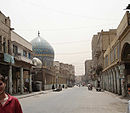
- Mansour district
-
Al Mansour district[1] (Arabic: المنصور، بغداد) is one of nine administrative districts in Baghdad, Iraq. It is named after Abu Ja'far al-Mansur, the second Abbasid Caliph and founder of Baghdad.
The Mansour district is bounded on the west by Baghdad International Airport, to the north by Kadhimiya, to the east by Karkh district, south by Baghdad Airport Road.
Neighborhoods
- 62.Qadissiya
- 63.Mansour neighbourhood, Dragh, Baghdad International Fair
- 64.Al-Washash
- 65.Iskan
- 66.14 Ramadan
- 67.Yarmouk
- 68.Safarat complex, Kafa'at
- 69.Al-A'amiriya
- 70.Al Khadhraa, Hayy Al-Jami'a
- 71.Al-Adel
- 72.Ghazaliya East
- 73.Ghazaliya west
- 74.Baghdad Airport-Abu Ghrib road
References
Districts and neighborhoods of Baghdad Main districts Neighborhoods Al-Ghazaliya • Al-A'amiriya • Dora • Al-Jadriya • Al-Saydiya • Al-Sa'adoon • Al-Shu'ala • Bab Al-Moatham •Bab Al-Sharqi • Al-Baya' • Al-Za'franiya • Hay Ur • Sha'ab • Hayy Al-Jami'a
• Al-Adel • Al Khadhraa • Hayy Al-Jihad • Hayy Al-A'amel • Al-Horaya • Hayy Al-Shurtta • Yarmouk • Al-Saydiya • Mansour • Jesr Diyala• Abu Disher • Raghiba Khatoun • Arab Jibor • Al-Washash • Al-Fathel • Al-Ubedy • Haifa Street • Al-Wazireya• ZayounaCategories:- Administrative districts in Baghdad
- Baghdad stubs
- Iraq geography stubs
Wikimedia Foundation. 2010.

