- Tikamgarh
-
This article is about the municipality in Madhya Pradesh, India. For its namesake district, see Tikamgarh District.
Tikamgarh
टीकमगढ़
The Land of Glorious Past — city and district headquarters — Tikamgarh Palace Coordinates 24°39′05″N 78°55′49″E / 24.65139°N 78.93028°ECoordinates: 24°39′05″N 78°55′49″E / 24.65139°N 78.93028°E Country India Region Bundelkhand State Madhya Pradesh Division Sagar District(s) Tikamgarh Chairman Mr.Rakesh Giri
(Member of Bharatiya Janata Party)MLA Mr.Yadvendra Singh Bundela
(Member of Indian National Congress)Mem.of Parlia. Virendra Kumar
(Member of Bharatiya Janata Party)Population
• Density
1,01,786 (2011[update])
• 1,541 /km2 (3,991 /sq mi)
Sex ratio 921 ♂/♀ Literacy 85[1]% Official languages Hindi , Bundeli , English Time zone IST (UTC+05:30) Area
• Elevation
• Coastline57 square kilometres (22 sq mi)
• 427 metres (1,401 ft)
• 0 kilometres (0 mi)Climate
• Precipitation
Temperature
• Summer
• Winter
• 1,057 mm (41.6 in)
• 33 °C (91 °F)
• 43 °C (109 °F)
• 13 °C (55 °F)Website tikamgarh.nic.in Tikamgarh ( टीकमगढ़ ) ( ٹیکمگاڑھ ) is a city and a tehsil, in Tikamgarh district, Madhya Pradesh, it also the district headquarter. The earlier name of the town was 'Tehri' (i..e. a triangle) consisting of three hamlets, forming a rough triangle. In the Tikamgarh town there is muhalla still known as 'Purani Tehri'. Until Indian independence in 1947, Tikamgarh, formerly called Tehri, was part of the kingdom of Orchha, which was founded in the 16th century by the Bundeli chief Rudra Pratap, who became the first Raja of Orchha. In 1783 the capital of the state was moved to Tehri, about 40 miles south of Orchha, which was home to the fort of Tikamgarh, and the town eventually took the name of the fort. The district is famous for the old fort of Kundar known as Garh Kundar, which was built by Khangars and remained the capital of kshatriya Khangar rulers from 1180 to 1347.
The origin of name
The district is named after its headquarters, Tikamgarh. The original name of the town was Tihri. In 1783, the ruler of Orchha Vikramajit (1776–1817) shifted his capital from Orchha to Tihri and renamed it Tikamgarh (Tikam is one of the names of Krishna).
History
The area covered by this district was part of the Princely State of Orchha till its merger with the Indian Union. The Orchha state was founded by Rudra Pratap in 1501. After merger, it became one of the eight districts of Vindhya Pradesh state in 1948. Following the reorganization of states on 1 November 1956 it became a district of the newly carved Madhya Pradesh
Orchha was founded in the 1501 AD,[2] by the Bundela chief, Rudra Pratap Singh, who became the first King of Orchha, (r. 1501-1531) and also built the Fort of Orchha.[3] He died in an attempt to save a cow from a lion. The Chaturbhuj Temple was built, during the time of Akbar, by the Queen of Orchha,[4] while Raj Mandir was built by 'Madhukar Shah' during his reign, 1554 to 1591.[5][6]
During the rule of Mughal Emperor, Jahangir, his ally, Bir Singh Deo (r. 1605-1627) reigned here, and it was during this period that Orchha reaches its height, and many extant palaces are a reminder of its architectural glory, including Jahangir Mahal (b. ca 1605) and Sawan Bhadon Mahal.[7]
In the early 17th century, Raja Jujhar Singh rebelled against the Mughal emperor Shah Jahan, whose armies devastated the state and occupied Orchha from 1635 to 1641. Orchha and Datia were the only Bundela states not subjugated by the Marathas in the 18th century. The town of Tehri, presently Tikamgarh, about 52 miles (84 km) south of Orchha, became the capital of Orchha state in 1783, and is presently the district town; Tehri was the site of the fort of Tikamgarh, and the town eventually took the name of the fort.[8]
 Flag of princely state of orchha,TKG
Hamir Singh, who ruled from 1848 to 1874, was elevated to the style of Maharaja in 1865. Maharaja Pratap Singh (born 1854, died 1930), who succeeded to the throne in 1874, devoted himself entirely to the development of his state, himself designing most of the engineering and irrigation works that were executed during his reign.
In 1901, the state had an area of 2,000 sq mi (5,200 km2), and population of 52,634. It was the oldest and highest in rank of all the Bundela states, with a 17-gun salute, and its Maharajas bore the hereditary title of First of the Prince of Bundelkhand. Vir Singh, Pratap Singh's successor, merged his state with the Union of India on January 1, 1950. The district became part of Vindhya Pradesh state, which was merged into Madhya Pradesh state in 1956. Today Orchha is almost a nondescript town with a small population, and its importance is maintained only due to its rich architectural heritage and tourism.
Books on the rich history of Orchha are available in local shops, mostly in the Hindi language. Only a thorough reading of some of this material will tell about the rich and varied history of this place.
General Information
As of 2011[update] India census,[9] Tikamgarh had a population of 1,01,786. (Including Nearest Villeges) Males constitute 53% of the population and females 47%. Tikamgarh has an average literacy rate of 77%, higher than the national average of 59.5%: male literacy is 84%, and female literacy is 60%. In Tikamgarh, 15% of the population is under six years old.
Demographies
Tikamgarh is a city in the central India state of Madhya Pradesh. It is the administrative headquarters of Tikamgarh District. It is nearby to the border of U.P.Tikamgarh, situated towards the west to the centre of plateau of Bundelkhand is surrounded by district Jhansi of UP in the north and Lalitpur(UP) in the west and south. So Tikamgarh is covered more by the parts of UP than that of MP. Towards its east, district Chattarpur is situated. People of Tikamgarh have constant and regular interaction with the cities of UP namely Jhansi and Lalitpur for their daily affairs.
Transportation
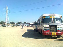
Tikamgarh has the biggest Bus Stand of madhya pradesh.
Roads
- About 20,000 of vehicles are running on Tikamgarh city roads including light and heavy vehicles.
- There are daily service of buses for every part of state.
-
- Highways Passing from Tikamgarh Are NH-12A, SH-37, SH-10.
- Daily service of Buses for new delhi, Nagpur, Kanpur, Indore, Bhopal, Gwalior, Jabalpur are also there.
Railways
The construction of railway line to Tikamgarh is in progress.... it will be completed in 2014.
But now Lalitpur (55 km) is the nearest railway station.
Airways
khajuraho is the nearest (125 km) airport from where a daily flight for Delhi & Agra.
Geography
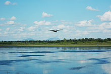
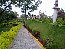
The city has good nature Beauty with many parks & lakes which surrounds the city from every directions
Lakes
- Mahendra sagar (Bada Talab).
- Sail Sagar.
- Vrandavan Talab (Jhir ki Baghiya).
- HanumanSagar Talab.
- Maharajpura Tal.
Gardens
- Rajendra Park (Central Park) inaugrated by Dr. Rajendra Prasad First President Of India .
- Subhash chandra Bose Park.
- Shaan-E-Park TKG.
- Chandra Shekhar Ajad Park.
- Children Park Civil line .
Tourism
Tikamgarh District have many tourist places like:-
- Orchha:- World famous for Ramraja Temple.
- Kundeshwar:-Famous for Lord Shiva temple.
- Baldeogarh:-Baldeogarh ki TOP (तोप) is famous in Bundelk
Civic administration
Tikamgarh City Officials municipality chairman Rakesh Giri[10] IAS Mr.Raghuraj MR [11] IPS Officer Dr.Akash Jindal[11] Games and sports
Govt. of India has announced here Rs. 19 crore for established a Turf Hockey Stadium here.
The Sports Authority of India http://www.saicrc.org/mp.aspx (SAI) has their training centre & Hostel here, for Hockey & Softball.
There are many National Tournaments organised in the city.
- Matabeti bai
- Veersingh ju dev
- Night Tournament Nazarbaugh
- State level School Championship.
- National level School Championship.
Places of interest
(Within 10 km)
- Jhir ki Baghiya
- Roraiya Mandir
- Nazarbaugh
- Kundeshwar
- Barighat
- Hanuman Chalisa
- Paragarh
- Shani Mandir (Mamaun Pahari).
- Siddh Khaan.
- Madkhera For(Surya Mandir).
- Ahar ji & Papaura Ji
- Picnic Point
- kamani dawaza and maidan
People from Tikamgarh
- Asgari Bai
- Uma Bharati
- Keshavdas
- Mrinal Pande-Story Writer of Girls
Educational institutes
Tikamgarh has many schools & colleges so students from different part of district comes here.
- Govt. Polytechnic College Dhonga Road. gpctikamgarh.nic.in
- Govt. Agriculture college tkg Kundeshwar road. http://www.jnkvv.nic.in/coa_tikamgarh.html/
- Govt. Veerangna avanti Bai Girls college jail Road. http://www.mp.gov.in/highereducation/gdctikamgarh/
- Govt. Science college Tal Kothi. http://www.mp.gov.in/highereducation/tikamgarh/
- Govt Technical School Tikamgarh.
- Basic Training Institute, Kundeshwar.
- School for the cultivation of fine Arts, Music and Dancing.
- Govt. Devendra Sanskrit Vidyalaya, Tikamgarh.
- Govt. Excellence School N0.1 & No.2.
- Kendriya Vidyalaya Sunwaha. (going to Open)
- Navodaya vidyalaya.http://jnvtikamgarh.org/
- Private Schools & colleges
- GPITM Computer Institute for PGDCA & DCA. http://www.gpitm.org
- Sharp computer centre for BCA & PGDCA. http://www.sharptkg.com/
- unique computer centre for BCA & PGDCA.
- Shiva computer academy for BCA & PGDCA.
- Daffodil's school.
- Saroj Convent higher sec. school.
- Shri Mahavir Bal Sanskar higher sec school. Jhansi road.
- Hope academy jhansi road (CBSE).
- Maharshi vidya mandir kundeshwar road.
- Pushpa higher sec. school tkg.
- Angel abode public school tkg.
-
- Apart from it there are many B.Ed colleges and many coaching institutes are running here////
Radio and television station
Tikamgarh catches radio station of All India Radio (आकाशवाणी) under Prasar Bharati at 675 kHz from Chhatarpur & 92.7 Big FM from Jhansi.
Tikamgarh has its own Durdarshan kendra established in 2008.
Banking
Many Govt. & Private banks are working in tikamgarh.
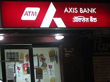
Bank No. of Branches No.of ATMs State Bank of India 3 4 Central Bank of India 1 1 Union Bank of India 1 1 Allahabad Bank 1 1 ICICI Bank 1 1 HDFC Bank 1 1 Axis bank 1 1 Punjab National Bank 1 1 Bank of Baroda 1 1 Bank of India 1 1 Co-operation Bank 1 - Madhya bharat gramin bank (Regional Office) 4 - See also
- Orchha
- Kundeshwar
- Bundelkhand
- Baldeogarh
- Prithvipur
- Jatara
- Niwari
- Palera
- Khargapur
References
- ^ [1]. Literacy rate. Retrieved 08 Aug 2010.
- ^ Orchha Tikamgarh district Official website.
- ^ .co.uk/personalisation/PHO000430S21U00011000 Mausoleum of Raja Rudra Pratap British Library.
- ^ Orchha British Library.
- ^ Genealogy of Orchha
- ^ Raj Mandir British Library.
- ^ Swan Bhadon Palace, Orcha British Library.
- ^ Orchha state The Imperial Gazetteer of India, 1909, v. 19, p. 241.
- ^ "Census of India 2001: Data from the 2001 Census, including cities, villages and towns (Provisional)". Census Commission of India. Archived from the original on 2004-06-16. http://web.archive.org/web/20040616075334/http://www.censusindia.net/results/town.php?stad=A&state5=999. Retrieved 2008-11-01.
- ^ "Indore Parshad/Mayor". Indore Municipal Corporation. 2010-08-08. http://www.imcindore.org/parshad.jsp. Retrieved 2010-08-08.
- ^ a b "From The Collector's Desk". Indore District Administration. 2010-03-17. http://www.indore.nic.in/collector.htm. Retrieved 2010-05-13.
External links
Cities and towns in Sagar Division Chhatarpur district Bada Malhera • Barigarh • Bijawar • Buxwaha • Chandla • Chhatarpur • Garhi-Malhara • Ghuwara • Harpalpur • Laundi • Maharajpur • Nowgaon • Rajnagar • SataiDamoh district Panna district Sagar district Bina Etawa • Bina Railway Colony • Deori • Dhana • Garhakota • Khurai • Makronia • Mandi Bamora • Rahatgarh • Rehli • Sagar Cantonment • Sagar • Shahgarh • ShahpurTikamgarh district Badagaon • Baldeogarh • Jatara • Jeron Khalsa • Kari • Khargapur • Lidhorakhas • Niwari • Orchha • Palera • Prithvipur • Taricharkalan • TikamgarhRelated topics Categories:
Wikimedia Foundation. 2010.


