- Narsinghgarh, Damoh
-
For other uses, see Narsinghgarh (disambiguation).
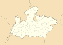
Narsinghgarh — town — Coordinates 23°59′N 79°23′E / 23.99°N 79.39°ECoordinates: 23°59′N 79°23′E / 23.99°N 79.39°E Country India State Madhya Pradesh District(s) Damoh Time zone IST (UTC+05:30) Narsinghgarh is a town of historical importance in the Damoh District of Madhya Pradesh in India. There is one ancient fort built by Shah Taiyab in Narsinghgarh. The town Narsinghgarh is situated on Sonar River. Birla group has established one cement factory at Narsinghgarh.
Contents
Geography
Narsinghgarh is located at 23°59′N 79°23′E / 23.99°N 79.39°E.[1]
See also
References
External links
Cities and towns in Sagar Division Chhatarpur district Bada Malhera • Barigarh • Bijawar • Buxwaha • Chandla • Chhatarpur • Garhi-Malhara • Ghuwara • Harpalpur • Laundi • Maharajpur • Nowgaon • Rajnagar • SataiDamoh district Panna district Sagar district Bina Etawa • Bina Railway Colony • Deori • Dhana • Garhakota • Khurai • Makronia • Mandi Bamora • Rahatgarh • Rehli • Sagar Cantonment • Sagar • Shahgarh • ShahpurTikamgarh district Badagaon • Baldeogarh • Jatara • Jeron Khalsa • Kari • Khargapur • Lidhorakhas • Niwari • Orchha • Palera • Prithvipur • Taricharkalan • TikamgarhRelated topics Categories:- Cities and towns in Damoh district
- 1681 establishments
- Madhya Pradesh geography stubs
Wikimedia Foundation. 2010.


