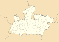
- Niwari, Madhya Pradesh
-
Niwari — city — Coordinates 25°26′N 79°43′E / 25.43°N 79.71°ECoordinates: 25°26′N 79°43′E / 25.43°N 79.71°E Country India State Madhya Pradesh District(s) Tikamgarh Population 20,711 (2001[update]) Official languages Bundeli, Hindi Time zone IST (UTC+05:30) Distance(s)-
• From New Delhi • 434 kilometres (270 mi) SE
Codes-
• Pincode • 472442 • Vehicle • MP 36
Website http://www.tikamgarh.nic.in/ Niwari is a tahsil/town and a nagar panchayat in Tikamgarh district of Indian state, Madhya Pradesh. It is adjacent to the Jhansi and Mahoba districts of Uttar Pradesh.
Contents
Demographics
As of 2001[update] India census[1], Niwari had a population of 20,711 with the 606,00 km² area. Males constitute 53% of the population and females 47%. Niwari has an average literacy rate of 60%, higher than the national average of 59.5%: male literacy is 69%, and female literacy is 50%. In Niwari, 7% of the population is under 6 years of age.
About
Niwari is reachable by Indian Railway on the way to Jhansi from Manikpur. The Niwari (tehsil) is situated on the Tikamgarh-Jhansi road, at a distance of about 80 km. to North-West of Tikamgarh. Niwari is the only tehsil of Tikamgarh district which is connected by Indian Railway and situated on Jhansi-Manikpur section of the Central Railways. In medieval period a small fort was in Niwari, however, was demolished by the Marathas. It possesses a temple of Khedapati Hanumanji. A government degree college of Madhya Pradesh government has been established in July 1967 and governed by the government since 1981.
References
- ^ "Census of India 2001: Data from the 2001 Census, including cities, villages and towns (Provisional)". Census Commission of India. Archived from the original on 2004-06-16. http://web.archive.org/web/20040616075334/http://www.censusindia.net/results/town.php?stad=A&state5=999. Retrieved 2008-11-01.
External links
Information
- Website Govt. Degree College, Niwari [1]
Cities and towns in Sagar Division Chhatarpur district Bada Malhera • Barigarh • Bijawar • Buxwaha • Chandla • Chhatarpur • Garhi-Malhara • Ghuwara • Harpalpur • Laundi • Maharajpur • Nowgaon • Rajnagar • SataiDamoh district Panna district Sagar district Bina Etawa • Bina Railway Colony • Deori • Dhana • Garhakota • Khurai • Makronia • Mandi Bamora • Rahatgarh • Rehli • Sagar Cantonment • Sagar • Shahgarh • ShahpurTikamgarh district Badagaon • Baldeogarh • Jatara • Jeron Khalsa • Kari • Khargapur • Lidhorakhas • Niwari • Orchha • Palera • Prithvipur • Taricharkalan • TikamgarhRelated topics Categories:- Cities and towns in Tikamgarh district
- Madhya Pradesh geography stubs
-
Wikimedia Foundation. 2010.


