Nili — This article is about the Jewish espionage network. For the Israeli settlement, see Nili (village). For the place in Afghanistan, see Nili, Afghanistan. For Nili (subgroup), the taxonomic subgroup, see Taxonomy of Anopheles. Nili (Hebrew: נִילִ… … Wikipedia
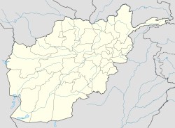
Nili District — Nili (also known as Layli) is a district in Daykundi Province, Afghanistan. The main town in the district, also called Nili is the capital of Daykundi Province. The town of Nili is at 2,022 m altitude and has a small airport (heliport) with a… … Wikipedia
Outline of Afghanistan — … Wikipedia
Districts of Afghanistan — Districts of Afghanistan. Afghanistan … Wikipedia
Districts d'Afghanistan — Districts de Afghanistan. Les provinces d Afghanistan sont divisés en Wolaswalei (Pashto: ولسوالۍ) ou districts. Le nombre de districts en Afghanistan a fluctué au fil des ans, avec de nouveaux districts créés par scission ou fusion des parties… … Wikipédia en Français
District d'Afghanistan — Districts de Afghanistan. Les provinces d Afghanistan sont divisés en Wolaswalei (Pashto: ولسوالۍ) ou districts. Le nombre de districts en Afghanistan a fluctué au fil des ans, avec de nouveaux districts créés par scission ou fusion des parties… … Wikipédia en Français
Daman District, Afghanistan — Daman district is situated in the central part of the Kandahar Province, Afghanistan. It borders Panjwai and Kandahar districts to the west, Shah Wali Kot District to the north, Zabul Province to the northeast, Arghistan and Spin Boldak districts … Wikipedia
Dila District, Afghanistan — Dila District (Pashto: ډله) is a district of Paktika Province, Afghanistan. All information is as of 2007. It has a population of approximately 20000 Afghans and an area of approximately 600 km2. The seat of the district capital is Dila… … Wikipedia
Charsadda District (Afghanistan) — Charsada (Chahar Sada) District is a district of Ghor Province, Afghanistan. It was created from the northwestern part of Chaghcharan District. The district center is Qale Zobayd. The population is 23,000. v … Wikipedia
Daykundi Province — For the Hazara tribe, see Daikundi (tribe). Coordinates: 33°45′N 66°15′E / 33.75°N 66.25°E / 33.75; 66.25 … Wikipedia
 Afghanistan

