- Logar Province
Geobox|Province
country = Afghanistan
country_
name = Logar
native_name = لوگر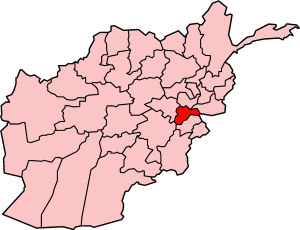
map_caption = Map of Afghanistan with Logar highlighted
capital =Pul-i-Alam
capital_lat_d = 34.0
capital_long_d = 69.2
population_as_of =
population = 292000
population_note = [ [http://afghanistan.usaid.gov/en/Province.21.aspx Afghanistan's Provincesndash Lowgar at USAID] ]
area = 3880
population_density = 120
timezone = UTC+4:30
free_type = Main languages
free = Persian,Pashto Logar ( _fa. لوگر) is one of the 34
provinces of Afghanistan . It is located in the eastern zone, southeast of Kabul, and the geography of the province centers on the largeLogar River which enters the province through the west and leaves to the north. Its capital isPul-i-Alam . Logar is home to Tajiks Pashtuns and small minority of Hazaras. The exact percentage of demography is unknown as there has been no census for decades. But out of 7 districts Azra, Kharwar andMohammad Agha District has Pashtun Majority WhileBaraki Barak ,Khushi and Charkh district have Tajik majority. The provincial capitalPul-i-Alam has a mix population of Tajiks Pashutns and small minority of hazarasPolitics
Logar is a generally religiously conservative province, although not to the extent of its southern neighbours. The province's political history is a microcosm of Afghanistan's recent turbulent past, with portions of the province controlled by both the
Taliban and the Northern Alliance previous to the American invasion of 2001. During the Jihad against Soviet occupation in the 1980s, Baraki Barak, Khushi, Charkh and Pule Alam districts were controlled by Jamiat e-Islami. Logar was known among Afghans as 'Bab al-Jihad', or 'the Gates of Jihad' because it became a fierce theatre of war between mujahideen groups and the Soviet army.The province also was home to several
Al-Qaeda training bases during that time, although the residents of the province were reportedly unfriendly to the foreign fighters. Mohamad Agha district has long been a stronghold of theHezb-i-Islami political party, which won seats in the 2005 parliamentary election [ [http://www.pajhwok.com/details.asp?id=27 Pajhwok Afghan News] ] , although the parliamentarians are not officially affiliated with the fugitive leader ofHezb-i-Islami ,Gulbuddin Hekmatyar . Additionally, the Northern Alliance-affiliatedJamiat-i-Islami was in control of the province for several years after the fall of theTaliban government.The
Governor of the province wasAbdullah Wardak until he was assassinated by car bomb on13 September 2008.Geography
Logar can be generally described as a relatively flat river valley in the north and central regions, surrounded by rugged mountains to the east, south, and southwest. The district of Azra, in the east, consists almost entirely of mountains, while travel to the Paktia province to the south is limited to the Tera Pass, a 2896m high road that was recently completed as part of the international reconstruction effort in Afghanistan.
Although the government of Afghanistan recognizes the Azra district as being in Logar, many widely-accepted maps include it in the
Paktia province to the south.ecurity situation
While more stable than some of its neighbouring provinces in the country, Logar sees a constant high level of anti-government activity, primarily in the form of car bombs and rocket attacks on government, military and civil targets. Unlike portions of southwest Afghanistan, poppy production is nearly non-existent, due to terrain and weather conditions. Tribal land disputes are a source of unrest, as is the case across much of the country. [ [http://www.pajhwok.com/viewstory.asp?id=15223 Pajhwok Afghan News] ]
Capital
Logar's capital is the city of Pul-i-Alam, located in the district of the same name. It sits on the main road running from
Kabul south toGardez andKhowst province, which borders Pakistan.Pul-i-Alam has seen a significant amount of reconstruction since the fall of the Taliban. The main road to Kabul was completed in 2006, significantly reducing travel time to the national capital. Additional projects include numerous schools, radio stations, government facilities, and a major Afghan National Police base situated just south of the city.
Like most Afghan cities, there is little municipal planning or services. Electricity is provided by diesel generators, and wells are the primary source of drinking water.
Districts
*
Azra District
*Baraki Barak District
*Charkh District
*Kharwar District
*Khoshi District
*Mohammad Agha District
*Pul-i-Alam References
External links

Wikimedia Foundation. 2010.