- Kunar Province
Geobox|Province
country = Afghanistan
country_
name = Kunar
native_name = کُنَر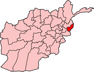
map_caption = Map of Afghanistan with Kunar highlighted
capital = Asadabad
capital_lat_d = 35.0
capital_long_d = 71.2
population_as_of =
population = 321000
population_note = [ [http://afghanistan.usaid.gov/en/Province.18.aspx Afghanistan's Provincesndash Konar] at [http://afghanistan.usaid.gov/ USAID] ]
area =
population_density =
timezone = UTC+4:30
free_type = Main language
free = PashtoKunar ( _ps. کُنَر) is one of the thirty-four
provinces of Afghanistan , located in the northeastern part of the country and on the border withPakistan 'sBajaur Agency of theFederally Administered Tribal Areas . It borders three Afghan provinces, Nurestan to the north-west, Laghman to the west, and Nangarhar to the south. Its capital is Asadabad.Geography and ethnic makeup
Kunar is a tiny and sparsely populated province embedded in the
Hindu Kush mountain range, and as such is heavily mountainous and forested.Pashtuns makes up the vast majority of the province and maintain a very strong tribal identity, some even going so far as to identify the province, and the eastern edge of Afghanistan in general, as "Pashtunistan." These Pashtun locals pronounce the name as Kunar or کونر.clarifymeMilitary activity
During both the Soviet occupation, and the more recent conflicts involving
U.S. , Afghan andNATO forces, Kunar has been a favoured spot of insurgent groups. Its impenetrable terrain, extensive cave networks and border with the semi-autonomous PakistaniNorthwest Frontier Province provides several advantages for militant groups. The province is informally known as "Enemy Central" by American troops.Like many of the mountainous eastern provinces of Afghanistan, the groups involved in armed conflict vary greatly in strength and purpose. Native
Taliban forces mingle with foreignAl-Qaeda fighters, whilemujahadeen militias, such asGulbuddin Hekmatyar 'sHezb-e-Islami Gulbuddin , continue to operate as they did in the chaotic post-Soviet years. Another strong militia in the region is theHezbi Islami faction of the lateMulavi Younas Khalis , who had his headquarters in neighbouringNurestan Province .Compounding the problems of the province is an extensive criminal trade in smuggled lumber and other natural resources. This criminal activity is often organized along tribal lines, and has led to intense deforestation in some areas.
Kunar Ambush
Infobox Military Conflict
conflict=Kunar Ambush
partof=War on Terrorism
date=2008
place=Kunar Province
result=Allied Victory
combatant1=noflag|NATO
flag|European Union
flag|United Nations|name=UN Peacekeepers
combatant2=flagicon|Afghanistan|TalibanTaliban
flagicon image|Flag of Jihad.svgal-Qaeda The Kunar Ambush was a small gun battle between allied forces and Islamic rebel groups. The combatants were German, Dutch, French and Danish forces fighting under European Union command; British, Canadian, Norwegian and Belgian forces under NATO command; and Filipino soldiers under UN command; and Taliban and al-Qaeda forces.
Hunt for Bin Laden
Osama bin Laden has often been rumoured to be in the province, or close by. In an intensive military operation in summer 2005, calledOperation Red Wing , American forces undertook a massive hunt for bin Laden and other seniorAl-Qaeda leaders. While attempting to rescue four strandedNavy SEALS during the operation, 19 American Forces were killed when theirCH-47 Chinook helicopter was shot down, representing the single biggest loss of American forces since their invasion of the country.Districts
* Asadabad
* Bar Kunar
* Chapa Dara
* Chawkay
* Dangam
* Dara-I-Pech
* Ghaziabad
* Khas Kunar
* Marawara
* Narang Wa Badil
* Nari
* Nurgal
* Shaygal Wa Shiltan
* Sirkanay
* Wata PurPolitics
Assadullah Wafa was the former governor of the province (replaced in Aug 2006).Asadabad hosts both an AmericanProvincial Reconstruction Team office and aUNAMA development office.References

Wikimedia Foundation. 2010.