- Kabul Province
Geobox|Province
country = Afghanistan
country_
name = Kabul
native_name = کابل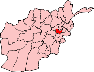
map_caption = Map of Afghanistan with Kabul highlighted
capital =Kabul
capital_lat_d = 34.00
capital_long_d = 69.00
population_as_of = 2006
population = 3314000
population_note = Fact|date=June 2008 [ [http://afghanistan.usaid.gov/en/Province.14.aspx Afghanistan's Provincesndash Kabul at USAID] ]
population_density = 703.3
leader_type = Governor
leader =Haji Din Mohammad
area = 4462
timezone = UTC+4:30
free_type = Main languages
free = Persian (Dari) PashtoKābul (PerB|کابل), situated in the east of the country, is one of the thirty-four
provinces of Afghanistan . The capital of the province is Kabul City, which is also the nation's capital and is situated at an elevation of about 1800m (5,900 ft) above sea level, making it one of the highest capital cities in the world. In the early 13th century, Kabul was considered one of the most educated and beautiful places in the world. It has since been demolished in heavy wars and strong political movements as well as invasions of foreign powers. It's also one of the country's most cosmopolitan area and is the center of government. The current governor of Kabul province isHaji Din Mohammad .Geography
Kabul is located between Latitude 34-31' North and Longitude 69-12' East at an altitude of 1800 m (6000 feet) above sea level, which makes it one of the world's highest capital cities. Kabul is strategically situated in a valley surrounded by high mountains at crossroads of north-south and east-west trade routes. One million year ago the Kabul region was surrounded from south-east between
Lowgar andPaghman Mountains;Charikar in the north and the Ningai Ghar mountains in the west. This region formed an icy sea. In the Silurian time, at the end of ice era, the icebergs are melted gradually and the territory of this region was poured by water under heavy raining. Some deep wells in the region of today's Poli Charkhi in the east part of city are the evidence of that time. Kabul is surrounded byKoh-e Paghman Mountain from the east,Koh-e Qrough Mountain from the south-west,Koh-e Shirdarwaza Mountain from the north-east. Kabul has only one river which is calledKabul River . Kabul River rises at the Paghman Mountain toward South Pass about 70 km (45 miles) west of Kabul. It flows in an easterly direction, past Kabul, and throughJalalabad city, and then on toDakka where it enters Pakistani territory and finally runs into the Indus atAttock .The climate within region of Kabul is considered to be arid to
semi-arid steppe . Because of the very low amounts of precipitation, especially from May to November, Kabul can be very dry and dusty. Extreme temperature changes occur from night to day, season to season, and from place to place. The chief characteristic of Afghanistan's climate is a blue cloudless sky with over 300 days of sunshine yearly. Even during the winter, skies usually remain clear between snowfalls, which are on average 15 to 30cm annually. The daily temperature in winter is -15 to -20 degreesCelsius (°C), and in summer +15 to +30°C. The coldest month of the year is January when the average temperature is -12°C, and the hottest month is July when the average is 25°C. The maximum temperature has been recorded as +42.7°C in July and the minimum as -26.3°C in january.History
Kabul's history dates back more than 5,000 years. It was once the center of
Zoroastrianism [http://news.bbc.co.uk/2/hi/south_asia/1651814.stm] and subsequently also a home for thousands ofBuddhists andHindus . TheArabs tried to conquer the area in the7th century , but they were defeated by the Hindu Shahi's of Kabul. The area was conquered by Mahmud Ghaznavid in 1002, when the Hindu Shahi King Jay Pala committed suicide. It was overshadowed byGhazni andHerat untilBabur made it his capital in 1504. It remained underMoghul rule until its capture in 1738 byNader Shah of Persia followed byAhmad Shah Durrani . It succeededKandahar as Afghanistan's capital in 1776.During the
First Anglo-Afghan War in 1839, the British army took over Kabul. In 1842, the withdrawing British troops were ambushed and almost annihilated after the Afghans had promised them safe conduct; in retaliation another British force partly burned Kabul. The British again occupied the city in 1879, after their resident staff were massacred there. On December 23, 1979, Soviet armed forces landed atKabul International Airport to help bolster a Communist government.Kabul became the Soviet command center for approximately 10 years during their stay in Afghanistan. In February 1989, Soviet forces withdrew from the city after they were defeated by the Afghan
Mujahideen s. In spring of 1992 the government ofMohammad Najibullah collapsed, Kabul fell into the hands ofMujahideen forces. Destruction of the city increased as the coalition of the parties broke into rival warring factions, and much of Kabul was damaged. In 1996 theTaliban took over the city and started a new strict IslamicSharia law which included Islamic schools, government, clothing, food, and recruitment to Al Qaeda, impacting the Afghan people's daily life. Some people happier with the strict Islamic laws, while some were unhappy.On
September 11 ,2001 , theWorld Trade Center was hit byOsama bin Laden 'sAl Qaeda group. OnNovember 12 ,2001 , American military forces finally took overKabul City , the Taliban forces fled by then. Kabul was under a new regime, and re-construction of new buildings, schools, and universities slowly began.Politics
Kabul has been long known for its politics and different
warlord s. It was under the control of many political groups and warlords when Mohammad Najibullah's government collapsed. Kabul city was in the hands of many political groups who fought for power until it was taken over by theTaliban in 1996 and its politics was changed. Kabul's politics become more aligned with the Islamic regime and new laws were introduced by the Taliban. There was only one leader for Afghanistan Mullah Omar, the head of Taliban who ran Kabul's political party until the US invaded onOctober 7 ,2001 . New laws and humanities came in effect to enable Kabul to recover from the destruction caused by the Taliban.Loya Jirga took place to solve the current political problems and situations in Kabul and introduce new laws. Kabul citizens have been given the right to vote.After being re-scheduled twice, Afghanistan's presidential
elections were held onOctober 9 ,2004 . Over 8 million Afghans voted in the elections. TheJoint Electoral Management Body of Afghanistan certified the elections on November 3rd, and declaredHamid Karzai , the interim President, the winner with 55.4% of the vote. Karzai's strongest opponent, Yunis Qanooni, received 16.3% of the vote. The elections were not without controversy; allegations of fraud and ballot stuffing were brought up by many of the presidential candidates including Yunis Qanooni. Many felt that Hamid Karzai had an unfair advantage over the other candidates as he had access to financial and logistical resources that many of the other candidates did not have. A panel of international experts was set up to investigate the matter. The panel did find evidence of voting irregularities, however, they said that it was not enough to affect the outcome of the elections. Some people claimed that they were forced to vote for the current president and some claim that they were paid to do so.With help from the United States and the United Nations, Afghanistan adopted its new constitution, establishing the country as an Islamic Republic, in early January 2004. According to the constitution, the Afghan government consists of a powerful and popularly elected President, two Vice Presidents, and a National Assembly consisting of two houses: the House of People (
Wolesi Jirga ), and the House of Elders (Meshrano Jirga ). There is also an independent Judiciary branch consisting of the Supreme Court (Stera Mahkama ),High Courts andAppeal Courts . The President appoints the members of the Supreme Court with the approval of the Wolesi Jirga. Assembly elections were planned for late 2005.Economy
Most of Kabul's economy depended on its tourists in the 1960s and 1970s. Kabul had textile, cotton production, and carpet production industries, but most of its economy came through tourism which it lost during its destruction. Kabul's produces include: natural gas, cotton, wool, carpets, agriculture, and some small production companies. Kabul has trade partnerships with the UK,
France ,Germany ,USA ,India ,South Korea ,Turkmenistan ,Kenya ,Russia ,Pakistan ,China ,Iran . Kabul's economy was influenced by the American power and has increased by almost 3500% after being down for 25 years. A new currency was introduced to Afghans which helped the economy. New business was in the new regime. Many American industries were interested in the new Kabul and many new companies have since then opened their branches in Kabul. The Kabul City Centre Mall was built and has nearly 100 shops. [http://www.iwpr.net/?p=arr&s=f&o=257693&apc_state=heniarr200511] The economy is in a boom level and is increasing dramatically. Home costs are going up as well as wages of employees. The cost of living has increased dramatically which is a problem for the non-educated Afghans, who cannot support themselves. The UN also helps Afghans in need of help by providing aid, food and school materials for schools. Many international aid organizations are contributing to the Afghanistan economy.Demographics
The ethnic
Tajiks [http://www.experiencefestival.com/a/kabul%20province%20-%20demographics/id/5199157 "The Majority Ethnic Group in Kabul is Tajik"] ] make up the largest percentage of the population of the province, while there are other important minorities likePashtuns Hazaras,Uzbeks , Turkmens,Baloch is,Sikh s andHindu s that are found mainly in the capital city.About 85% of the population is
Sunnite while 14% include Shi'ites.Sikhism andHinduism form the remaining 1%. See the diagram at the bottom for detailed information on each District. Data was cllected byUnited Nations High Commissioner for Refugees ("UNHCR").Transportation
Transportation in Kabul is improving as the numbers of new vehicles and experienced drivers are increasing. There is public transportation service in the Kabul vicinity, but many roads are in disrepair. Drivers are also impeded by the large number of cyclists. More vehicles are seen in the city because people are purchasing cars. Taxi cabs are found everywhere in the city, also in most of the districts of Kabul.
Kabul's Milli Bus (National Bus) system, which has about 800 buses, provides service to the city and nearby areas. There are several new highways in the province, and the government has scheduled to rebuild most of the smaller roads. Funding for the roads comes from current drivers who must pay toll charges for driving on highways and major roads. The money is collected by the government through issuing motorists monthly, quarterly or annual inspection certificates that are affixed to the windshield of their vehicles.
Trucks are used to transport goods from one district to another, or to other cities of the country. The Afghan government, with the help of foreign companies or organizations, have begun work on many of Kabul's roads. Auto companies like
Honda ,Toyota ,Ford Motor Company , andChevrolet have also been reintroduced in Kabul.Education
Kabul is Afghanistan's center for education. People from all the provinces of the country come to Kabul for education. There are many schools and universities that have opened doors for men and women. In the 1970s, about 55% of Kabul's population was educated without materials or proper learning resources to get a proper education. Most of the young children are sent to work by their parents to support their living costs. The education rate has declined dramatically during the last 20 years. Most of the schools in Kabul were set as battle points during the wars and have been demolished.
Kabul's education level is going up now by the help of many international organizations, and more people are being sent back to schools to get a degree. The value of education is being reintroduced in the communities, and they are encouraged to send their children to schools for a better education and a better life. Most of the people of Afghanistan, who took refuge in Pakistan, Iran and India, have returned to Kabul with their degrees and been able to obtain better jobs. Most of them are contributing their knowledge to the community by opening new courses and institutes. According to
UNICEF , Kabul's education level is in a boom now and is getting better and better.List of Universities in Kabul
*
American University of Afghanistan
*Kabul University
*Polytechnical University of Kabul
*National Military Academy of Afghanistan
*Kabul Medical University Sports
Kabul is the center of annual
Buzkashi andSoccer tournaments, where teams from all overAfghanistan ,Pakistan ,Iran ,Uzbekistan , andTajikistan participate. Sports is a daily routine for employees in Afghanistan, when they all join each other in tournaments and matches, specially soccer games. Afghanistan's Soccer Team also participated in many Asian Soccer Leagues. Many Afghans who were living as refugees inPakistan andIndia returned back to their country, and they brought the game ofcricket with them. Afghanistan now has national Cricket Team that plays internationally. They play mostly against Pakistani and Hindi Teams as well as some Arab nations in the Middle East.There are
Boxing ,Taekwondo ,Volleyball , andKung fu teams in Kabul, which participate in tournaments locally and go on tours to other Asian countries. One of the oldest and most popular stadiums in Kabul isGhazi Stadium , where tournaments, concerts, and national celebrations take place, however the city has lost most of the stadiums it previously had. Ghazi Stadium is currently going through a reconstruction programme whereby a new design and a new system will be established for the stadium. There is also another new stadium under construction near Kabul City. Schools and universities encourage participation in team sports, and there is a group of Afghans are being trained in Kabul for the nextOlympic Games .See also
*
Kabulistan
*Kabul Golf Club References
External links
* [http://www.aisk.org/misc/woik2007issue42.pdf What's On In Kabul (pdf format)]
* [http://www.afghanistan-photos.com/crbst_5.html Historical Photos of Kabul]
* [http://www.zharov.com/dupree/chapter04.html Historical Guide to Afghanistan (Kabul)]
* [http://www.kabulcaravan.com/kabul.php Kabul Caravan]

Wikimedia Foundation. 2010.