Mohammad Agha District

Mohammad Agha District
Mohammad Agha
محمد اغه
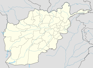
Mohammad Agha is located in Afghanistan
Mohammad Agha
Location in Afghanistan
Coordinates: 34.0°45′N 69.2°45′E / 34.75°N 69.95°E / 34.75; 69.95Coordinates: 34.0°45′N 69.2°45′E / 34.75°N 69.95°E / 34.75; 69.95
Country  Afghanistan
Province Logar Province
District Mohammad Agha District
Population (1990)
 - Total 57,690

Mohammad Agha District (Pashto: د محمد اغه ولسوالی) (Persian: ولسوالی محمد آغه) is a district of Logar Province, Afghanistan. It lies next to Kabul Province. The District capital is Mohammad Agha.

Contents

Geography

Mohammad Agha district is located in the north part of Logar Province, 35 km from Kabul City or one hour drive, at an altitude of 1,875 mt.

The District consists of 17 Zones ( Zarghun Shar, Deh Naw, Moghol Khail, Qala Shekhak, Qala Ahmad Zai, Mohammad Agha, Kotubkhel, Gomaran, Safed Sang, Abbazak, Surkh Abad, Dewalak, Surkhab, Burg, Abparan, Dashtak and Karezes), 8 main villages and 15 sub-villages.

Demographics

Pashtuns make 60% of the population while Tajiks make 40% of the population.[1]

Pashtuns live mainly in the zones of Gomaran, Burg, Qala Ahmad Zai, Kotubkhel, Surkhab, Abparan ,Abbazak and Moghul Khail, while Tajiks are present mainly in Deh Now,Zarghun Shahr, Safed Sang, Zayed Abad, Mohammad Agha.

Security and Politics

Mohammad Agha has been severely affected by conflict, mainly during the Soviet invasion, around 85% of houses have been destroyed and a large-scale displacement, mainly to Pakistan, took place. Many refugees returned at the beginning of the 90s, but were again displaced by the fighting between the Mujaheddin and later on between Talibans and Jamiat Party.

On 25 November 2009 a bomb facilitator was captured by ISAF forces in Qal' eh-ye Shayhee along with several other suspected militants.[2]

References

  1. ^ AIMS UNHCR, http://www.aims.org.af/afg/dist_profiles/unhcr_district_profiles/centra/logar/mohammad_agha.pdf
  2. ^ "Afghan-ISAF forces detain insurgents in Kandahar and Logar; Afghan director provides donated items; ISAF casualties". NATO. 26 November 2009. Accessed at: http://www.reliefweb.int/rw/rwb.nsf/db900SID/JBRN-7Y6HD5?OpenDocument


Wikimedia Foundation. 2010.

Игры ⚽ Поможем написать курсовую

Look at other dictionaries:

  • District d'Afghanistan — Districts de Afghanistan. Les provinces d Afghanistan sont divisés en Wolaswalei (Pashto: ولسوالۍ) ou districts. Le nombre de districts en Afghanistan a fluctué au fil des ans, avec de nouveaux districts créés par scission ou fusion des parties… …   Wikipédia en Français

  • Mohammad Bashir Qant Chah Abi — Governor of Sar e Pol Province, Afghanistan Incumbent Assumed office August 2008 Preceded by Sayed Mohammad Iqbal Munib Succeeded by …   Wikipedia

  • Mohammad Gulab Mangal — Gulab Mangal speaking at the ISAF headquarters in February 2010 Governor of Helmand, Afghanistan Incumbent …   Wikipedia

  • Mohammad Halim Fidai — Governor of Wardak, Afghanistan Incumbent Assumed office 24 July 2008 Preceded by Abdul Jabbar Naeemi Personal details Born …   Wikipedia

  • Mohammad Ali Jinnah Road — aka M.A. Jinnah Road (Urdu: شاہراہ محمد على جناح) is a major road of Karachi, Sindh, Pakistan. It was formerly known as Bandar Road (Urdu: شاہراہ بندر گاہ) i.e. Port Road. It begins at Port of Karachi and ends at Super Highway which connects… …   Wikipedia

  • Agha Rafiq Ahmed Khan — Justice Agha Rafiq Ahmed Khan 12th Chief Justice of the Federal Shariat Court Incumbent Assumed office 05 June 2009 …   Wikipedia

  • Mohammad Omar (Afghan governor) — Engineer Mohammad Omar انجنير محمد عمر Governor of Kunduz, Afghanistan In office 2004–2010 Preceded by Abdul Latif Ibrahimi Succeeded by Hamdullah Danishi Governor of Baghlan …   Wikipedia

  • Nawa-I-Barakzayi District — Not to be confused with Nawa District. Coordinates: 31°22′59″N 64°18′00″E / 31.383°N 64.3°E / 31.383; 64.3 …   Wikipedia

  • Marawara District — is one of the 15 districts in Kunar Province, Afghanistan, bordering Pakistan to the east. It borders Sirkanay district to the west, Asadabad district to the westand northwest and asmar district to northeast. Marawara s population is not exactly… …   Wikipedia

  • Malestan District — Malistan is a district in the west of Ghazni Province, Afghanistan. Its population, which is 100% Hazara, was estimated at 71,784 in 2003.[1] The district capital is Meradina. Contents 1 History 2 Security …   Wikipedia

Share the article and excerpts

Direct link
Do a right-click on the link above
and select “Copy Link”