- Morony Dam
-
Morony Dam 
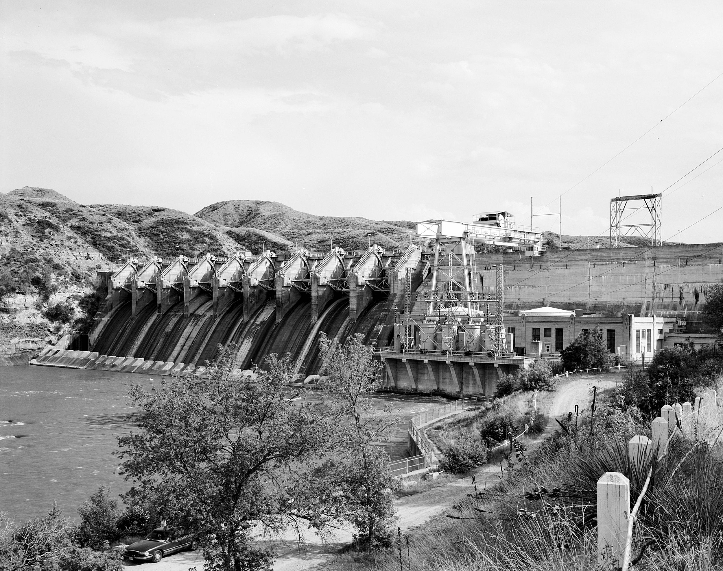
Looking southeast at Morony Dam in 2007Official name Morony Dam Location Cascade County, Montana, U.S. Coordinates 47°58′16″N 111°06′08″W / 47.97111°N 111.10222°W Construction began 1928 Opening date 1930 Dam and spillways Height 94 feet (29 m)[1][2] Length 883 feet (269 m)[1] Impounds Missouri River Morony Dam is a hydroelectric gravity dam located on the Missouri River in Cascade County, Montana. The dam is 883 feet (269 m) long and 94 feet (29 m) high,[1] and generates 48 megawatts (MW) of power.[3]
Contents
About the dam
The dam is named after John G. Morony,[3] a banker, director of the Amalgamated Copper Company (a forerunner of the Anaconda Copper Company), and director of the Montana Power Company. (Morony was largely responsible for constructing Ryan Dam.)[4] Morony Dam was built by the Phoenix Utility Company.[5] Montana Power commissioned the dam in order to provide additional power to the Anaconda Copper's zinc refinery at nearby Great Falls, Montana.[5] Construction began in 1928, and the dam was completed in 1930.[5]
Morony Dam has a 390-foot (120 m) wide spillway.[6] Nine tainter gates and one sluice gate control the flow over water down the spillway.[6] The headrace (or water inlet) for the powerhouse and the powerhouse itself are on the north side of the dam.[6] The powerhouse, a portio of which is open to the elements, has two vertical Francis turbines.[6]
As of 2000, PPL Montana had planned no major changes at Morony Dam.[6]
Big Eddy
Just below Morony Dam is a well-known hydrologic fetaure of the Missouri River known as the "Big Eddy." Belt Creek enters the Missouri River about 1 mile (1.6 km) below Morony Dam, past the rapids created by the dam. The large stream creates significant undertow and turbulence, which is not easily seen by boaters approaching from either side of the confluence of the two waterways. The Lewis and Clark Expedition camped on the west bank of the Missouri River just below the Big Eddy on June 15,1805, after the hydrologic feature held them back temporarily.[7] The area is primarily reached by water, but the head of the Big Eddy Land Trail is nearby.[7]
The Big Eddy is well-known by local boaters.[8] Between 1970 and 2010, several people drowned there after being caught unawares by the feature.[8] In 2010, a man and his son were jetboating in the area and barely avoided drowning after the Big Eddy sucked their machine underwater.[8]
Footnotes
- ^ a b c Emerling, p. 296.
- ^ Ellinghausen, Judy. "Water Falls of the Missouri." Destination Great Falls. Summer 2010, p. 11.
- ^ a b Peterson, p. 74.
- ^ "Great Dam Is Now Complete." Steam Shovel and Dredge. September 1919, p. 788.
- ^ a b c Aarstad, et al., p. 182.
- ^ a b c d e PPL Montana, Form S-4, p. A-24.
- ^ a b Lewis and Clark National Historic Trail. Comprehensive Plan for Management and Use. National Park Service. U.S. Department of the Interior. January 1982. Accessed 2011-09-30.
- ^ a b c Babcock, Michael. "'Big Eddy' Swallows Brand New Jet Boat." Great Falls Tribune. June 18, 2010.
Bibliography
- Aarstad, Rich; Arguimbau, Ellen; Baumler, Ellen; Porsild, Charlene L.; and Shovers, Brian. Montana Place Names From Alzada to Zortman. Helena, Mont.: Montana Historical Society Press, 2009.
- Emmerling, Clifford L. "Montana Power Company's Dam Repair Program." Journal of the Construction Division, ASCE. Vol. 98, No. C02, Proc. Paper 9208. September 1972: 295-311.
- Peterson, Don. Great Falls. Charleston, S.C.: Arcadia Publishing, 2010.
- PPL Montana, LLC. Form S-4. Registration Statement Under the Securities Act of 1933. EIN 54-1928759. November 21, 2000.
External links
 State of Montana
Helena (capital) Topics Index · History · Governors · People · Geography · State Government · Delegations · Visitor Attractions
Society Crime · Demographics · Economy · Education · Politics
Regions The Flathead · Glacier National Park · Regional designations of Montana · Western Montana · Yellowstone
Largest cities Counties Beaverhead · Big Horn · Blaine · Broadwater · Carbon · Carter · Cascade · Chouteau · Custer · Daniels · Dawson · Deer Lodge · Fallon · Fergus · Flathead · Gallatin · Garfield · Glacier · Golden Valley · Granite · Hill · Jefferson · Judith Basin · Lake · Lewis and Clark · Liberty · Lincoln · Madison · McCone · Meagher · Mineral · Missoula · Musselshell · Park · Petroleum · Phillips · Pondera · Powder River · Powell · Prairie · Ravalli · Richland · Roosevelt · Rosebud · Sanders · Sheridan · Silver Bow · Stillwater · Sweet Grass · Teton · Toole · Treasure · Valley · Wheatland · Wibaux · Yellowstone
Dams on the Missouri River Toston Dam · Canyon Ferry Dam · Hauser Dam · Holter Dam · Black Eagle Dam · Rainbow Dam · Cochrane Dam · Ryan Dam · Morony Dam · Fort Peck Dam · Garrison Dam · Oahe Dam · Big Bend Dam · Fort Randall Dam · Gavins Point Dam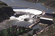 Categories:
- Hydroelectric power plants in Montana
- Dams in Montana
- Missouri River dams
- Buildings and structures in Cascade County, Montana
- Run-of-the-river power stations

Wikimedia Foundation. 2010.