- Midtown Detroit
-
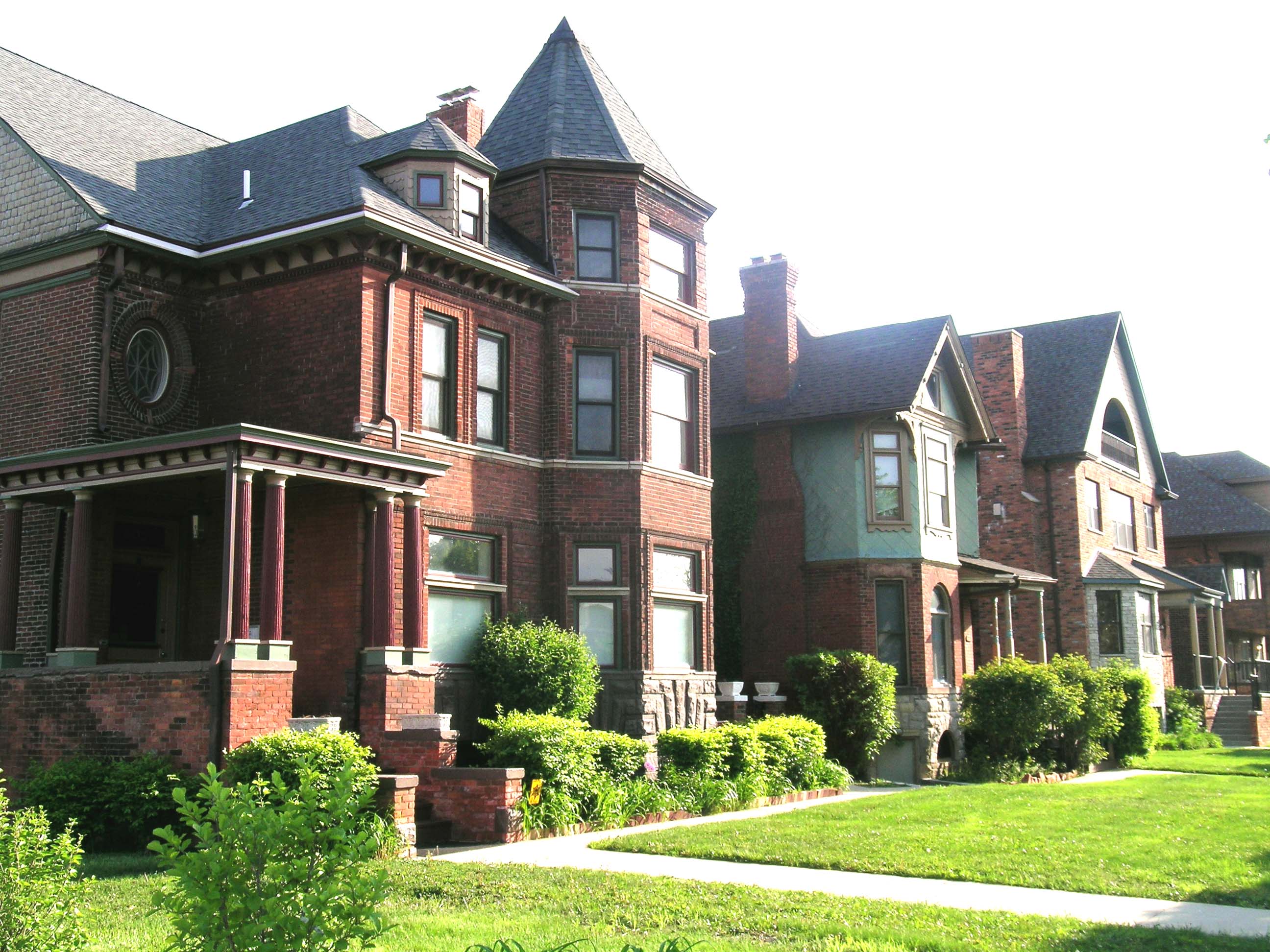
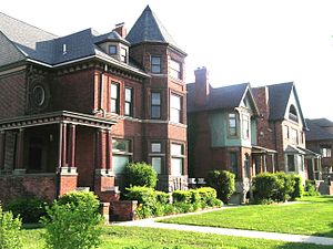 East Ferry Avenue Historic District in Midtown Detroit.
The Midtown area in Detroit is a mixed-use area located along the east and west side of Woodward Avenue between Downtown Detroit and the New Center. The community area of neighborhoods is bounded by the Chrysler Freeway (I-75) on the east, the Lodge Freeway (M-10) on the west, the Edsel Ford Freeway (I-94) on the north, and the Fisher Freeway (I-75) on the south.[1] The vibrant area includes several Historic Districts, Detroit Medical Center, and Wayne State University.
Contents
Overview
The Midtown area is a general mixed-use community area of neighborhoods containing successive waves of development that have transformed the area multiple times since it was first platted. The neighborhoods are dominated by the thoroughfare of Woodward Avenue, which runs north and south through the heart of Midtown. Midtown can be roughly divided into six general areas:[2]
- Wayne State University neighborhood - north of Warren Avenue and west of Woodward Avenue.
- Art Center (or Cultural Center) neighborhood - north of Warren Avenue and east of Woodward Avenue.
- North Cass (or Cass Farms) neighborhood - between Warren Avenue and Martin Luther King Jr. Boulevard and west of Woodward Avenue.
- Detroit Medical Center neighborhood - between Warren Avenue and Mack Avenue and east of Woodward Avenue.
- Cass Park neighborhood - south of Martin Luther King Jr. Boulevard and west of Woodward Avenue.
- Brush Park neighborhood - south of Mack Avenue and east of Woodward Avenue.
Woodward Avenue
Woodward Avenue, running north and south through the center of the neighborhood, is primarily inhabited by commercial businesses, public-oriented/cultural institutions, and religious buildings. The heart of the cultural center (the Detroit Public Library and the Detroit Institute of Arts) is located directly on Woodward in the northern part of Midtown.
Wayne State University
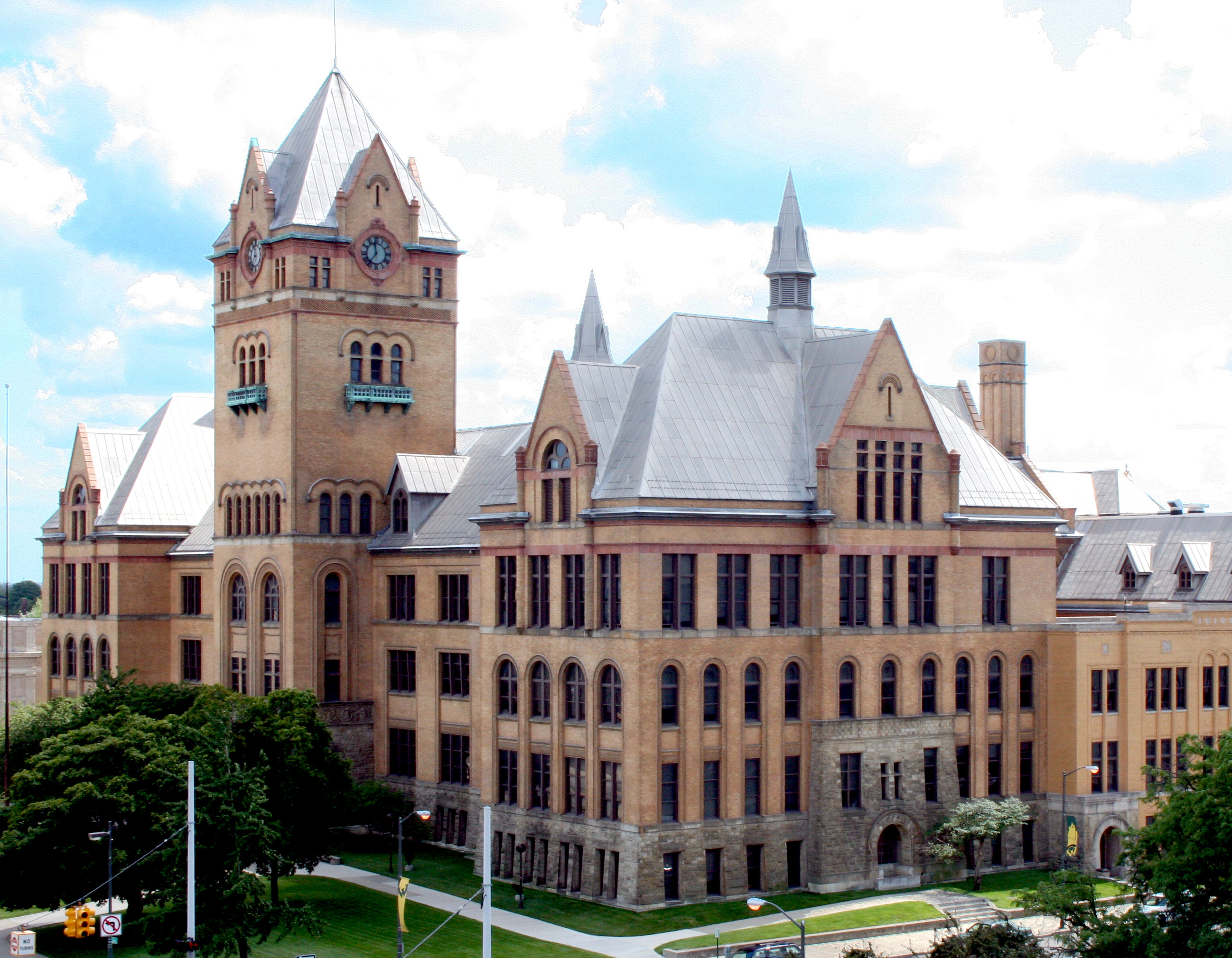
Main article: Wayne State UniversityThe north part of Midtown west of Woodward Avenue is dominated by Wayne State University, whose campus subsumes nearly the entire northwest portion of Midtown north of Warren Avenue and West of Woodward.[3] Wayne State University's campus covers 203 acres (0.82 km2) in the northwestern section of Midtown.[4] Wayne's campus is irregular, and parts extend south of Warren (notably Old Main) and north of I-94, out of Midtown and into the New Center neighborhood. Wayne is one of Michigan's three research institutions and serves over 32,000 students.[4]
The first portion of what later became Wayne State University was the Detroit Medical College, which was founded in 1868. The school of education was begun in 1881.[5] In 1896, Old Main was built as Detroit's Central High School. College classes were added in 1913, and these Liberal Arts classes evolved into Detroit Junior College in 1917. The school began offering four-year degrees in 1923 and graduate courses were added in 1930. In 1933, the previously disparate colleges were united under one administration into Wayne University. In 1956, the school was renamed Wayne State University.[5]
Since the early 1940s, Wayne State University, backed by the City Planning Commission, has shaped the development of the surrounding area through its plan for growth. The availability of urban redevelopment grants beginning in the 1950s became an important funding resource for expansion of the university.[6] The size of the campus has continued to expand, with the University constructing new building as well as repurposing older buildings located in the area. As of Winter 2009, nearly 30,000 students were enrolled at Wayne State: over 18,000 undergraduate students andover 8000 graduates students, with the remainder enrolled in professional programs.[7]
Art Center
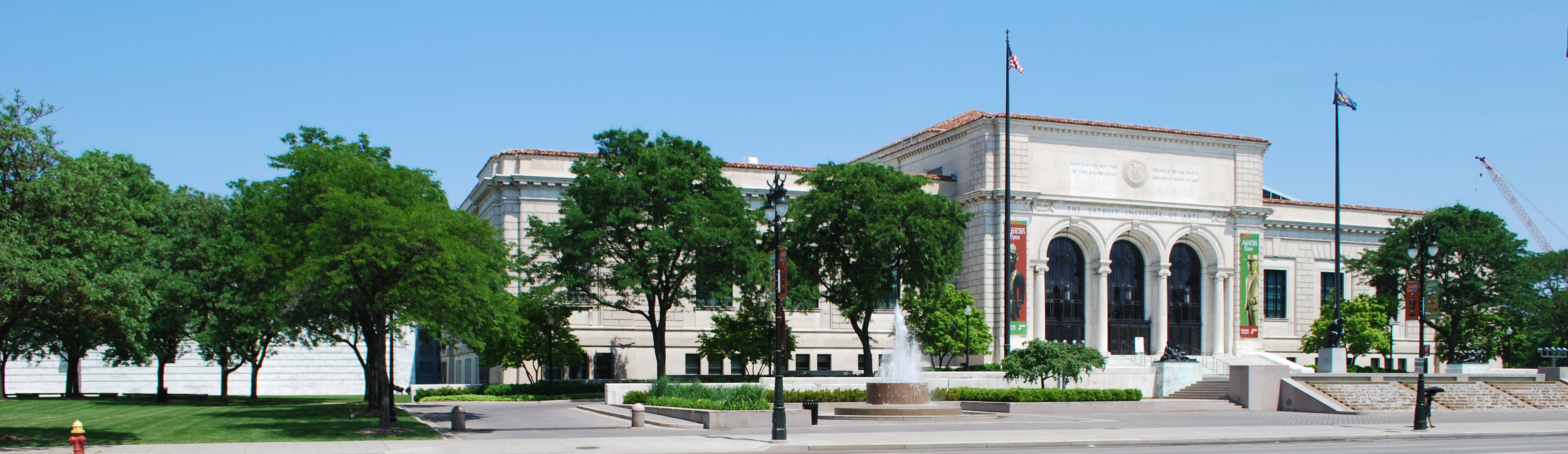
The Art Center (or Cultural Center) is centered on the Cultural Center Historic District: the Detroit Public Library, the Detroit Institute of Arts, and the Horace H. Rackham Education Memorial Building. The district contains several cultural attractions.
The library and art museum were built in the 1920s, heralding a City Beautiful movement in Detroit that aimed to establish the area along Woodward as the cultural center of the city.[6] Wayne State University, then housed in the former Central High School, began offering four-year degrees. These institutions formed a core area that attracted other public-oriented institutions to the area, including several music schools, the Merrill-Palmer Institute, the Detroit Historical Museum, and the College for Creative Studies.[6] The Charles H. Wright Museum of African American History, the Detroit Science Center, and the Museum of Contemporary Art Detroit also are located in the Art Center area.
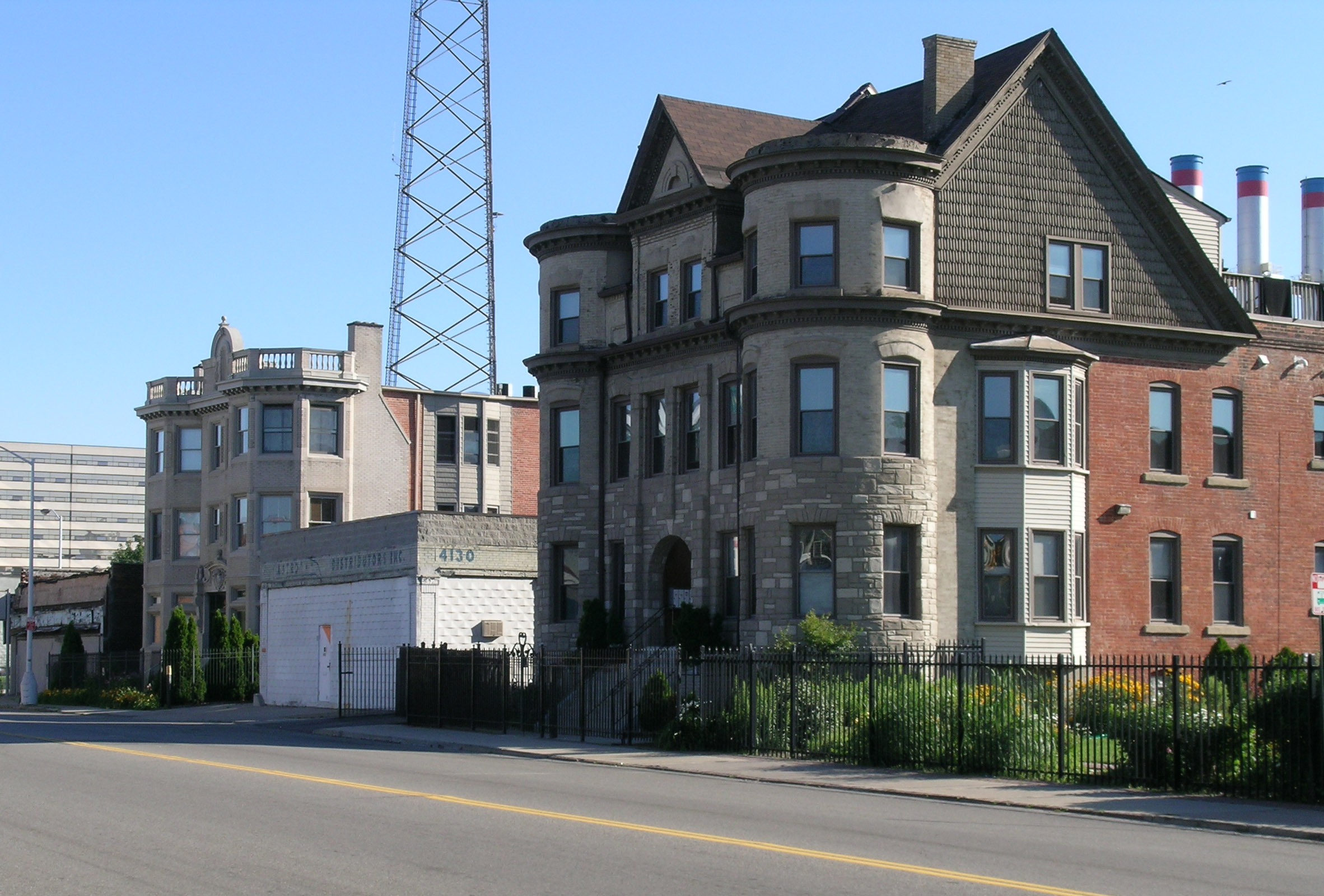
The Art Center portion of Midtown also contains substantial residential areas, including the East Ferry Avenue Historic District and scattered late-19th century homes to the east of the Detroit Institute of Art. These neighborhoods have been infilled with townhomes and other residential developments and revitalizations.[8]
North Cass
 Cass Avenue north of Alexandrine.
South of Wayne State University, the North Cass (or Cass Farm) area contains a substantial number of multi-unit apartment houses, many mixed with earlier single-family homes. This area has been heavily influenced by the expansion of Wayne State, with some of WSU's campus extending into the northern section of North Cass, and much of the residential housing stock taken up by Wayne students.
 Willis Overland Lofts, on Willis looking east.
There are also a number of commercial buildings, particularly along the Cass Corridor just west of Woodward. Many of these support commercial businesses, and an independent retail study by the University Cultural Center Association has shown that the number of independent retail outlets in Midtown, Detroit is increasing. The north Cass section also has a smattering of industrial buildings dating from the automotive heyday of Detroit. Many of these, such as the Willys Overland building,[8] have been or are being converted into residential loft space.
Detroit Medical Center
Main article: Detroit Medical CenterDetroit Medical Center was organized in 1985 as a union among several hospitals: Harper University Hospital, Grace Hospital, Hutzel Women's Hospital, and Children's Hospital of Michigan.[9] With the addition of other hospitals, such as Detroit Receiving Hospital, the campus of the DMC and its adjacent partner institutions (the Karmanos Cancer Institute and the John D. Dingell Veteran's Administration Hospital Center)[10] now takes up most of the area between Mack Avenue on the south, Warren Avenue on the north, John R. on the west, and Beaubien on the east.[11]
Harper Hospital was founded in 1863, receiving its first patients, Civil War soldiers, in 1864.[12] Two years later it opened as a general hospital. In 1882 a new hospital building was constructed on what is now the campus of the DMC. Additional buildings were constructed in 1913 and 1928.[12] Hutzel Women's Hospital, founded in 1868, was Detroit's second hospital.[13] Grace Hospital was founded in 1883,[14] and Children's Hospital was founded three years later.[15] Detroit Receiving was founded in 1915, and moved to its present location in 1980.[16]
As of 2009, The DMC has more than 2,000 licensed beds and 3,000 affiliated physicians. The DMC is the affiliated clinical research site for medical program at Wayne State University, the nation’s fourth largest medical school.[17] It is the largest private employer in the city of Detroit with more than 12,000 employees.[17] On March 19, 2010, Vanguard Health Systems announced plans to invest nearly $1.5 B in Detroit Medical Center, including $850 M for expansion and renovation, and $417 M to retire debts, pending approval of its acquisition.[18][19] In 2010, Henry Ford Health System in the New Center also announced a $500 M expansion in Detroit with plans for a biomedical research center.[20]
Cass Park
South of Martin Luther King Jr Boulevard, the area of Midtown around Cass Park is at a substantial distance from both the downtown core and the influence of Wayne State. The area around Cass Park proper is anchored by Cass Technical High School and the Detroit Masonic Temple, but the portion near Woodward Avenue and the once-fashionable Park Avenue district are awaiting redevelopment.
Brush Park
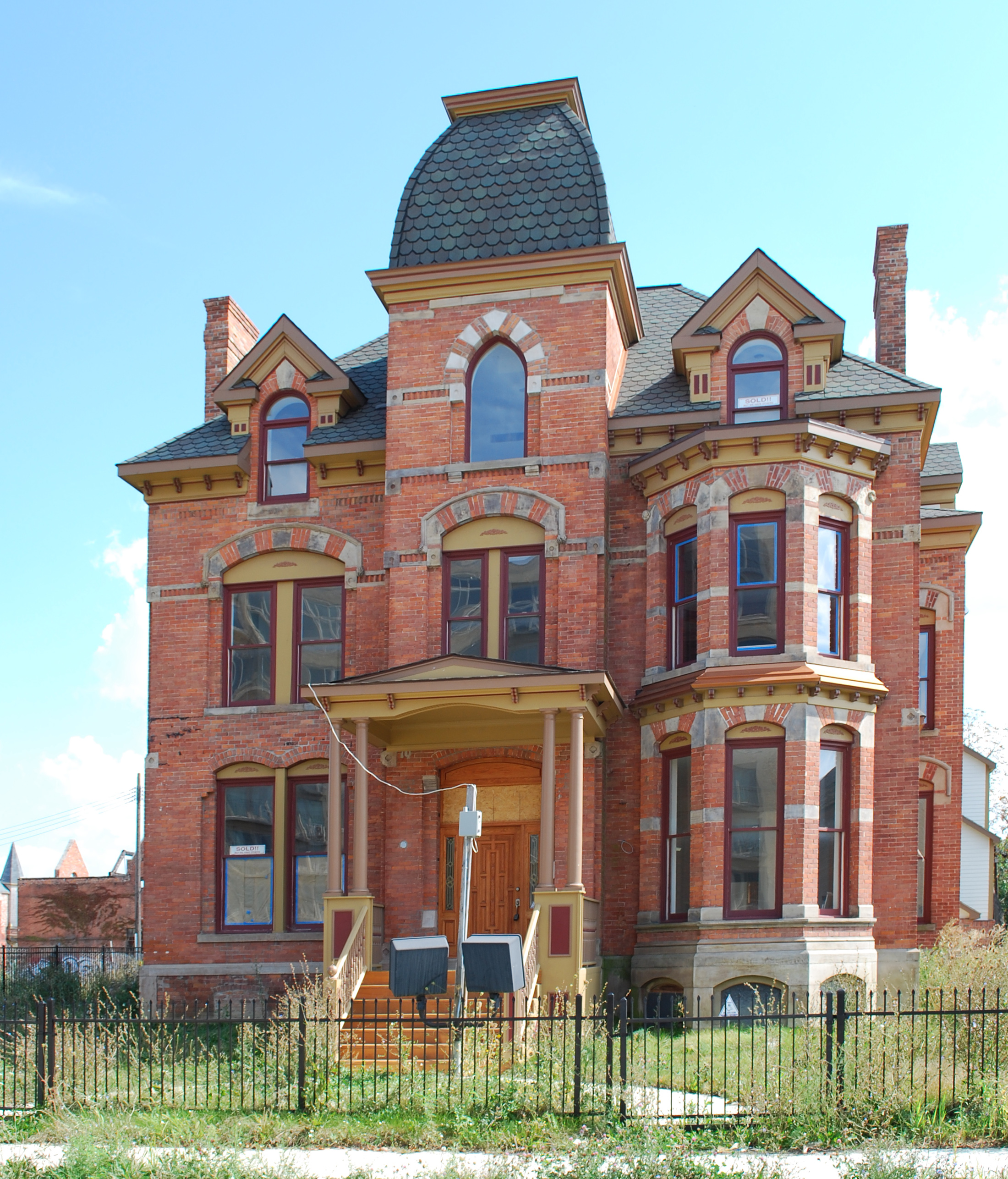
Main article: Brush Park Historic District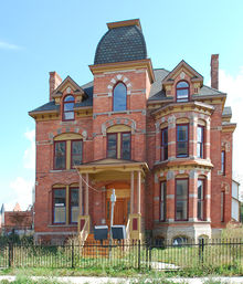 Restoration in 2006 of the Lucien Moore House (1885) in Brush Park Historic District.[21]
Brush Park proper runs from Mack to the Fisher freeway, and extends east and west from Woodward Avenue to Beaubien.[21][22]
The Brush Park neighborhood was developed beginning in the 1850s as a residential neighborhood for Detroit's elite citizens.[23] Construction peaked in the 1870s and 1880s; one of the last homes built was constructed in 1906 by architect Albert Kahn for his personal use. Early residents of Brush Park included lumber baron David Whitney Jr., his daughter Grace Whitney Evans, Joseph L. Hudson, founder of the eponymous department store, lumber baron Lucien Moore, banker Frederick Butler, and dry goods manufacturer Ransom Gillis. During the 19th century, around 300 homes were built in Brush Park, including 70 Victorian mansions.[23] The neighborhood is experiencing restoration in the first decade of the 21st century, and as of 2001, about 154 original structures remained in the area including the David Whitney House which is now a five star restaurant known as 'the Whitney'. Brush Park's revival began in the 1990s and has accelerated recently. A number of the older mansions have been restored, and more have been stabilized. In addition, new condominiums have been built in the southern part of Brush Park, near the Fisher Freeway.[24]
In the far southeastern corner of Midtown, to the east of Beaubien and Brush Park proper, the Brewster-Douglass Housing Projects are located near the Chrysler Freeway.
Historic Districts and neighborhoods
 David Whitney House, a restaurant in Midtown, is listed on the National Register of Historic Places.
Midtown contains within its boundaries a number of historic districts and neighborhoods.[25] These include:
- Cultural Center Historic District (a primarily public-oriented district consisting of the Detroit Public Library, 1921; the Detroit Institute of Arts, 1927; and the Horace H. Rackham Education Memorial Building, 1941)
- Cass Corridor
- Cass-Davenport Historic District (a multi-unit apartment district built in the 1910s and 1920s)
- Cass Park Historic District (a mix of buildings, including the Detroit Masonic Temple and the S. S. Kresge World Headquarters)
- East Ferry Avenue Historic District (single-family home residential district built primarily in the 1880s and 1890s)
- Midtown Woodward Historic District (a primarily commercial district along Woodward Avenue built in the 20th century)
- Wayne State University Buildings (another public-oriented district including the Mackenzie House, 1895; Hilberry Theater, 1916; and Old Main, 1895)
- West Canfield Historic District (single-family home residential district built primarily in the 1870s and 1880s)
- Woodward East Historic District within Brush Park (single-family home residential district built primarily in the 1870s and 1880s)
- Sugar Hill Historic District (an important commercial and entertainment center of African-American life in the 1940s)
- Warren-Prentis Historic District (consisting substantially of single-family homes built in the late 19th century and multi-unit apartments built in the early 20th century)
- Willis-Selden Historic District (a mix of residential and commercial structures, most from the early 20th century)
Historic structures within Midtown
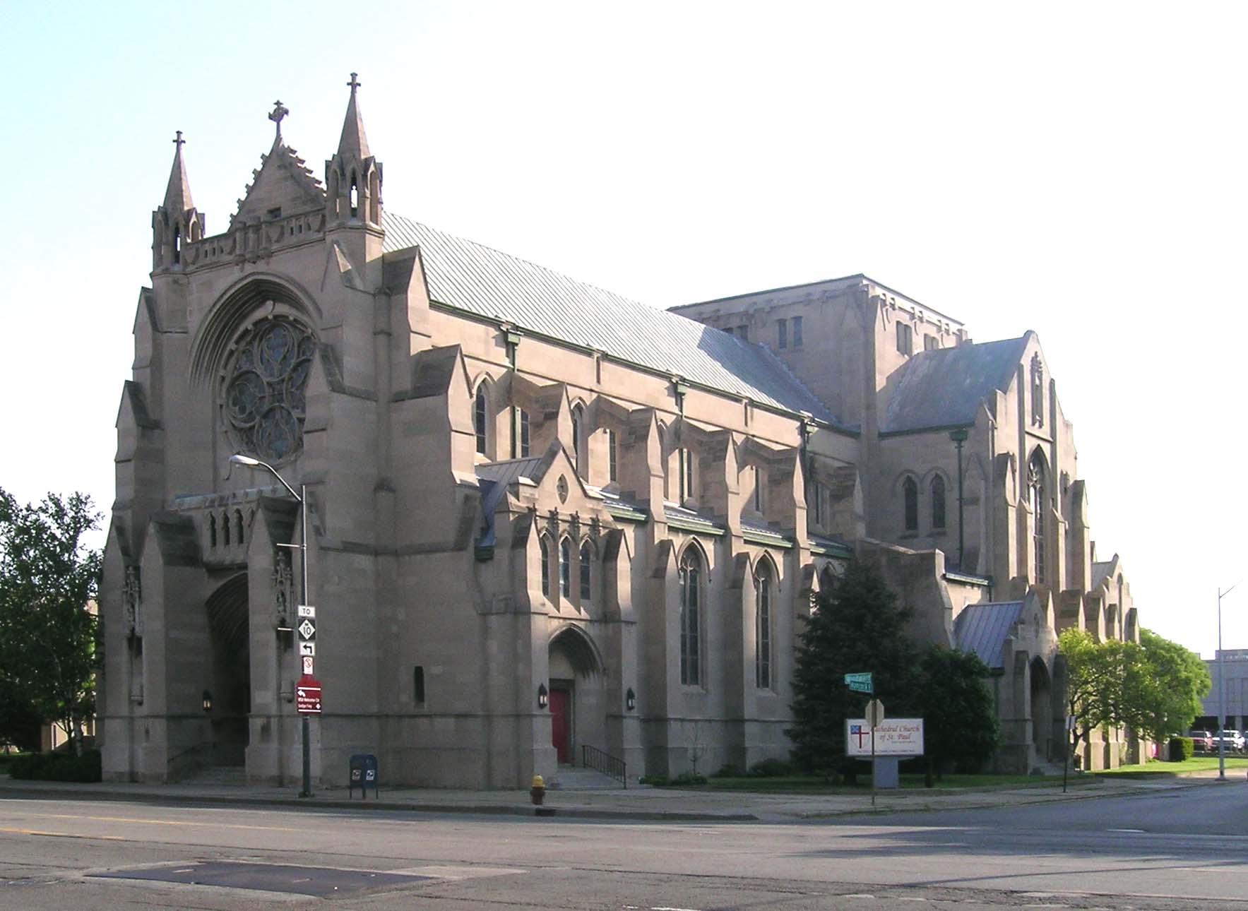
 Cathedral Church of St. Paul on Woodward Ave.
In addition to the buildings within historic districts, there are numerous historically significant structures located within Midtown. Many of these structures are listed on the National Register of Historic Places, and include structures from three multiple property submissions: the University-Cultural Center Multiple Resource Area Phases I and II, and the Cass Farm Multiple Property Submission. These structures include:
- Churches (First Unitarian Church of Detroit, First Presbyterian Church, Temple Beth-El (Bonstelle Theatre), Chapel of St. Theresa-the Little Flower, Cass Avenue Methodist Episcopal Church, First Congregational Church, Cathedral Church of St. Paul, and Saint Andrew's Memorial Episcopal Church. St. Albertus, St. Josaphat's, and Sweetest Heart of Mary Roman Catholic Churchs are adjacent to the East side of Midtown across I-75).
- Single-family homes (John Harvey House, Bernard Ginsburg House, Elisha Taylor House, Hudson-Evans House, Albert Kahn House, Robert M. and Matilda (Kitch) Grindley House, David Whitney House, Perry McAdow House, William C. Boydell House, Mulford T. Hunter House, George W. Loomer House, Samuel L. Smith House, Herman Strasburg House, Charles Lang Freer House, Col. Frank J. Hecker House, Thomas S. Sprague House).
- Hotels and apartment buildings (Park Avenue Hotel, Eddystone Hotel, Hotel Stevenson, League of Catholic Women Building, Coronado Apartments, Helen Newberry Nurses Home, Thompson Home, Santa Fe Apartments, Chatsworth Apartments, The Wardell, Belcrest Hotel, Verona Apartments, Lancaster and Waumbek Apartments).
- Office and commercial buildings (S. S. Kresge World Headquarters, Architects Building, Detroit-Columbia Central Office Building, Stuber-Stone Building, Graybar Electric Company Building, Edwin S. George Building, Cass Motor Sales).
- Public structures (Orchestra Hall, Garden Bowl, Majestic Theater, Dunbar Hospital).
- Schools (The Clay School, Sts. Peter and Paul Academy, Jefferson Intermediate School).
- Clubs (Detroit Masonic Temple, Maccabees Building, Scarab Club).
- Utility buildings (Detroit Edison Company Willis Avenue Station).
History
1800 - 1870
The area that is now Midtown was first platted after the disastrous 1805 fire in Detroit, when the United States Congress authorized the platting of a new village at Detroit.[26] Land titles were granted to settle remaining uncertainty over the ownership of some parcels, which was in part due to the then fairly recent departure of British colonial forces.[26] During this platting, congress authorized the platting of land north of Detroit on both sides of the main thoroughfare, Woodward Avenue. These lots were known as the "Park Lots."
The section of Midtown to the west of the Park Lots is known as the "Cass Farm" area, after the name of one of the original ribbon farms that ran north from the river through the area. The original Cass Farm ran between what is now Cass Avenue and Third Avenue.[26] In 1816, Lewis Cass purchased the ribbon farm. The property was gradually developed over the years, with the sections closest to the river being developed first. By the time Cass died in 1866, a few of the blocks north of Martin Luther King Boulevard had just been platted. Cass's children continued to plat the area after his death.[26] Two more farms ran through Midtown west of Woodward< the Jones/Crane Farm, named for De Garmo Jones, onetime mayor of Detroit, which was located between what is now Third Avenue and the alley east of Fourth Street; and the Forsythe Farm, located between what is now Fourth Street and the Lodge Freeway.[26]
To the east of the Park Lots, the ribbon farm running through the midtown area was originally owned by John Askin, an Irish trader.[27] Askin's daughter Adelaide married Elijah Brush, the scion of the well-known Brush family of Detroit; the farm passed on to the couple and eventually their son Edmund.[27] Edmund Brush began subdividing the farm in the latter half of the 19th century.[27]
Despite the early date of the platting of the Park Lots, development of the area was slow at first, as early 19th century growth in Detroit occurred primarily east and west of Woodward, along Fort Street and Jefferson Avenue.[28] Even into the 1840s, only a handful of buildings, presumably farm structures, were located in the area.[26] The first east-west street in what is now Brush Park, in the southern section of Midtown, was not opened until 1852.[27]
It wasn't until during the Civil War, as the downtown district became more business-oriented, that northern Woodward Avenue began to be developed.[28] Construction turned the area that is now Midtown into a primarily upscale, quiet residential district, far from the hustle of the city center. Urban development of the area accelerated in 1870, when the population of Detroit was nearly 80,000. Streetcar lines established in the 1860s allowed residents to more conveniently travel from the Midtown area to downtown.[26]
1870 - 1910
The West Canfield Historic District, platted in 1871, was one of the first recorded subdivisions in the area.[26] The district features large and expensive lots, and many prominent Detroiters settled on the block. A severe depression slowed development, but it picked up again in the late 1870s.[26] The period from 1880-1895 brought a boom in the construction of elegant single-family and duplex homes in the Midtown area. The lots on Woodward were the most expensive and featured the most opulent homes; the lots immediately off the main street were soon filled with the homes of Detroit's upper class. School and religious buildings were also constructed in the area.[26]
As Detroit grew, the demand for apartment housing also grew; beginning in 1895, the construction in the Cass Farm area began to focus more on small apartment buildings.[26] This was particularly true in the last portion of the district to be developed, the section south of Warren between Cass and Third. Here a number of small-scale apartment buildings were constructed around the turn of the 20th century.[26]
1910 - 1930
As the city continued to expand, the character of the neighborhood changed. Even before World War I, the congestion along Woodward precipitated a change from upper-class housing to commercial ventures.[26] The rise of the automobile made more distant neighborhoods such as Boston-Edison and Indian Village easily accessible from the center of Detroit, and families of means moved out of the stately houses along Woodward and in Brush Park.[27]
The construction of Orchestra Hall heralded a City Beautiful movement that turned much of the area into public-oriented space; the idea of turning Midtown into a cultural mecca continued with the construction of the library and the DIA in the 1920s.[26]
The rise of the automobile also changed the area. Midtown's proximity to the automotive plants in the Milwaukee Junction area made it ideal for housing auto workers. During the 1910s and 1920s, larger apartment buildings were constructed in the area, and many remaining single-family homes were converted into boardinghouses.[23][26] Commercial usage also increased in the area, particularly in automotive-related sectors: showrooms, service stations, and part supply businesses.[26]
1930 - onward
The Great Depression heralded the beginning of a long decline for the Midtown area. Newly-constructed buildings fell into foreclosure, and many of the formerly well-paid auto workers living in the area were out of work.[26] By the time the industrial recovery from World War II stimulated the economy, industry had relocated to the suburbs, and the economic recovery for the most part passed the area by.[26]
During the Great Depression, many of the old mansions were subdivided into apartments, and as demand for housing fell after World War II, the homes were abandoned and fell into disrepair.
In the 1950s, widespread demolition of houses and businesses began, a practice that extended into the 1980s. Wayne State University also began to have more influence in the area, rehabilitating old buildings and building new ones in the northwestern section of the neighborhood.[26] The current boundaries of Midtown were also delineated when the interstate freeways through Detroit were built, particularly the Chrysler Freeway (I-75) on the east, the Lodge Freeway (M-10) on the west, the Edsel Ford Freeway (I-94) on the north, and the Fisher Freeway (I-75) on the south. The Chrysler followed the course of Hastings Street, the center of African-American life in Detroit at the time. To house displaced residents, the Brewster-Douglass Housing Projects were built in the far west of the Midtown area, near the Chrysler and what once had been the thriving Hastings Street community.
As the focus shifted to urban rehabilitation in the 1990s, more structures in the area have been refurbished, by Wayne State, other public groups, and by private parties.[26]
Midtown's apartment buildings are 94% occupied.[29]
Education
Colleges and universities
Wayne State University is located in Midtown. The College for Creative Studies is also located in Midtown and is one of the top art schools in the country.
Primary and secondary schools
The area is zoned to Detroit Public Schools. At one time DPS had its headquarters in the Maccabees Building in Midtown.[30] In 2002 the district paid the owner of the Fisher Building $24.1 million in so the district could occupy five floors in the building; the Fisher Building in the New Center area now serves as the DPS headquarters.[31]
Schools in Midtown serving sections of Midtown for elementary school include Golightly K-8, Malcolm X K-8, and Spain K-8. Schools outside of Midtown that serve sections of Midtown for elementary school include Burton K-8 and Edmonson.[32] Golightly K-8, Malcolm X K-8, Spain K-8, and Burton K-8 serve sections of Midtown for middle school.[33] All residents are zoned to Martin Luther King High School.[34]
Prior to its closure, Murray-Wright High School served Midtown Detroit.[35] At one point in the first decade of the 21st century a portion of Midtown was served by Dewey PK-8 for elementary school, while a portion was served by Edmonson Elementary. Two separate portions of Midtown were served by Golightly K-8 and Spain PK-8 for elementary school.[36] At one point in the first decade of the 21st century a portion of Midtown was served by Dewey PK-8 for middle school, while another section was served by Sherrard PK-8 for middle school; during that time Spain PK-8 served the rest of Midtown.[37]
Public libraries
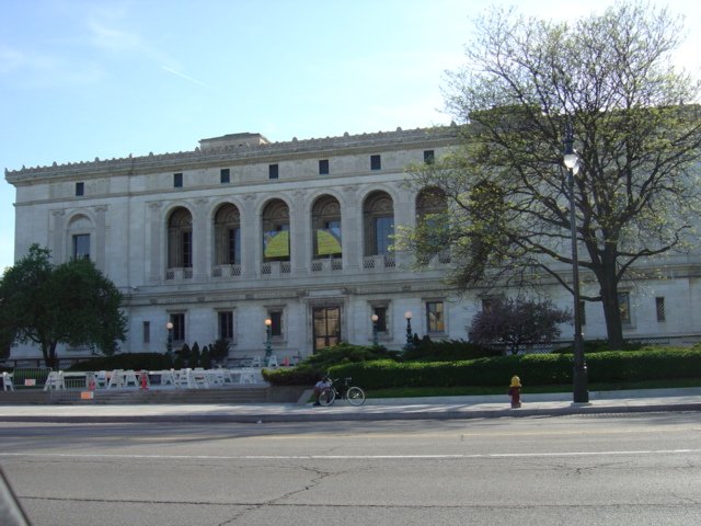
 Detroit Public Library Main Library
Detroit Public Library operates the Main Library in Midtown. The current library facility opened on March 21, 1921. The extension wings of the facility opened on June 23, 1963.[38]
References
- ^ Midtown location from the University Cultural Center Association, retrieved 6/9/09
- ^ Midtown Detroit map from the University Cultural Center Association, retrieved 6/30/09
- ^ Map of Wayne, retrieved 6/29/09
- ^ a b About WSU from the Cancer Biology program (retrieved 6/9/09)
- ^ a b Historical timeline from WSU (retrieved 6/9/09)
- ^ a b c University-Cultural Center Phase I MRA from the National Park Service
- ^ Headcount Enrollment, 2000-2009, Wayne State University, retrieved 6/24/09.
- ^ a b Development map from the University Cultural Center Association, retrieved 6/30/09.
- ^ Arthur M. Woodford, This is Detroit, 1701-2001 , ISBN 0-8143-2914-4, pp. 232-233.
- ^ Health Directory from the University Cultural Center Association, retrieved 6/26/09
- ^ Map of the DMC, retrieved 6/24/09
- ^ a b Harper Hospital papers from WSU's Reuther library. Retrieved 6/24/09.
- ^ History from Hutzel Women's Hospital, retrieved 6/24/09
- ^ History from Sinai-Grace Hospital. Retrieved 6/24/09
- ^ History and profile from Detroit Medical Center, retrieved 6/24/09
- ^ History from Detroit Receiving, retrieved 6/24/09
- ^ a b Careers at the DMC, retrieved 6/24/09
- ^ Anstett, Patricia (March 20, 2010).$1.5 Billion for new DMC.Detroit Free Press. DMC.org. Retrieved on June 12, 2010.
- ^ http://www.crainsdetroit.com/article/20100611/FREE/100619971
- ^ Greene, Jay (April 5, 2010).Henry Ford Health System plans $500 million expansion. Crains Detroit Business. Retrieved on June 12, 2010.
- ^ a b Pfeffer, Jaime, (September 12, 2006).Falling for Bush Park. Metro Times. Retrieved on June 14, 2008.
- ^ Archambault, Dennis (February 14, 2006).Forging Bush Park. Metro Times. Retrieved on 6/30/09.
- ^ a b c Brush Park Historic District from the City of Detroit
- ^ Dennis Archambault, "Forging Brush Park," 2/14/06
- ^ Historic Districts from the University Cultural Center Association, retrieved 6/9/09
- ^ a b c d e f g h i j k l m n o p q r s t Cass Farm MPS from the National Park Service
- ^ a b c d e Brush Park from the Detroit Historic District Commission. Retrieved 6/26/09.
- ^ a b Christensen, Robert O.; Vollmert, Leslie J.; Cotman, Charles C. (April 14, 1982) (PDF). National Register of Historic Places Inventory — Nomination Form. http://pdfhost.focus.nps.gov/docs/NRHP/Text/64000332.pdf. (Nomination of Religious Structures of Woodward Avenue TR to the National Register of Historic Places.)
- ^ Crain's Detroit Business
- ^ "Contact Us." Detroit Public Schools. May 10, 2000. Retrieved on November 7, 2009.
- ^ Oosting, Jonathan. "Audit: Detroit Public Schools overpaid millions for real estate after middle-man markups." MLive.com. September 24, 2009. Retrieved on November 7, 2009.
- ^ "Elementary School Boundary Map." Detroit Public Schools. Retrieved on November 7, 2009.
- ^ "Middle School Boundary Map." Detroit Public Schools. Retrieved on October 20, 2009.
- ^ "High School Boundary Map." Detroit Public Schools. Retrieved on October 20, 2009.
- ^ "High School Attendance Areas 7/10/2003." Detroit Public Schools. Retrieved on November 13, 2009.
- ^ "Proposed Elementary School Attendance Area Boundaries 3/27/02." Retrieved on November 13, 2009.
- ^ "Proposed Middle School Attendance Area Boundaries 3/27/02." Retrieved on November 13, 2009.
- ^ "Main Library." Detroit Public Library. Retrieved on November 7, 2009.
City of Detroit Architecture · Culture · Detroit River · Economy · Freeways · Government · History · Historic places · International Riverfront · Media · Music · Neighborhoods · Parks and beaches · People · Skyscrapers · Sports · Theatre · Tourism · Transportation


Wikimedia Foundation. 2010.