- Maryland Route 852
-
Maryland Route 852
Route information Maintained by MDSHA and City of Westminster Location Counties: Carroll Highway system Maryland highway system
Interstate • US • State • Minor • Former • Turnpikes←  MD 851
MD 853  →
→Maryland Route 852 (MD 852) is a collection of state highways in the U.S. state of Maryland. These highways are service roads related to and sections of an old alignment of MD 31 between New Windsor and Manchester in Carroll County. Between Westminster and Manchester, the sections of MD 852 follow MD 27, which replaced MD 31 north of Westminster in 1967. MD 852 has three distinct sections of mainline highway: MD 852 runs from New Windsor to south of Westminster, MD 852K runs from south of Westminster into the county seat, and MD 852G runs from north of Westminster to Mexico. What are now parts of MD 852 were originally constructed as MD 31 around 1920 south of Westminster and in the early 1910s north of Westminster. The sections of MD 852 were assigned north of Westminster in the late 1950s and south of Westminster in the mid 1960s.
Contents
New Windsor – Westminster
Maryland Route 852
Location: New Windsor – Westminster Length: 3.72 mi[1] (5.99 km) MD 852 runs 3.72 miles (5.99 km) from MD 31 in New Windsor east to MD 31 near Westminster. The state highway was originally constructed as MD 31 around 1920 and received its present designation in 1965.
Route description
MD 852 begins at an intersection with MD 31 (New Windsor Road) just east of the town of New Windsor. The state highway heads north perpendicular to MD 31, then curves east and starts to follow old alignment at its intersection with MD 852M (Old New Windsor Road), which heads southwest to a dead end adjacent to MD 31. MD 852 follows a curvy path through farmland in the Wakefield Valley. After crossing Little Pipe Creek just west of its intersection with Adams Mill Road, the state highway veers to the southeast to parallel the creek. MD 852 runs along the southwestern edge of Wakefield Valley Golf Course before reaching its eastern terminus at MD 31 southwest of Westminster.[1][2]
History
MD 31 from New Windsor to southwest of Westminster was originally constructed as a 15-foot (4.6 m) wide concrete road between 1919 and 1921.[3][4] The state highway was widened to 21 feet (6.4 m) with a pair of 3-foot (0.91 m) wide macadam shoulders between 1936 and 1939.[5] MD 852 was assigned to its present course after MD 31's present alignment was constructed between 1963 and 1965.[6][7]
Junction list
Location Mile[1] Destinations Notes New Windsor 0.00  MD 31 (New Windsor Road)
Western terminus 0.07 Old New Windsor Road west Unsigned MD 852M Westminster 3.72 MD 31 (New Windsor Road)Eastern terminus 1.000 mi = 1.609 km; 1.000 km = 0.621 mi Auxiliary route
MD 852M is the designation for Old New Windsor Road, a section of old alignment of MD 31 in New Windsor. The state highway runs 0.20 miles (0.32 km) from MD 852 west to a dead end adjacent to MD 31.[1][8]
South side of Westminster
Maryland Route 852KLocation: Westminster Length: 2.19 mi[1] (3.52 km) MD 852K runs 2.19 miles (3.52 km) from MD 31 near Westminster to Main Street in Westminster. The state highway was originally constructed as MD 31 around 1920 and received its present designation in 1967.
Route description
MD 852K begins at an intersection with MD 31 (New Windsor Road) a short distance east of MD 852's eastern terminus southwest of Westminster. The state highway heads south as Stone Chapel Road to a three-way intersection where Stone Chapel Road turns west as a county highway. MD 852K turns east onto New Windsor Road. MD 852K closely parallels the eastbound direction of MD 31, serving as a service road for properties on the south side of the two highways. There appears to be a connector between MD 31 and MD 852K at MD 31's intersection with Tahoma Farm Road; however, barriers prevent access between the two highways. Access between the two highways was cut off in 2008 when a traffic signal was added at the MD 31 – Tahoma Farm Road intersection.[9][10] MD 852K diverges from MD 31 just inside the city limit of Westminster. MD 852K becomes municipally-maintained just south of where houses start to line the westbound side of the highway. The state highway climbs to the top of the ridge on which downtown Westminster sits and reaches its eastern terminus at the intersection of Main Street and Uniontown Road on the edge of the Western Maryland College Historic District and the district's namesake, McDaniel College.[1][11]
History
MD 31 from southwest of Westminster to Main Street was originally constructed as a 15-foot (4.6 m) wide concrete road between 1919 and 1921.[3][4] The state highway was widened to 21 feet (6.4 m) with a pair of 3-foot (0.91 m) wide macadam shoulders between 1936 and 1939.[5] MD 852K was assigned to its present course after MD 31's present alignment from southwest of Westminster to MD 140 was completed in 1967.[12] By 1978, the state highway was municipally-maintained on its present stretch, which was named Doyle Avenue.[13]
Junction list
The entire route is in Westminster.
Location Mile[1] Destinations Notes 0.00 MD 31 (New Windsor Road) – New WindsorWestern terminus 0.02 Stone Chapel Road south MD 852K turns east onto New Windsor Road 2.19 Main Street / Uniontown Road west Eastern terminus 1.000 mi = 1.609 km; 1.000 km = 0.621 mi North side of Westminster
There are two segments of MD 852 just north of the city limits of Westminster.
- MD 852H is the designation for a 0.24-mile (0.39 km) section of MD 31's old alignment from a dead end on the east side of MD 27's crossing of the Maryland Midland Railway to MD 852G's (Old Manchester Road) intersection with Lucabaugh Mill Road. MD 852H is unnamed from the dead end to county-maintained Cranberry Road North, then takes the latter name as it crosses the railroad track to its junction with MD 852G.[1][14]
- MD 852I is the designation for a 0.09-mile (0.14 km) section of the unnamed spur of old alignment from Hahn Road east to a dead end on the west side of MD 27's crossing of the railroad.[1][15]
Westminster–Mexico
Maryland Route 852GLocation: Westminster–Mexico Length: 2.70 mi[1] (4.35 km) MD 852G runs 2.70 miles (4.35 km) from MD 27 in Westminster to MD 27 in Mexico. The state highway was originally constructed as MD 31 around 1920 and received its present designation in 1960.
Route description
MD 852G begins at an intersection with MD 27 (Manchester Road) just north of the latter highway's crossing of the Maryland Midland Railway. MD 852G heads southeast to the intersection of MD 852H (Cranberry Road North) and Lucabaugh Mill Road, where the state highway picks up MD 31's old alignment and crosses Cranberry Branch. MD 852G curves to the northeast and passes through a mix of farmland and scattered residences. In the village of Mexico, the state highway intersects MD 482 (Hampstead Mexico Road) and that highway's old alignment, MD 849 (Leisters Church Road). North of Mexico, MD 852G veers north and reaches its northern terminus at MD 27 (Manchester Road).[1][16]
History
MD 27 from Westminster to Manchester was originally part of MD 31; Manchester Road became a northern extension of MD 27 in 1967.[17][12] The Westminster–Manchester road was one of the original state roads marked for improvement by the Maryland State Roads Commission in 1909.[18] The highway was completed from the Westminster city limit north to Cranberry Station on the Western Maryland Railway (now Maryland Midland Railway) in 1911.[19][20] The road was extended to just south of Mexico in 1913; in addition, construction on the state road began from the Manchester end. The gap between Mexico and south of Manchester was filled in 1914.[20] Construction began on reconstructing and widening MD 31 from Manchester to Westminster in 1957.[21] This project involved several relocations of the highway by the time it was completed in 1960; sections of old road became segments of MD 852, including MD 852G between Westminster and Mexico.[22]
Junction list
Location Mile[1] Destinations Notes Westminster 0.00  MD 27 (Manchester Road) – Manchester
Southern terminus 0.22 Cranberry Road North south / Lucabaugh Mill Road north Cranberry Road North is MD 852H Mexico 2.21  MD 482 (Hampstead Mexico Road) – Hampstead
2.31 Leisters Church Road east Unsigned MD 849 2.70 MD 27 (Manchester Road) – Westminster, ManchesterNorthern terminus 1.000 mi = 1.609 km; 1.000 km = 0.621 mi Mexico–Manchester
There are five sections of MD 852 between Mexico and Manchester.
- MD 852J is the designation Martin Drive, a 0.46-mile (0.74 km) service road that extends from MD 27 south of its intersection with MD 482 north along the southbound side of MD 27 to a dead end.[1][23]
- MD 852F is the designation for an unnamed 0.20-mile (0.32 km) section of old alignment between two dead ends just north of the northern terminus of MD 852G. MD 852F is connected to MD 27 by MD 27A (Random Ridge Road).[1][24]
- MD 852A is the designation for an unnamed 0.07-mile (0.11 km) spur of old alignment that parallels the southbound side of MD 27 between a county-maintained section of Old Manchester Road and Snydersburg Road, just south of MD 852B.[1][25]
- MD 852B is the designation for an unnamed 0.07-mile (0.11 km) section of old alignment between two dead ends just north of MD 852A. MD 852B is connected to MD 27 by MD 27B.[1][26]
- MD 852C is the designation for Manchester Road, a 0.58-mile (0.93 km) section of old alignment from MD 27 north to a dead end adjacent to MD 27's intersection with Westminster Street just south of Manchester. Westminster Street is the old alignment of MD 31 north to MD 30 in the center of Manchester. MD 852C is the only signed section of MD 852. The state highway runs parallel to the northbound direction of MD 27 and is connected to that highway by a trio of unnamed connector roads: MD 27C, MD 27D, and MD 27E.[1][27]
References
- ^ a b c d e f g h i j k l m n o p q "Highway Location Reference: Carroll County" (PDF). Maryland State Highway Administration. 2009. http://www.marylandroads.com/Location/2009_CARROLL.pdf. Retrieved 2011-04-18.
- ^ Google, Inc. Google Maps – Maryland Route 852 (Map). Cartography by Google, Inc. http://maps.google.com/maps?f=d&source=s_d&saddr=Unknown+road&daddr=Old+New+Windsor+Pike+to:Old+New+Windsor+Rd%2FOld+New+Windsor+Pike&hl=en&geocode=FXZoWwIdxadn-w%3BFfSIWwIdDxRo-w%3BFYebWwIdioRo-w&mra=ls&sll=39.55758,-77.036197&sspn=0.007461,0.01929&ie=UTF8&t=h&z=14. Retrieved 2011-04-18.
- ^ a b Report of the State Roads Commission of Maryland. 1916-1919. Baltimore: Maryland State Roads Commission. January 1920. p. 24. http://www.archive.org/details/annualreportsofs1916mary. Retrieved 2011-04-21.
- ^ a b Maryland Geological Survey. Map of Maryland: Showing State Road System and State Aid Roads (Map) (1921 ed.).
- ^ a b Report of the State Roads Commission of Maryland. 1937-1938. Baltimore: Maryland State Roads Commission. 1939-03-04. p. 127. http://www.archive.org/details/reportofstateroa1937mary. Retrieved 2011-04-21.
- ^ "NBI Structure Number: 100000060057020". National Bridge Inventory. http://nationalbridges.com/nbi_record.php?StateCode=24&struct=100000060057020. Retrieved 2011-04-21.
- ^ Maryland State Roads Commission. Maryland: Official Highway Map (Map) (1965 ed.).
- ^ Google, Inc. Google Maps – Maryland Route 852M (Map). Cartography by Google, Inc. http://maps.google.com/maps?f=d&source=s_d&saddr=Old+New+Windsor+Pike&daddr=Old+New+Windsor+Pike&geocode=FbJoWwIdZptn-w%3BFTZsWwIdeKdn-w&hl=en&mra=ls&sll=39.546313,-77.093725&sspn=0.007462,0.01929&ie=UTF8&ll=39.545932,-77.094734&spn=0.007462,0.01929&t=h&z=16. Retrieved 2011-04-18.
- ^ "Highway Location Reference: Carroll County" (PDF). Maryland State Highway Administration. 2007. http://www.marylandroads.com/Location/2007_CARROLL.pdf. Retrieved 2011-04-18.
- ^ "Highway Location Reference: Carroll County" (PDF). Maryland State Highway Administration. 2008. http://www.marylandroads.com/Location/2008_CARROLL.pdf. Retrieved 2011-04-18.
- ^ Google, Inc. Google Maps – Maryland Route 852K (Map). Cartography by Google, Inc. http://maps.google.com/maps?f=d&source=s_d&saddr=Unknown+road&daddr=Old+New+Windsor+Pike+to:Old+New+Windsor+Pike&geocode=FVKiWwIduJxo-w%3BFSnOWwIdos9o-w%3BFZT0WwIdGglp-w&hl=en&mra=ls&sll=39.570185,-77.016345&sspn=0.029839,0.077162&ie=UTF8&t=h&z=14. Retrieved 2011-04-18.
- ^ a b Maryland State Roads Commission. Maryland: Official Highway Map (Map) (1967 ed.).
- ^ Maryland State Highway Administration. Maryland: Official Highway Map (Map) (1978 ed.).
- ^ Google, Inc. Google Maps – Maryland Route 852H (Map). Cartography by Google, Inc. http://maps.google.com/maps?f=d&source=s_d&saddr=Old+Manchester+Rd&daddr=Cranberry+Rd+N&geocode=FcQFXAIdmGxp-w%3BFVQBXAId3Hxp-w&hl=en&mra=ls&sll=39.58459,-76.973326&sspn=0.007458,0.01929&ie=UTF8&ll=39.584904,-76.973959&spn=0.003729,0.009645&t=h&z=17. Retrieved 2011-04-18.
- ^ Google, Inc. Google Maps – Maryland Route 852I (Map). Cartography by Google, Inc. http://maps.google.com/maps?f=d&source=s_d&saddr=Hahn+Rd&daddr=Hahn+Rd&geocode=FWQCXAIdUmJp-w%3BFWoFXAId5Wdp-w&hl=en&mra=ls&sll=39.58435,-76.978637&sspn=0.001865,0.004823&ie=UTF8&ll=39.584863,-76.979007&spn=0.001865,0.004823&t=h&z=18. Retrieved 2011-04-18.
- ^ Google, Inc. Google Maps – Maryland Route 852G (Map). Cartography by Google, Inc. http://maps.google.com/maps?f=d&source=s_d&saddr=MD-852+N%2FOld+Manchester+Rd&daddr=MD-852+N%2FOld+Manchester+Rd+to:MD-852+N%2FOld+Manchester+Rd&geocode=FZIKXAIdU3Np-w%3BFT8wXAIdFNRp-w%3BFatXXAIdGvNp-w&hl=en&mra=ls&sll=39.604498,-76.946311&sspn=0.006877,0.01929&ie=UTF8&ll=39.593387,-76.958714&spn=0.029829,0.077162&t=h&z=14. Retrieved 2011-04-18.
- ^ Maryland Geological Survey. Map of Maryland: Showing State Road System and State Aid Roads (Map) (1927 ed.).
- ^ Maryland Geological Survey. Map of Maryland (Map) (1910 ed.).
- ^ Maryland Geological Survey. Map of Maryland: Showing State Road System and State Aid Roads Completed or Under Construction December 31, 1911 (Map) (1911 ed.).
- ^ a b Report of the State Roads Commission of Maryland. 1912-1915. Baltimore: Maryland State Roads Commission. May 1915. p. 106. http://www.archive.org/details/annualreportsofs1912mary. Retrieved 2011-04-21.
- ^ Report of the State Roads Commission of Maryland. 1957-1958. Baltimore: Maryland State Roads Commission. 1958-12-15. p. 91. http://www.archive.org/details/reportofstateroa1957mary. Retrieved 2011-04-21.
- ^ Maryland State Roads Commission. Maryland: Official Highway Map (Map) (1960 ed.).
- ^ Google, Inc. Google Maps – Maryland Route 852J (Map). Cartography by Google, Inc. http://maps.google.com/maps?f=d&source=s_d&saddr=Martin+Dr&daddr=Martin+Dr&geocode=FYEzXAIdSL9p-w%3BFRZFXAIdXNVp-w&hl=en&mra=ls&sll=39.60091,-76.950195&sspn=0.003728,0.009645&ie=UTF8&t=h&z=16. Retrieved 2011-04-18.
- ^ Google, Inc. Google Maps – Maryland Route 852F (Map). Cartography by Google, Inc. http://maps.google.com/maps?f=d&source=s_d&saddr=Old+Rd&daddr=Old+Rd&geocode=FY5eXAIdKPNp-w%3BFRRpXAIdt_Jp-w&hl=en&mra=ls&sll=39.610515,-76.942113&sspn=0.000932,0.002411&ie=UTF8&t=h&z=17. Retrieved 2011-04-18.
- ^ Google, Inc. Google Maps – Maryland Route 852A (Map). Cartography by Google, Inc. http://maps.google.com/maps?f=d&source=s_d&saddr=Unknown+road&daddr=Unknown+road&geocode=FbyUXAIdQA9q-w%3BFTmVXAIdQRBq-w&hl=en&mra=ls&sll=39.622206,-76.934574&sspn=0.001864,0.004823&ie=UTF8&ll=39.622239,-76.935164&spn=0.001864,0.004823&t=h&z=18. Retrieved 2011-04-18.
- ^ Google, Inc. Google Maps – Maryland Route 852B (Map). Cartography by Google, Inc. http://maps.google.com/maps?f=d&source=s_d&saddr=Unknown+road&daddr=Unknown+road&geocode=FR6XXAIdKhFq-w%3BFY6aXAIdABNq-w&hl=en&mra=ls&sll=39.622706,-76.934761&sspn=0.001864,0.004823&ie=UTF8&ll=39.622598,-76.933393&spn=0.003727,0.009645&t=h&z=17. Retrieved 2011-04-18.
- ^ Google, Inc. Google Maps – Maryland Route 852C (Map). Cartography by Google, Inc. http://maps.google.com/maps?f=d&source=s_d&saddr=Old+Manchester+Rd&daddr=Old+Manchester+Rd&geocode=FY8XXQIdSZRq-w%3BFfAoXQId0rNq-w&hl=en&mra=ls&sll=39.659632,-76.893659&sspn=0.001863,0.004823&ie=UTF8&t=h&z=16. Retrieved 2011-04-18.
External links
Roads in Carroll County, Maryland State highways 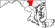
U.S. Highways Interstate Highways Categories:- State highways in Maryland
- Roads in Carroll County, Maryland


Wikimedia Foundation. 2010.