- Mary Plantation House
-
Mary Plantation House
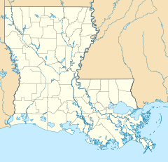
Nearest city: Braithwaite, Louisiana Coordinates: 29°48′15″N 89°59′59″W / 29.80417°N 89.99972°WCoordinates: 29°48′15″N 89°59′59″W / 29.80417°N 89.99972°W Area: 1.5 acres (0.61 ha) Built: 1820 Architectural style: French Colonial Governing body: Private NRHP Reference#: 83000533[1] Added to NRHP: July 13, 1983 Mary Plantation House is located in Braithwaite, Louisiana. It was built in 1820 and was added to the National Register of Historic Places on July 13, 1983.
References
- ^ "National Register Information System". National Register of Historic Places. National Park Service. 2009-03-13. http://nrhp.focus.nps.gov/natreg/docs/All_Data.html.
U.S. National Register of Historic Places Topics Lists by states Alabama • Alaska • Arizona • Arkansas • California • Colorado • Connecticut • Delaware • Florida • Georgia • Hawaii • Idaho • Illinois • Indiana • Iowa • Kansas • Kentucky • Louisiana • Maine • Maryland • Massachusetts • Michigan • Minnesota • Mississippi • Missouri • Montana • Nebraska • Nevada • New Hampshire • New Jersey • New Mexico • New York • North Carolina • North Dakota • Ohio • Oklahoma • Oregon • Pennsylvania • Rhode Island • South Carolina • South Dakota • Tennessee • Texas • Utah • Vermont • Virginia • Washington • West Virginia • Wisconsin • WyomingLists by territories Lists by associated states Other  Category:National Register of Historic Places •
  Portal:National Register of Historic PlacesCategories:
- Houses on the National Register of Historic Places in Louisiana
- Buildings and structures completed in 1820
- Buildings and structures in Plaquemines Parish, Louisiana
- Louisiana Registered Historic Place stubs
Wikimedia Foundation. 2010.

