- Alonnisos
-
Alonnisos
Αλόννησος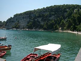
Port of AlonnisosLocation 
 Alonnisos
Coordinates 39°9′N 23°50′E / 39.15°N 23.833°ECoordinates: 39°9′N 23°50′E / 39.15°N 23.833°E Location within the region
Government Country: Greece Region: Thessaly Regional unit: Sporades Population statistics (as of 2001) Municipality - Population: 2,700 - Area: 129.6 km2 (50 sq mi) - Density: 21 /km2 (54 /sq mi) Other Time zone: EET/EEST (UTC+2/3) Elevation (min-max): 0 - 476 m (0 - 1562 ft) Postal: 370 05 Telephone: 24240 Auto: BO Website www.alonissos.gov.gr Alonnisos (Greek: Αλόννησος), also transliterated as Alonissos or Alonisos, is a Greek island in the Aegean Sea. After Skiathos and Skopelos it is the third member of the Northern Sporades. It is 3 km (2 nm) E of the island of Skopelos. Alonnisos is also the name of a village on the island, as well as the municipality that encompasses the island and the village.
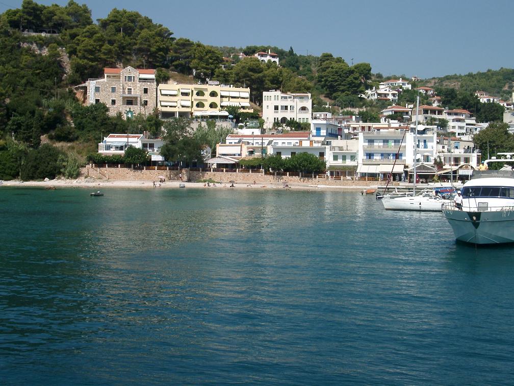
The village of Alonnisos is located on the southern part of the island. It is locally known as Chora. The main port of the island is located in the southeast and is called Patitiri. There is ferry and hydrofoil service from Patitiri to Volos, Agios Konstantinos, and Thessaloniki on the mainland and to the islands of Skiathos, Skopelos and Skyros. The bay at the southern end of the island is also called Alonnisos.
The Municipality of Alonnisos includes the nearby islands of Adelfoi, Gioura, Kyra Panagia (Pelagos), Peristera, Piperi, Psathoura and Skantzoura.
Contents
History
In the Middle Ages and until the 19th century, the island was known as Liadromia (Λιαδρόμια). It was renamed in 1838, as it was – mistakenly according to later research – identified with Alonnisos of Antiquity. In reality, the present island of Alonissos was known as Ikos (Ίκος) to the Ancient Greeks.
Geography
The island at its widest is 4.5 km from northwest to southeast and at its longest is 20 km from southwest to northeast. The area of the island is 64 km2. The island is mostly limestone. It is located east of mainland Greece and Magnesia, northeast of Euboea and northwest of the island of Skyros.
The island
 Alonnisos
Agriculture is widespread on Alonnisos, predominantly mixed farming and vineyards. The main products are almonds, grapes, figs and olives. Spruce trees are abundant on the island. While fishing is a popular profession on the island, tourism is now the main industry.
Housing traditionally consists of closely constructed houses with stone walls, which, until 1965, were centered around the capital. A small fortress protected against enemies and pirates. The island and the village were heavily damaged in the 1965 earthquake. Many inhabitants returned not to the village of Alonnisos, but to Patitiri. The old village has been restored in recent years, with rebuilt houses now utilised for tourism.
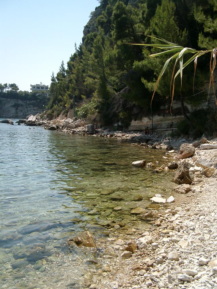
The beaches around the island consist of pebbles. The ecosystem in the north side of the island is in good condition. The Mediterranean Monk Seal (Monachus-Monachus) is common around the island, and in 1992 the Alonnisos Marine Park was created to protect these seals and other animals.
Communities and subdivisions
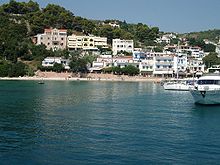
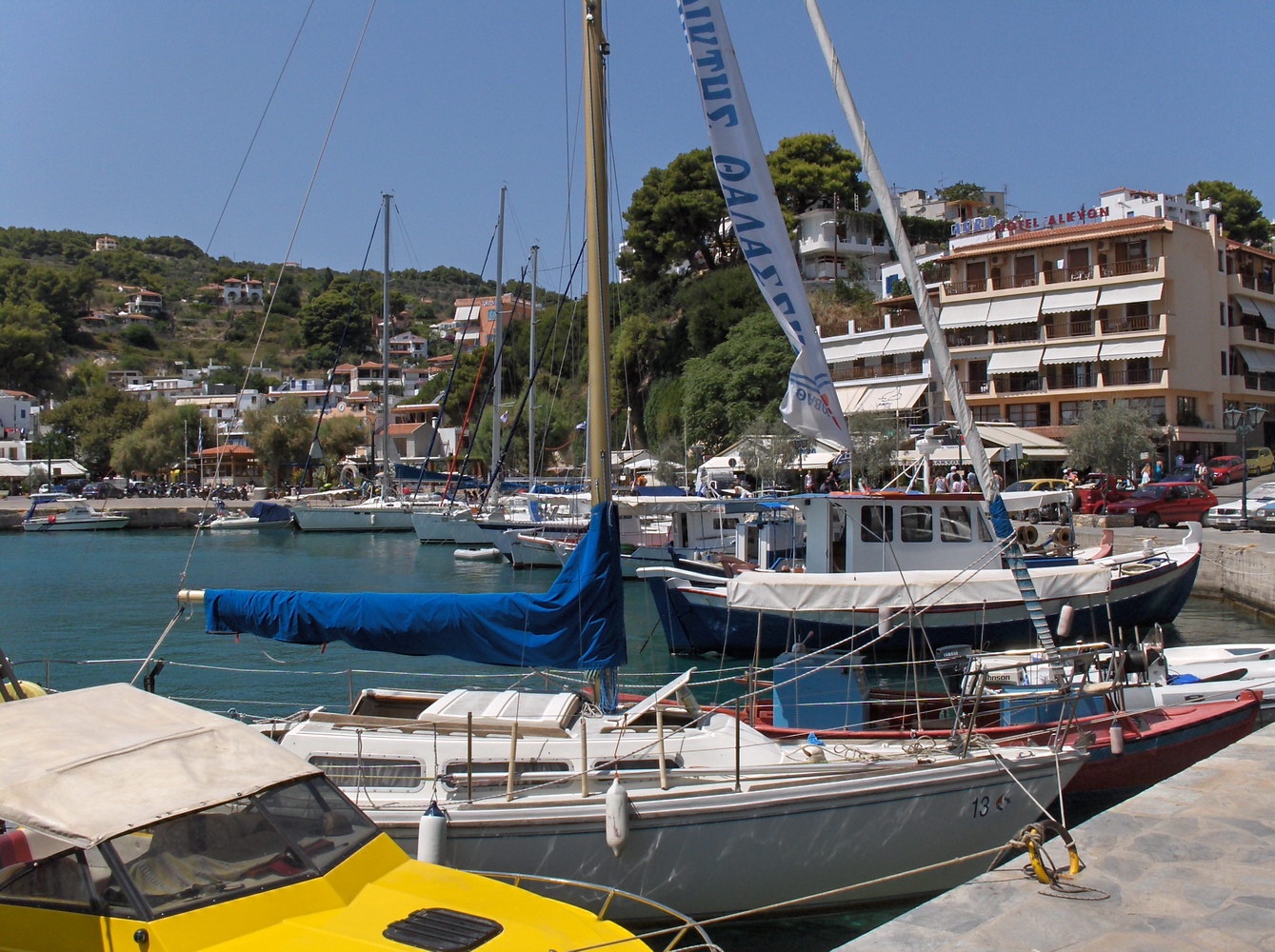
 Port of Patitiri
 Beach in Alonissos
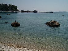 Beach in Alonissos
The Municipality includes several other islands with small resident populations. The total land area of the municipality is 129.607 km². The 2001 census population was 2,700 inhabitants, of whom only 28 persons lived on the other islands.
Alonissos Island
- Ágios Pétros (Άγιος Πέτρος)
- Alónnisos (Αλόννησος)
- Chrysi Milia (Χρυσή Μηλιά)
- Gérakas (Γέρακας)
- Isiomata (Ισιώματα)
- Kalamákia (Καλαμάκια)
- Marpounta (Μαρπούντα) - abandoned
- Mourtero (Μουρτερό)
- Patitiri (Πατητήρι)
- Steni Vala (Στενή Βάλα)
- Votsi (Βότση)
Other islands
- Adelfoi (Αδελφοί)
- Gioura (Γιούρα)
- Kyra Panagia (Κυρά Παναγιά)
- Peristera (Περιστέρα)
- Piperi (Πιπέρι)
- Psathoura (Ψαθούρα)
- Skantzoura (Σκάντζουρα)
Historical population
Year Population 1991 2,985 2001 2,425 2011 2,366 References
External links
- Official website (English) (Greek)
- National Marine Park of Alonnisos Northern Sporades (English) (Greek)
Islands of the Sporades Main Other Adelfoi Islets · Agios Georgios Skopelou · Argos Skiathou · Dasia · Erinia · Gioura · Grammeza · Kyra Panagia · Lekhoussa · Peristera · Piperi · Psathoura · Repio · Rineia Skyrou · Sarakino · Skandili · Skantzoura · Skyropoula · Tsougria · ValaxaArea: 14,037 km² • Population : 753,888 (2001) • Capital: LarissaRegional unit of Karditsa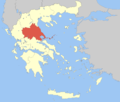 Regional unit of LarissaRegional unit of MagnesiaRegional unit of the SporadesRegional unit of TrikalaRegional governor: Konstantinos Agorastos • Website: http://www.pthes.gov.gr
Articles on the Aegean Sea GeneralCountries Other Cyclades Amorgos · Anafi · Andros · Antimilos · Antiparos · Delos · Despotiko · Donoussa · Folegandros · Gyaros · Ios · Irakleia · Kardiotissa · Kea · Keros · Kimolos · Koufonisia · Kythnos · Milos · Mykonos · Nata · Naxos · Paros · Polyaigos · Rineia · Santorini · Schoinoussa · Serifopoula · Serifos · Sifnos · Sikinos · Syros · Therasia · Tinos · VousDodecanese Agathonisi · Arkoi · Armathia · Alimia · Astakida · Astypalaia · Çatalada · Chalki · Chamili · Farmakonisi · Gaidaros · Gyali · Imia/Kardak · Kalolimnos · Kalymnos · Kandelioussa · Kara Ada · Karpathos · Kasos · Kinaros · Kos · Küçük Tavşan Adası · Leros · Lipsi · Lebynthos · Nimos · Nisyros · Patmos · Pacheia · Platy · Pserimos · Rhodes · Saria · Salih Ada · Symi · Syrna · Telendos · Tilos · ZaforaNorth Aegean Agios Eustratius · Ammouliani · Ayvalık Islands · Büyük Ada · Chios · Chryse · Cunda · Foça Islands · Fournoi Korseon · Icaria · Imbros · Koukonesi · Lemnos · Lesbos · Metalik Ada · Nissiopi · Oinousses · Psara · Samiopoula · Samos · Samothrace · Tenedos · Thasos · ThymainaSaronic Sporades Adelfoi Islets · Agios Georgios Skopelou · Alonnisos · Argos Skiathou · Dasia · Erinia · Gioura · Grammeza · Kyra Panagia · Lekhoussa · Peristera · Piperi · Psathoura · Repio · Rineia Skyrou · Sarakino · Skandili · Skantzoura · Skiathos · Skopelos · Skyropoula · Skyros · Tsougria · ValaxaCretan Afendis Christos · Agia Varvara · Agioi Apostoloi · Agioi Pandes · Agioi Theodoroi · Agios Nikolaos · Anavatis · Arnaouti · Aspros Volakas · Avgo · Crete · Daskaleia · Dia · Diapori · Dionysades · Elasa · Ftena Trachylia · Glaronisi · Gramvousa · Grandes · Kalydon (Spinalonga) · Karavi · Karga · Katergo · Kavallos · Kefali · Kolokythas · Koursaroi · Kyriamadi · Lazaretta · Leon · Mavros · Mavros Volakas · Megatzedes · Mochlos · Nikolos · Palaiosouda · Peristeri · Peristerovrachoi · Petalida · Petalouda · Pontikaki · Pontikonisi · Praso Kissamou · Prosfora · Pseira · Sideros · Souda · Valenti · Vryonisi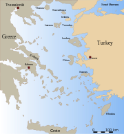
Other Categories:- Populated places in the Sporades
- Mediterranean port cities and towns in Greece
- Islands of Greece
- Sporades
- Municipalities of Thessaly
- Tourism in Greece


Wikimedia Foundation. 2010.