- Mouzaki
-
For other uses, see Mouzaki (disambiguation).
Mouzaki
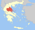
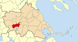
ΜουζάκιLocation Coordinates 39°26′N 21°39′E / 39.433°N 21.65°ECoordinates: 39°26′N 21°39′E / 39.433°N 21.65°E Government Country: Greece Region: Thessaly Regional unit: Karditsa Population statistics (as of 2001) Municipality - Population: 17,910 - Area: 307.8 km2 (119 sq mi) - Density: 58 /km2 (151 /sq mi) Municipal unit - Population: 10,148 Community - Population: 2,190 Other Time zone: EET/EEST (UTC+2/3) Auto: ΚΑ Mouzaki (Greek: Μουζάκι) is a town and a municipality in the northwestern part of the Karditsa Prefecture, Greece. Mouzaki is located 50 km from Anthiro, 75 km northeast from Vragkiana, 34 km from Petrilo and 28 km west of Karditsa. It is also located 20 km from Trikala and 180 km east of Arta. Mouzaki is linked with the GR-30 (Arta - Karditsa).
Contents
Municipality
The municipality Mouzaki was formed at the 2011 local government reform by the merger of the following 3 former municipalities, that became municipal units:[1]
Subdivisions
The municipal unit of Mouzaki is divided into the following communities (constituent settlements in brackets):
- Amygdali
- Anthochori (Anthochori, Anoixiatiko, Platanakos)
- Drakotrypa (Drakotrypa, Arpakia, Keramargio, Milies, Spathes, Trygona, Tsarouchi)
- Ellinokastro (Ellinokastro, Gravia, Petrota)
- Gelanthi
- Kryopigi (Kryopigi, Lakkes, Xirokampos)
- Lazarina
- Magoulitsa
- Mavrommati (Mavrommati, Georgios Karaiskakis)
- Mouzaki
- Oxya (Oxya, Vagenia, Dafni, Zamanatiko, Koura, Megali Vrysi, Mesorrachi, Palaiampela, Palaiochori, Platania, Soula, Sykia)
- Pefkofyto (Pefkofyto, Nisia, Padi, Charavgi)
- Porti (Porti, Martini, Meligos, Palaiokastro)
- Vatsounia
Population
Year Village population Municipality population 1981 2,560 - 1991 2,353 - 2001 2,190 10,148 External links
References
- ^ Kallikratis law Greece Ministry of Interior (Greek)
Agios Akakios · Charma · Ellinopyrgos · Fanari · Kanalia · Kappas · Loxada · Pyrgos IthomisMunicipal unit of Mouzaki Municipal unit of Pamisos Agnantero · Kranea · Magoula · Palaiochori · RizovouniArea: 14,037 km² • Population : 753,888 (2001) • Capital: Larissa Regional unit of Karditsa Regional unit of LarissaRegional unit of MagnesiaRegional unit of the SporadesRegional unit of Trikala
Regional governor: Konstantinos Agorastos • Website: http://www.pthes.gov.gr Categories:- Populated places in Karditsa (peripheral unit)
- Municipalities of Thessaly
Wikimedia Foundation. 2010.


