- Karditsa Prefecture
Infobox Pref GR
name = Karditsa
name_local = Νομός Καρδίτσας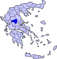
periph =Thessaly
capital =Karditsa
population = 130,214
population_as_of = 2005
pop_rank = 28th
pop_dens = 49.4
popdens_rank = 31st
area = 2,636
area_rank = 20th
postal_code = 43x xx
area_code = 244x0
licence = ΚΑ
provinces =
municip = 20
commun = 1
ISO = GR-41
website =Karditsa is one of the
prefectures of Greece . Located in the south-westernThessaly , it is primarily an agricultural prefecture. The name of the prefecture is derived from its capitalKarditsa , a small city of approximately 35,000 people. The prefecture is known for its beautiful countryside and friendly people, while theDimotiki Agora (Δημοτική Αγορά) or Public Market is found in the city and forms one ofUNESCO 's protected cultural monuments.The city is also an important knowledge centre, supporting the Faculty of Veterinary Medicine of the
University of Thessaly , the Faculty of Wood and Furniture Technology, and the Faculty of Forestry Technology of theEducational and Technological Institution of Larissa . There is also a Police Academy.Karditsa is about 300 kilometers from
Athens , and can be reached by bus or train from Athens andThessaloniki . It is located SSE of Trikala, SW of Larissa and NE of Arta.The western half of the prefecture is dominated by the
Pindus mountains, famous for theAgrafa region of Greece.Karditsa is bounded by the prefectures of Trikala to the north, Larissa to the east,
Phthiotis to the southeast,Aetolia-Acarnania andEvrytania to the southwest and Arta to the west. The main rivers areMegdova to the south, one, another to the northwest to the east and the Pineios River to the north.Geography
The farmlands dominate the central and the eastern part which is part of the
Thessalian Plain while theAgrafa mountains dominate the southern and the western part. ThePlastiras Dam andLake Plastiras , located to the west of the city of Karditsa, supplies water to the plains and the central part of Greece.Population
*2001: 121,775
History
Encompassing the ancient geographical region of
Thessaliotis , one of the four ancient districts ofThessaly , the present day Karditsa prefecture was in theKingdom of Macedonia and later theRoman Empire , theByzantine Empire ,Great Wallachia , theOttoman Empire from the 1400s until 1881 and finally Greece after the liberation of Thessaly and northcentral Greece. Its economy and agriculture boomed during that period; Karditsa was administered as theTrikala-Karditsa prefecture until 1947. It was affected byWorld War II and theGreek Civil War which saw many buildings destroyed and inhabitants left homeless and in hiding. The prefecture was later rebuilt and received electricity, appliances and motorised transport, while emigration also began in the 1950s, when construction of Lake Plastiras was added. Television arrived in the 1970s and the 1980s for its villages, and its economy later declined, seeing high unemployment in the prefecture.People
The plains of central and southern Karditsa are inhabited by the Karagounides ( _el. Καραγκούνηδες), while the
Agrafa mountains in the west of the prefecture are dominated by a strongSarakatsani ( _el. Σαρακατσάνοι) and Aromanian, or "Vlach" ( _el. Βλάχοι - Vlahi), element.Transport
There are a number of highways E75 and the main railway from
Volos toMeteora crossesThessaly . The region is directly linked to the rest ofEurope throughInternational Airport of Central Greece located inNea Anchialos in a small distance fromKarditsa .*
Greece Interstate 30 , NW, Cen., SE
*Karditsa - Larissa road, Cen., NE
*Karditsa BypassNotable Figures
*
Nikolaos Plastiras
*Vassilis Papazachos
*Georgios Karaiskakis
*Charilaos Florakis
*Seraphim Archbishop of Athens and All Greece
*Elena Paparizou
*Nikolaos Michopoulos
*Kostas Bantas Municipalities and communities
See also:
List of settlements in the Karditsa prefecture porting teams
*
Anagennisi Karditsa ("football") - Karditsa (city) - fourth division
*A.O. Karditsa - Karditsa - fourth division
*Iraklis Sofades - Sofades
*Tavropos - Karditsa - fourth divisionExternal links
* [http://www.culture.gr/maps/thessal/karditsa/karditsa.html Map of Karditsa] en icon
*dmoz|Regional/Europe/Greece/Prefectures/Karditsa/ en icon
* [http://www.ecoguide.gr/en/area/ Ecoguides - Area of Karditsa] en icon
* [http://www.karditsa-city.gr/index.htm Municipality of Karditsa (Greek)] dead link|date=January 2008|url=http://www.karditsa-city.gr/index.htm
* [http://www.e-city.gr/karditsa/ Karditsa e-City] gr icon
*http://www.karditsa-net.gr/ gr icon
* [http://www.mykarditsa.gr/ MyKarditsa] , includes news gr icon
* [http://www.kwmn.gr/ Karditsa Wireless Metropolitan Network] , Karditsas Wifi Community Network gr icon
*http://www.e-karditsa.gr/ gr icon
* [http://www.magicways.gr Informations, maps, reservations for Lake Plastira - Λίμνη Πλαστήρα]
* [http://www.odigoslimnisplastira.gr Λίμνη Πλαστήρα]
Wikimedia Foundation. 2010.