- Trikala Prefecture
Infobox Pref GR
name = Trikala
name_local = Νομός Τρικάλων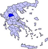
periph =Thessaly
capital =Trikala
population = 137,723
population_as_of = 2005
pop_rank = 25th
pop_dens = 40.7
popdens_rank = 41st
area = 3,384
area_rank = 13th
postal_code = 42x xx
area_code = 243x0
licence = ΤΚ
provinces =
municip = 23
commun = 3
ISO = GR-44
website = [http://www.trikala.gr/ www.trikala.gr]Trikala ( _el. Τρίκαλα) is a prefecture in northwestern
Thessaly ,Greece ; its capital is the city ofTrikala . The prefecture was created in 1881 and Karditsa separated in 1947, and containsKalampaka andMeteora , with monasteries above the rocky ledges. It is located NW ofAthens , NW of Karditsa, E ofIoannina andMetsovo , S ofGrevena , SW ofThessaloniki , and W ofLarissa .Boundaries
Trikala is bounded by the prefectures of Karditsa to the south, Arta to the southwest, Ioannina to the west, Grevena to the north and Larissa to the east.
Municipalities and communities
See also:
List of settlements in the Trikala prefecture Provinces
Trikala prefecture has two provinces, named Trikala and Kalampaka, after the two largest towns.
Geography
Its geography includes the
Thessalian Plain to the south and east with a maximum elevation of 100 m, and it also includes a valley to the north. ThePindus mountain range dominates the western part, with forested terrain in the westcentral part. The northern part is also mountainous and made up of forests and barren lands, with its mountains incorporatingChasia andAntichasia ; and to the northeast the steep terrain continues. Its major river, the Pineios, flows to the south, while several other rivers flow to the south and northeast, centrally and to the northwest along with theVia Egnatia and the GR-6.History
The area around the modern Trikala Prefecture was first with Thessaly, later moving to Macedonian rule, and subsequently run by the Romans, the Byzantines, the
Wallachia ns and lastly the Ottoman Turks. Trikala was known as "Tırhala" for Turks and a sanjak center in Yanya eyalet. During their rule, the area was affected by theGreek War of Independence of 1821, lost an earlier struggle, and continued its Turkish rule until the liberation ofThessaly of 1881. Several villages were relocated to remain hidden from the Turks, and the area was finally incorporated into Greece after the liberation. The prefecture was occupied byOttomans duringGreco-Turkish War (1897) . It was created and included Karditsa until 1947 ; its economy and agricutlure boomed but its standard of living was somewhat lower than that of Athens.Electricity and radio arrived in the city in the 1930s. After
World War II and theGreek Civil War , a number of structures were rebuilt ; the prefecture saw a small growth in the 1950s and the 1960s, but growth slowed due to emigration. The villages saw their roads paved, their homes furnished with electricity, and improved motor transport and communication added. Television arrived in the 1970s, and as late as the 1980s for the rural portion. In the 1980s, the Trikala Bypass was opened and between 1998 and 2006, theVia Egnatia was under construction with tunnels and bridges ; the first section was opened in 2002, and the final section in 2006.Agriculture
The agriculture of the area is famous, and produces a part of the country's production also in export ; its well-known production includes fruit and vegetables,
cotton ,olive s,cattle and other foodstuffs.Climate
Its climate is mainly of Mediterranean character, with hot summers and cold winters, along with temperate climate conditions by the mountains. The temperate climate dominates the westcentral portion, and winter is dominant in the mountains to the west and north.
Media
Newspapers
*"I Enimerosi"
*"I Erevna"
*"Trikalina Nea "Transport
There are a number of highways and the main railway from
Volos toMeteora crossesThessaly . The region is directly linked to the rest ofEurope throughInternational Airport of Central Greece located inNea Anchialos in a small distance from Trikala.*
Greece Interstate 6 , NW, N, Cen., SE
*Greece Interstate 15 , NW
*Greece Interstate 30 , SW, Sporting clubs
*
AO Trikala
*Trikala 2000 BCExternal links
* [http://www.culture.gr/maps/thessal/trikala/trikala.html Prefectural map of Trikala]
*http://www.greecebyclick.com/regions/central/trikala/index.cfm
*dmoz|Regional/Europe/Greece/Prefectures/Trikala/ en icon
Wikimedia Foundation. 2010.