- Mavros Volakas
-
Mavros Volakas
Μαύρος ΒώλακαςGeography Coordinates: 35°05′48″N 24°37′01″E / 35.09667°N 24.61694°E Island chain: Cretan Islands Government  Greece
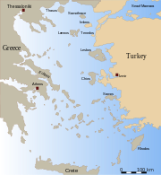
Periphery: Crete Prefecture: Rethymno Capital: Rethymnon Statistics Population: 0 Mavros Volakas (Greek: Μαύρος Βώλακας) is a large rock, next to Long Beach, on the coast of Crete, near Lambi, in Rethymno Prefecture.
There is another large rock that is even closer to the beach, called Aspros Volakas.[1]
See also
References
Cretan islands Chania
PrefectureMajor islandsAgioi Theodoroi (Agios Theodoros · Mikros Agios Theodoros) · Elafonisi · Gavdos · Gavdopoula · Gramvousa, Agria · Gramvousa, Imeri · Pontikonisi · SoudaIslets and rocksAgioi Apostoloi · Agios Nikolaos · Ammoudi tous Volakous · Arnaouti · Artemis · Gaidouronisi · Karga · Katonisi · Koursaroi · Lazaretta · Leon/Nisi · Loutro · Palaiosouda/Marathi · Petalida/Xera · Petalouda · Pontikaki · Praso Kissamou · Prasonisi Gavdou · Schistonisi/Trachyli · Treis Volakous · ValentiRethymno
PrefectureMajor islandsPaximadia (Megalo Paximadi · Mikro Paximadi)Islets and rocksHeraklion
PrefectureMajor islandsIslets and rocksAfendis Christos · Agia Varvara · Glaronisi/Petalidi · Mavronisi · Megalonisi/Makronisi · Mikronisi/Agios Pavlos · Nisoplaka · Papadoplaka · Paximadi · Psarocharako · Thetis · TrafosLasithi
PrefectureMajor islandsAgioi Pandes · Chrysi/Gaidouronisi · Dionysades (Dragonada · Gianysada · Paximada · Paximadaki) · Elasa · Koufonisi/Lefki · Kyriamadi · Mikronisi · Strongyli · TrachilosIslets and rocksAgia Eirini · Agios Nikolaos/Mochlos · Agriomandra · Avgo · Daskaleia · Fotia · Grandes (Grandes E · Grandes W) · Io · Kalydon/Spinalonga · Karavi · Kavaloi (Anavatis · Kavallos · Kefali) · Katergo · Kolokythas/Vryonisi · Konida · Kymo/Koumeli · Makroulo · Marmaro · Mavros · Mavros Vrachos · Megatzedes · Mikronisi · Nikolos/Nikolonisi/Agios Antonios · Paximadaki/Prasonisi Siteias · Peristerovrachoi · Ftena Trachylia/Pinakl · Prasonisi · Prosfora · Pseira · Psyllos · Sideros/Strongylo · Vryonisi/PrasonisiArticles on the Aegean Sea GeneralCountries Other Cyclades Amorgos · Anafi · Andros · Antimilos · Antiparos · Delos · Despotiko · Donoussa · Folegandros · Gyaros · Ios · Irakleia · Kardiotissa · Kea · Keros · Kimolos · Koufonisia · Kythnos · Milos · Mykonos · Nata · Naxos · Paros · Polyaigos · Rineia · Santorini · Schoinoussa · Serifopoula · Serifos · Sifnos · Sikinos · Syros · Therasia · Tinos · VousDodecanese Agathonisi · Arkoi · Armathia · Alimia · Astakida · Astypalaia · Çatalada · Chalki · Chamili · Farmakonisi · Gaidaros · Gyali · Imia/Kardak · Kalolimnos · Kalymnos · Kandelioussa · Kara Ada · Karpathos · Kasos · Kinaros · Kos · Küçük Tavşan Adası · Leros · Lipsi · Lebynthos · Nimos · Nisyros · Patmos · Pacheia · Platy · Pserimos · Rhodes · Saria · Salih Ada · Symi · Syrna · Telendos · Tilos · ZaforaNorth Aegean Agios Eustratius · Ammouliani · Ayvalık Islands · Büyük Ada · Chios · Chryse · Cunda · Foça Islands · Fournoi Korseon · Icaria · Imbros · Koukonesi · Lemnos · Lesbos · Metalik Ada · Nissiopi · Oinousses · Psara · Samiopoula · Samos · Samothrace · Tenedos · Thasos · ThymainaSaronic Sporades Adelfoi Islets · Agios Georgios Skopelou · Alonnisos · Argos Skiathou · Dasia · Erinia · Gioura · Grammeza · Kyra Panagia · Lekhoussa · Peristera · Piperi · Psathoura · Repio · Rineia Skyrou · Sarakino · Skandili · Skantzoura · Skiathos · Skopelos · Skyropoula · Skyros · Tsougria · ValaxaCretan Afendis Christos · Agia Varvara · Agioi Apostoloi · Agioi Pandes · Agioi Theodoroi · Agios Nikolaos · Anavatis · Arnaouti · Aspros Volakas · Avgo · Crete · Daskaleia · Dia · Diapori · Dionysades · Elasa · Ftena Trachylia · Glaronisi · Gramvousa · Grandes · Kalydon (Spinalonga) · Karavi · Karga · Katergo · Kavallos · Kefali · Kolokythas · Koursaroi · Kyriamadi · Lazaretta · Leon · Mavros · Mavros Volakas · Megatzedes · Mochlos · Nikolos · Palaiosouda · Peristeri · Peristerovrachoi · Petalida · Petalouda · Pontikaki · Pontikonisi · Praso Kissamou · Prosfora · Pseira · Sideros · Souda · Valenti · VryonisiOther Coordinates: 35°05′48″N 24°37′01″E / 35.09667°N 24.61694°E
Categories:- Rethymno Prefecture
- Islands of Greece
- Mediterranean islands
- Islands of Crete
Wikimedia Foundation. 2010.

