- Nissiopi
-
 Aerial view of Nissiopi's lighthouse in summer 2004
Nissiopi is a long island in front of Sigri's harbour, which stretches across the mouth of the bay and acts as a buffer to the prevailing winds. In the middle stands an old pharos lighthouse to help ships navigate in the rough east Aegean seas.
Articles on the Aegean Sea GeneralCountries Other Cyclades Amorgos · Anafi · Andros · Antimilos · Antiparos · Delos · Despotiko · Donoussa · Folegandros · Gyaros · Ios · Irakleia · Kardiotissa · Kea · Keros · Kimolos · Koufonisia · Kythnos · Milos · Mykonos · Nata · Naxos · Paros · Polyaigos · Rineia · Santorini · Schoinoussa · Serifopoula · Serifos · Sifnos · Sikinos · Syros · Therasia · Tinos · VousDodecanese Agathonisi · Arkoi · Armathia · Alimia · Astakida · Astypalaia · Çatalada · Chalki · Chamili · Farmakonisi · Gaidaros · Gyali · Imia/Kardak · Kalolimnos · Kalymnos · Kandelioussa · Kara Ada · Karpathos · Kasos · Kinaros · Kos · Küçük Tavşan Adası · Leros · Lipsi · Lebynthos · Nimos · Nisyros · Patmos · Pacheia · Platy · Pserimos · Rhodes · Saria · Salih Ada · Symi · Syrna · Telendos · Tilos · ZaforaNorth Aegean Agios Eustratius · Ammouliani · Ayvalık Islands · Büyük Ada · Chios · Chryse · Cunda · Foça Islands · Fournoi Korseon · Icaria · Imbros · Koukonesi · Lemnos · Lesbos · Metalik Ada · Nissiopi · Oinousses · Psara · Samiopoula · Samos · Samothrace · Tenedos · Thasos · ThymainaSaronic Sporades Adelfoi Islets · Agios Georgios Skopelou · Alonnisos · Argos Skiathou · Dasia · Erinia · Gioura · Grammeza · Kyra Panagia · Lekhoussa · Peristera · Piperi · Psathoura · Repio · Rineia Skyrou · Sarakino · Skandili · Skantzoura · Skiathos · Skopelos · Skyropoula · Skyros · Tsougria · ValaxaCretan Afendis Christos · Agia Varvara · Agioi Apostoloi · Agioi Pandes · Agioi Theodoroi · Agios Nikolaos · Anavatis · Arnaouti · Aspros Volakas · Avgo · Crete · Daskaleia · Dia · Diapori · Dionysades · Elasa · Ftena Trachylia · Glaronisi · Gramvousa · Grandes · Kalydon (Spinalonga) · Karavi · Karga · Katergo · Kavallos · Kefali · Kolokythas · Koursaroi · Kyriamadi · Lazaretta · Leon · Mavros · Mavros Volakas · Megatzedes · Mochlos · Nikolos · Palaiosouda · Peristeri · Peristerovrachoi · Petalida · Petalouda · Pontikaki · Pontikonisi · Praso Kissamou · Prosfora · Pseira · Sideros · Souda · Valenti · Vryonisi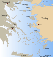
Other Categories:- Islands of Greece
- North Aegean islands
- Greece geography stubs


Wikimedia Foundation. 2010.