- Uberaba Airport
-
Uberaba-Mário de Almeida Franco Airport
Aeroporto Uberaba-Mário de Almeida FrancoIATA: UBA – ICAO: SBUR Summary Airport type Public Operator Infraero Serves Uberaba Elevation AMSL 809 m / 2,655 ft Coordinates 19°45′54″S 047°57′53″W / 19.765°S 47.96472°WCoordinates: 19°45′54″S 047°57′53″W / 19.765°S 47.96472°W Website Map Location in Brazil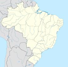
 UBA
UBARunways Direction Length Surface m ft 17/35 1,759 5,771 Asphalt Statistics (2010) Passengers 75,389 Aircraft Operations 8,610 Metric tonnes of cargo 245 Statistics: Infraero [1]
Sources: Airport Website[2]Uberaba-Mário de Almeida Franco Airport (IATA: UBA, ICAO: SBUR) is the airport serving Uberaba, Brazil.
It is operated by Infraero.
Contents
History
Uberaba-Mário de Almeida Franco Airport was founded on May 23, 1935 and originally called after Alberto Santos-Dumont. On June 13, 1980 the name was changed to Mário de Almeida Franco.
Airlines and destinations
Airlines Destinations Azul Brazilian Airlines Campinas-Viracopos TRIP Linhas Aéreas Araguaína, Belo Horizonte-Pampulha, Brasília, Uberlândia Access
The airport is located 6 km (4 mi) from downtown Uberaba.
See also
References
External links
- Airport information for SBUR at World Aero Data. Data current as of October 2006.Source: DAFIF.
- Airport information for SBUR at Great Circle Mapper. Source: DAFIF (effective Oct. 2006).
- Current weather for SBUR at NOAA/NWS
- Accident history for UBA at Aviation Safety Network
Lists of airports By IATA code - A
- B
- C
- D
- E
- F
- G
- H
- I
- J
- K
- L
- M
- N
- O
- P
- Q
- R
- S
- T
- U
- V
- W
- X
- Y
- Z
By ICAO code - A
- B
- C
- D
- E
- F
- G
- H
- I
- J
- K
- L
- M
- N
- O
- P
- Q
- R
- S
- T
- U
- V
- W
- X
- Y
- Z
By traffic Other lists - Airports by country
- Airport eponyms
- Airline destinations
- Military installations
Lists relating to aviation General Aircraft (manufacturers) · Aircraft engines (manufacturers) · Airlines (defunct) · Airports · Civil authorities · Museums · Registration prefixes · Rotorcraft (manufacturers) · TimelineMilitary Accidents/incidents Records  Brazil
History First inhabitants · Colonization · Empire · Old Republic · Vargas Era · Second Republic · Military rule · ContemporaryGeography Regions · States · Mesoregions · Microregions · Municipalities · Islands · Coastline · Climate · Environment · Extreme points · Protected areas · CapitalsGovernment Constitution · Federal government · President · National Congress · Foreign relations · Law · Law enforcement · MilitaryPolitics Economy Society Demographics · People · Languages · Religion · Immigration · Education · Health · Crime · Social issues · Largest cities · ApartheidCulture Categories:- Airports in Brazil
- Airports established in 1935
- Minas Gerais

Wikimedia Foundation. 2010.