- Damariscove Lifesaving Station
-
Damariscove Lifesaving Station
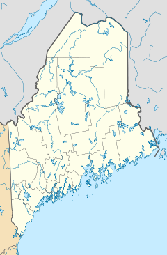

Nearest city: Boothbay, Maine Coordinates: 43°45′17″N 69°36′58″W / 43.75472°N 69.61611°WCoordinates: 43°45′17″N 69°36′58″W / 43.75472°N 69.61611°W Area: less than one acre Built: 1897 Architect: Mendelheff,Victor Governing body: Private NRHP Reference#: 87000924[1] Added to NRHP: June 25, 1987 The Damariscove Lifesaving Station is located on Damariscove Island in Boothbay, Maine. The station was built in 1897 and was added to the National Register of Historic Places on June 25, 1987.
History
In 1897, the station was built on the southern end of the island in response to the frequent shipwrecks on the ledges and shoals that surround the island. The station was manned by the United States Life-Saving Service and then the U.S. Coast Guard until 1959. The station is now privately owned.[2]
See also
References
- ^ "National Register Information System". National Register of Historic Places. National Park Service. 2009-03-13. http://nrhp.focus.nps.gov/natreg/docs/All_Data.html.
- ^ http://www.boatmaine.us/damariscove-island.aspx Accessed March 30, 2010.
U.S. National Register of Historic Places Topics Lists by states Alabama • Alaska • Arizona • Arkansas • California • Colorado • Connecticut • Delaware • Florida • Georgia • Hawaii • Idaho • Illinois • Indiana • Iowa • Kansas • Kentucky • Louisiana • Maine • Maryland • Massachusetts • Michigan • Minnesota • Mississippi • Missouri • Montana • Nebraska • Nevada • New Hampshire • New Jersey • New Mexico • New York • North Carolina • North Dakota • Ohio • Oklahoma • Oregon • Pennsylvania • Rhode Island • South Carolina • South Dakota • Tennessee • Texas • Utah • Vermont • Virginia • Washington • West Virginia • Wisconsin • WyomingLists by territories Lists by associated states Other Categories:- National Register of Historic Places in Maine
- Buildings and structures completed in 1897
- Buildings and structures in Lincoln County, Maine
- Maine Registered Historic Place stubs

Wikimedia Foundation. 2010.