- Crugmeer
-
Coordinates: 50°33′02″N 4°57′51″W / 50.5505°N 4.9643°W
Crugmeer Cornish: Krugmeur 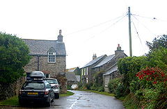
 Crugmeer
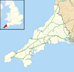
Crugmeer shown within CornwallOS grid reference SW901765 Parish Padstow Unitary authority Cornwall Ceremonial county Cornwall Region South West Country England Sovereign state United Kingdom Post town PADSTOW Postcode district PL28 Dialling code 01841 Police Devon and Cornwall Fire Cornwall Ambulance South Western EU Parliament South West England UK Parliament North Cornwall List of places: UK • England • Cornwall
Crugmeer (Cornish: Krugmeur) is a hamlet in north Cornwall, United Kingdom. It is situated one-and-a-half miles (2 kilometres) from Padstow to the west of the River Camel estuary.The hamlet consists of half-a-dozen houses and a farm at the junction of two lanes. One lane gives access to Crugmeer from the Padstow-St Merryn road then continues northeast to Lellizzick, Hawker's Cove and Stepper Point. The other lane leads west from Crugmeer to Trevone beach[1][2].
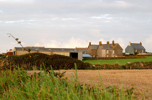
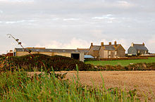 Looking west towards Crugmeer Farm
 Crugmeer village centre, Cornwall, in 2008
- ^ http://www.crugmeer.org/ The Crugmeer Society website
- ^ Ordnance Survey: Landranger map sheet 200 Newquay & Bodmin ISBN 9780319229385
External links
 Media related to Crugmeer at Wikimedia Commons
Geography of Cornwall Unitary authorities Major settlements Bodmin • Bude • Callington • Camborne • Camelford • Falmouth • Fowey • Hayle • Helston • Launceston • Liskeard • Looe • Lostwithiel • Marazion • Newlyn • Newquay • Padstow • Par • Penryn • Penzance • Porthleven • Redruth • Saltash • St Austell • St Blazey • St Columb Major • St Ives • St Just-in-Penwith • St Mawes • Stratton • Torpoint • Truro • Wadebridge
See also: Civil parishes in CornwallRivers Topics History • Status debate • Flag • Culture • Places • People • The Duchy • Diocese • Politics • Hundreds/shires • Places of interest • full list...Categories:- Villages in Cornwall
- Cornwall geography stubs


Wikimedia Foundation. 2010.