- Crapo Park
-
Crapo Park and Arboretum Historic District
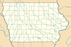
Location: Bounded by Parkway Dr., Koestner St., Madison Ave., and Main St., Burlington, Iowa Coordinates: 40°46′33″N 91°6′7″W / 40.77583°N 91.10194°WCoordinates: 40°46′33″N 91°6′7″W / 40.77583°N 91.10194°W Built: 1895 Governing body: Local NRHP Reference#: 76000762[1] Added to NRHP: June 03, 1976 Crapo Park (85 acres, 34 hectares) is a city park with arboretum and botanical garden, located alongside the Mississippi River at Parkway Drive, Burlington, Iowa. Those who are not familiar with the park often mispronounce it as "Crap-O" Park while the correct pronunciation is Cray-po Park. It is reputed to be the site where the American flag was first raised on Iowa's soil, by Zebulon Pike in 1805.
The park includes an arboretum with over 200 varieties of trees and shrubs, as well as botanical gardens of annuals and perennials. As of 2003, the following park trees were on Iowa's statewide "Big Tree" list: Arizona cypress (Cupressus arizonica), black hickory (Carya glabra), pawpaw (Asimina triloba), and black walnut (Juglans nigra).
The park was established in 1895 by Philip Crapo, a local businessman and philanthropist, in time for the Iowa semi-centennial (1896), with landscape engineering by Earnshaw and Punshon of Cincinnati, Ohio. The park includes walking paths and four shelters, as well as Lake Starker (constructed 1905, 1.5 acres (6,100 m2), 0.6 hectares), the Hawkeye Natives Log Cabin (replica constructed 1910), Zebulon Pike Memorial, and Foehlinger Fountain. It also includes the Black Hawk Spring and Cave, commemorating Chief Black Hawk. One can crawl for more than a hundred feet through a rock tube before the passage gets too small. A cold spring runs through the cave as well. The neighboring Dankwardt Park is popular with frisbee-golf enthusiasts.
One of the primary downsides of the park is the narrow roads that wind through it, the road width, and the brick drainages on either side, which taper rather sharply, can sometimes be a hazard, especially when a driver gets his tires stuck in the drainages.
The park was added to the National Register of Historic Places in 1976.
In 2007, Main Street was blocked off while crews attempt to repair, or replace the aging 150 year old Cascade Bridge, which leads to the park, as of August, 2010, the bridge still remains closed.
See also
References
- ^ "National Register Information System". National Register of Historic Places. National Park Service. 2009-03-13. http://nrhp.focus.nps.gov/natreg/docs/All_Data.html.
U.S. National Register of Historic Places Topics Lists by states Alabama • Alaska • Arizona • Arkansas • California • Colorado • Connecticut • Delaware • Florida • Georgia • Hawaii • Idaho • Illinois • Indiana • Iowa • Kansas • Kentucky • Louisiana • Maine • Maryland • Massachusetts • Michigan • Minnesota • Mississippi • Missouri • Montana • Nebraska • Nevada • New Hampshire • New Jersey • New Mexico • New York • North Carolina • North Dakota • Ohio • Oklahoma • Oregon • Pennsylvania • Rhode Island • South Carolina • South Dakota • Tennessee • Texas • Utah • Vermont • Virginia • Washington • West Virginia • Wisconsin • WyomingLists by territories Lists by associated states Other  Category:National Register of Historic Places •
  Portal:National Register of Historic PlacesCategories:
- Historic districts in Iowa
- Arboreta in Iowa
- Botanical gardens in Iowa
- National Register of Historic Places in Iowa
- Protected areas of Des Moines County, Iowa
Wikimedia Foundation. 2010.

