- Corinella, Victoria
-
Corinella
Victoria
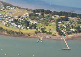
Aerial view of Corinella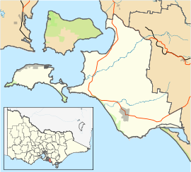
 Corinella
Population: 507 (2006)[1] Postcode: 3925 Location: LGA: Bass Coast Shire State District: Bass Federal Division: Flinders Corinella is a town in Victoria, Australia, located 114 km south-east of Melbourne via the M1 and the Bass Highway, on the eastern shore of Western Port Bay. The town serves as a holiday destination with a focus on recreational fishing, and has a pier and boat ramp and provides access to French Island via a privately operated barge.
History
Just to the east of the present town, a settlement was founded in 1826 from Sydney in response to a concern for possible French territorial claims. In that year Dumont d'Urville in command of the corvette Astrolabe examined Westernport, aroused suspicion during his scientific voyage.[2] Authorities in Sydney had also recently received reports from explorers Hamilton Hume and William Hovell who mistakenly believed they had reached Westernport in 1824 (when in fact they had arrived at Corio Bay many kilometres to the west. A contingent of soldiers and 21 convicts under the command of Captain Wright was dispatched with William Hovell to assist. A small military settlement called Fort Dumaresq was established near the present-day site of Rhyll on the north coast of Phillip Island. Lack of fresh water proved a problem and the outpost was moved to Corinella then called Settlement Point.
Hovell's subsequent report claiming Westernport was unsuitable for agriculture, owing to poor soil and lack of fresh water, and the absence of any Frenchmen, led to the abandonment of the settlements in 1828. The buildings were burnt to prevent use by escaped convicts. A memorial cairn in Jamieson Street marks the site of the original settlement and another monument at the end of Smythe Street commemorates Paul Edmund de Strzelecki's exploration in 1840.[3]
The 1826-8 Corinella was subject to extensive archaeological investigations in the late 1970s by the Victoria Archaeological Survey led by Peter Coutts. Although equivocal in its conclusions about the location and remains of the settlement, the dig established the importance of the site to Victoria's history and European settlement.[4]
References
- ^ Australian Bureau of Statistics (25 October 2007). "Corinella (State Suburb)". 2006 Census QuickStats. http://www.censusdata.abs.gov.au/ABSNavigation/prenav/LocationSearch?collection=Census&period=2006&areacode=SSC25397&producttype=QuickStats&breadcrumb=PL&action=401. Retrieved 2007-10-01.
- ^ The Exploration of Westernport, Western Port Seagrass Partnership 2008, http://www.seagrass.com.au/downloads/PDFs/Exploration_WP.pdf
- ^ Visit Corinella http://www.visitcorinella.com/topic/index.html
- ^ Report on the results of archaeological investigations at the 1826 settlement site at Corinella, by P.J.F. Coutts, Records of the Victorian Archaeological Survey ; no. 18, Victoria Archaeological Survey, Ministry for Planning and Environment, 1985.
- Corinella, a forgotten episode in Victoria's history. Part 1. History and description of the settlement by P.J.F. Coutts, Records of the Victorian Archaeological Survey ; no. 15 1983
Coordinates: 38°25′S 145°25′E / 38.417°S 145.417°E
Towns in the Bass Coast Shire | Gippsland | Victoria Mainland Almurta · Anderson · Archies Creek · Bass · Cape Paterson · Corinella · Coronet Bay · Dalyston · Glen Alvie · Glen Forbes · Grantville · Harmers Haven · Inverloch · Kilcunda · Kongwak · North Wonthaggi · San Remo · South Dudley · Wonthaggi
Phillip Island Cape Woolamai · Churchill Island · Cowes · Newhaven · Rhyll · Silverleaves · Smiths Beach · Summerlands · Sunderland Bay · Sunset Strip · Surf Beach · Ventnor · Wimbledon Heights ·
Towns in South Gippsland Alberton · Allambee · Arawata · Bena · Berry's Creek · Buffalo · Cape Woolamai · Cowes · Dumbalk · Fish Creek · Foster · Inverloch · Kardella · Kilcunda · Koonwarra · Kongwak · Korumburra · Leongatha · Loch · Meeniyan · Mirboo North · Newhaven · Nyora · Poowong · Port Albert · Port Franklin · Port Welshpool · Ruby · Sandy Point · San Remo · Stony Creek · Strzelecki · Tarwin Lower · Toora · Trida · Venus Bay · Walkerville · Waratah Bay · Welshpool · Wonthaggi · Yanakie · Yarram ·
Categories:- Towns in Victoria (Australia)
- Towns in South Gippsland
- Coastal towns in Victoria (Australia)
- Gippsland

Wikimedia Foundation. 2010.