- Newhaven, Victoria
-
Newhaven
Victoria
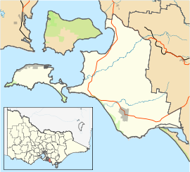
Bridge connecting Newhaven with the adjacent town of San Remo.Population: 428 (2006)[1] Postcode: 3925 Coordinates: 38°30′47″S 145°21′32″E / 38.513°S 145.359°ECoordinates: 38°30′47″S 145°21′32″E / 38.513°S 145.359°E Location: LGA: Bass Coast Shire State District: Bass Federal Division: Flinders Newhaven is a town in southern Victoria, in the south Gippsland region. Located on Phillip Island, adjacent to the channel known as The Narrows, it is the town on the island side of the bridge linking Phillip Island to the mainland. At the 2006 census, Newhaven had a population of 428.
The Post Office opened on 1 January 1873 and closed in 1975.[2]
The town's economy is primarily based around retirement living and tourism, and has a fine Yacht Club with marina. Atlantis Nereus™ tidal turbines are installed at Newhaven [1]. Recently located in Newhaven is Newhaven College, Newhaven Primary School has been situated in Newhaven for a great number of years.
Towns in the Bass Coast Shire | Gippsland | Victoria Mainland Almurta · Anderson · Archies Creek · Bass · Cape Paterson · Corinella · Coronet Bay · Dalyston · Glen Alvie · Glen Forbes · Grantville · Harmers Haven · Inverloch · Kilcunda · Kongwak · North Wonthaggi · San Remo · South Dudley · Wonthaggi
Phillip Island Cape Woolamai · Churchill Island · Cowes · Newhaven · Rhyll · Silverleaves · Smiths Beach · Summerlands · Sunderland Bay · Sunset Strip · Surf Beach · Ventnor · Wimbledon Heights ·
References
- ^ Australian Bureau of Statistics (25 October 2007). "Newhaven (State Suburb)". 2006 Census QuickStats. http://www.censusdata.abs.gov.au/ABSNavigation/prenav/LocationSearch?collection=Census&period=2006&areacode=SSC26335&producttype=QuickStats&breadcrumb=PL&action=401. Retrieved 2007-10-01.
- ^ Premier Postal History, Post Office List, https://www.premierpostal.com/cgi-bin/wsProd.sh/Viewpocdwrapper.p?SortBy=VIC&country=, retrieved 2008-04-11
Categories:- Towns in Victoria (Australia)
Wikimedia Foundation. 2010.

