- Inverloch, Victoria
Infobox Australian Place | type = town
name = Inverloch
state = vic
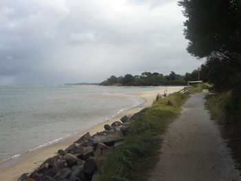
caption = The beach at Anderson's Inlet, alongside which the town of Inverloch sits.
lga =Bass Coast Shire
postcode = 3996
est =
pop = 4140 (2006)Census 2006 AUS | id = SSC25803 | name = Inverloch (State Suburb) | accessdate = 2007-10-01 | quick = on]
elevation=
maxtemp =
mintemp =
rainfall =
stategov = Bass
fedgov = McMillan
dist1 = 141
dir1 = SE
location1=Melbourne
dist2 = 14
dir2 = E
location2= WonthaggiInverloch is a seaside village in Victoria,
Australia . It is located on the Bass Highway 143 kilometres southeast ofMelbourne , at the mouth of Anderson Inlet, in theBass Coast Shire and is located close to Australia’s southernmost stand ofmangroves . At the 2006 census, Inverloch had a population of 4140.History
The first European to settle in the Inverloch area was a Mr. Samuel Anderson, who, together with his brother, ran cattle in the area. The inlet on which the town is situated on is named Anderson Inlet after Mr. Anderson and his brother. The town was first named Andersons Inlet and later renamed Inverloch after
Loch Inver (Lake Entrance) inScotland . The Post Office opened on 1 September 1883 as Anderson's Inlet and was renamed Inverloch in 1889. Citation
last = Premier Postal History | title = Post Office List | url = https://www.premierpostal.com/cgi-bin/wsProd.sh/Viewpocdwrapper.p?SortBy=VIC&country= | accessdate = 2008-04-11 ]As the area developed Inverloch became a port for the shipment of black coal from
Wonthaggi toMelbourne .The Town today
Today, it is a tourist destination, particularly for
surfer s and fishers. The town hosts ajazz festival each Labour Day long weekend in March. According to the Bass Coast Shire Council Inverloch's amenities include a visitor information centre, twoPub s threemotel s, sevenbed and breakfast s, three caravan parks and a foreshore camping reserve.Like most other Australian coastal towns Inverloch has a local
surf lifesaving club.During 2005 and early 2006 the
RACV is building an eco-village holiday resort on the Cape Paterson Road near Inverloch.The town in conjunction with neighbouring township Kongwak has an
Australian Rules football team competing in theAlberton Football League .Citation | last = Full Points Footy | title = Inverloch_Kongwak | url = http://www.fullpointsfooty.net/Inverloch_Kongwak.htm | accessdate = 2008-07-25 ]Dinosaurs at Inverloch
Australia’s first dinosaur bone, the Cape Paterson Claw, was discovered near Inverloch in 1903. Today, the Dinosaur Dreaming fossil excavation at the Flat Rocks coastal site by Anderson's Inlet attracts both Australian and international visitors.
Gallery
References
* [http://www.walkabout.com.au/locations/VICInverloch.shtml Inverloch Historical Society]External links
* [http://www.sci.monash.edu.au/msc/dinodream// Dinosaur Dreaming Web Site]
* [http://www.thylacoleo.com/news/oct2004/oct2004.html Dinosaur Dreaming "At Inverloch"]
* [http://www.inverlochholiday.com/ Inverloch Holiday Online Directory]
* [http://www.islsc.org.au/ Inverloch Surf Lifesaving Club Website]
Wikimedia Foundation. 2010.